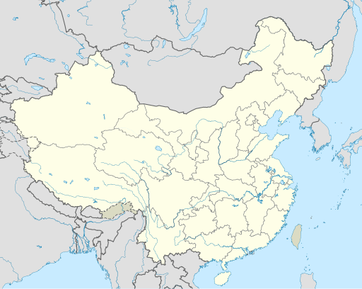
tóng-àn:China edcp location map.svg

Choân kái-sek-tō͘ (SVG ùng-giông, chék-cháung: 512 × 408 chuông-só, ùng-giông duâi-nâung:2.56 MB)
Tóng-àn le̍k-sú
Chhi̍h ji̍t-kî/sî-kan, khoàⁿ hit sî-chūn--ê tóng-àn.
| Ji̍t-kî/Sî-kan | Suè-tiunn-tôo | Tshùn-tshioh | Iōng-chiá | Chù-kái | |
|---|---|---|---|---|---|
| hiān-chāi | 2021-nî 12-goe̍h 13-ji̍t (pài-it) 04:10 |  | 512 × 408(2.56 MB) | Maanshen | Update borders and land reclamation. |
| 2021-nî 10-goe̍h 31-ji̍t (lé-pài) 02:44 |  | 512 × 408(2.54 MB) | Not logging in | Fix colored path shown as land in XInjiang and Gansu. | |
| 2021-nî 10-goe̍h 31-ji̍t (lé-pài) 02:41 |  | 512 × 408(2.54 MB) | Not logging in | FIx | |
| 2021-nî 10-goe̍h 31-ji̍t (lé-pài) 02:35 |  | 512 × 408(2.54 MB) | Not logging in | Corrected borders for Xinjiang, Qinghai, and Gansu provincial borders per request, see NordNordWest's talk page | |
| 2021-nî 3-goe̍h 29-ji̍t (pài-it) 12:32 |  | 512 × 408(2.36 MB) | 瑞丽江的河水 | Reverted to version as of 09:13, 22 February 2021 (UTC), disputed area, special color | |
| 2021-nî 3-goe̍h 29-ji̍t (pài-it) 07:40 |  | 1,181 × 940(4.07 MB) | Turbo Slayer 2021 | Reverted to version as of 02:23, 28 March 2021 (UTC)Firstly, Taiwan is not a part of China cause the Government of Taiwan is Republic of China. Southern Tibet is a part of India not China. That's all | |
| 2021-nî 3-goe̍h 28-ji̍t (lé-pài) 14:08 |  | 512 × 408(2.36 MB) | 瑞丽江的河水 | Reverted to version as of 09:13, 22 February 2021 (UTC) | |
| 2021-nî 3-goe̍h 28-ji̍t (lé-pài) 02:23 |  | 1,181 × 940(4.07 MB) | Turbo Slayer 2021 | Reverted to version as of 20:14, 31 August 2011 (UTC) | |
| 2021-nî 2-goe̍h 22-ji̍t (pài-it) 09:13 |  | 512 × 408(2.36 MB) | DokiDonkey | Fix | |
| 2021-nî 2-goe̍h 19-ji̍t (Pài-gō͘) 09:23 |  | 512 × 408(2.34 MB) | DokiDonkey | Change Trans-Karakoram Tract |
Iáⁿ-siōng liân-kiat
Í-hā ê ia̍h liân kàu chit ê iáⁿ-siōng:
- Alxa Chó-kî
- Bú-hàn-chhī
- Chheng-tó-chhī
- Chhim-chùn-chhī
- Chiang-chiu-chhī
- Chio̍h-ka-chng-chhī
- Choân-chiu-chhī
- Chu-hái-chhī
- Chè-lâm-chhī
- Gîn-chhoan-chhī
- Hah-ní-pin-chhī
- Ha̍p-pûi-chhī
- Hohhot Chhī
- Hok-chiu-chhī
- Hái-kháu-chhī
- Hâng-chiu-chhī
- Khun-bêng-chhī
- Kùi-iông-chhī
- Kńg-chiu-chhī
- Lhasa Chhī
- Lâm-chhiong-chhī
- Lâm-kiaⁿ-chhī
- Lâm-lêng-chhī
- Lâm-pêng-chhī
- Lân-chiu-chhī
- Lêng-nâ-chhī
- Lêng-pho-chhī
- Lêng-tek-chhī
- Phô͘-chhân-chhī
- Sam-bêng-chhī
- Se-an-chhī
- Se-lêng-chhī
- Sêng-to͘-chhī
- Sím-iông-chhī
- Sòaⁿ-thâu-chhī
- Thài-goân-chhī
- Tiô-chiu-chhī
- Tiông-an
- Tiông-chhun-chhī
- Tn̂g-soa-chhī
- Tāi-liân-chhī
- Tām-kang-chhī
- Tēⁿ-chiu-chhī
- Un-chiu-chhī
- Ürümqi Chhī
- Ē-mn̂g-chhī
- Thó-lūn:Hah-ní-pin-chhī
- Pang-chān:潮州市
tóng-àn hō͘ lâng sái--ê chōng-hóng
Ē-kha--ê kî-thaⁿ wiki ēng tio̍h chit--ê tóng-àn:
- ace.wikipedia.org hō͘ lâng ēng--ê chêng-hêng
- af.wikipedia.org hō͘ lâng ēng--ê chêng-hêng
- Nanjing
- Groot Muur van China
- Sjabloon:Liggingkaart Volksrepubliek China
- Shangqiu
- Dongguan
- Wenzhou
- Zibo
- Suzhou, Jiangsu
- Kaifeng
- Qingdao
- Xiamen
- Shantou
- Wuxi
- Quanzhou
- Shijiazhuang
- Changsha
- Hefei
- Kunming
- Tangshan
- Ningbo
- Fuzhou
- Changzhou
- Taizhou, Zhejiang
- Ürümqi
- Guiyang
- Xuzhou
- Nanchang
- Lanzhou
- Anshan
- Yangzhou
- Nantong
- Hohhot
- Jilin (stad)
- Huainan
- Linyi
- Xiangtan
- Huizhou
- Baotou
- Nanyang
- Baoding
- Liuzhou
- Tai'an
- Fuyang
- Jiangmen
- Yinchuan
- Weifang
- Zhuhai
- Huangshi
Khuànn tsit-ê tóng-àn ê koh-khah-tsuē tsuân-i̍k sú-iōng.
Guân-tsu-liāu
Text is available under the CC BY-SA 4.0 license; additional terms may apply.
Images, videos and audio are available under their respective licenses.


