Tập tin:ChanLapProtectorate.png

Tập tin gốc (2.497×1.760 điểm ảnh, kích thước tập tin: 6,54 MB, kiểu MIME: image/png)
Miêu tả
[sửa | sửa mã nguồn]| Miêu tả |
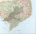
Lãnh thổ bảo hộ Chân Lạp thời các chúa Nguyễn |
|---|---|
| Nguồn gốc |
Tôi sáng tạo ra toàn bộ tác phẩm , bản đồ nền Perry-Castañeda Library Map Collection, Indochina Atlas (1970), University of Texas, Austin. http://www.lib.utexas.edu/maps/indochina_atlas/ "Indochina Atlas", published in October 1970 by the Directorate of Intelligence, Office of Basic and Geographic Intelligence, U.S. Central Intelligence Agency. |
| Ngày tạo ra |
3/2010 |
| Tác giả | |
| Giấy phép (Dùng lại tập tin) |
Xem bên dưới. |
Giấy phép
[sửa | sửa mã nguồn]Tôi, người giữ bản quyền của tác phẩm này, từ đây phát hành nó dưới giấy phép sau:
|
 | Đối tượng này có thể đủ điều kiện để chuyển sang dự án Wikimedia Commons. Những hình ảnh, âm thanh, video nào thỏa mãn quy định Commons thì nên được chuyển sang đó để dùng chung với các dự án Wikimedia khác. Ai cũng có thể di chuyển tập tin, thông tin chi tiết có tại Chuyển hình sang Commons. Xin hãy kiểm tra kỹ tình trạng bản quyền trước khi di chuyển!
Sau khi xuất xong, hãy xóa thẻ này và thay bằng ((nowcommons|1=Tên hình trên Commons)) Xuất tập tin sang Commons bằng FileImporter (Đọc thêm và điều chỉnh công cụ tại đây.) |
Lịch sử tập tin
Nhấn vào ngày/giờ để xem nội dung tập tin tại thời điểm đó.
| Ngày/giờ | Hình xem trước | Kích cỡ | Thành viên | Miêu tả | |
|---|---|---|---|---|---|
| hiện tại | 20:03, ngày 14 tháng 3 năm 2010 |  | 2.497×1.760 (6,54 MB) | RobertJordan (thảo luận | đóng góp) | Thu gọn vùng Trấn Tây Thành chịu ảnh hưởng trực tiếp của nhà Nguyễn, các lãnh thổ thuộc Chân Lạp nhưng chịu ảnh hưởng của cả Xiêm lẫn Việt Nam được tô màu hồng |
| 11:30, ngày 13 tháng 3 năm 2010 |  | 1.784×1.666 (4,94 MB) | Doãn Hiệu (thảo luận | đóng góp) | Kết thúc thử nghiệm, phục hồi hiện trạng. Bản thử nghiệm là bản vừa tải ngay trước bản này. Ranh giới vùng ảnh hưởng trong bản thử nghiệm là đường nối ranh giới phía Bắc và Tây tỉnh Kompong T | |
| 11:01, ngày 13 tháng 3 năm 2010 |  | 1.784×1.666 (4,56 MB) | Doãn Hiệu (thảo luận | đóng góp) | thử nghiệm | |
| 10:42, ngày 13 tháng 3 năm 2010 |  | 642×600 (645 kB) | Doãn Hiệu (thảo luận | đóng góp) | thử vẽ ranh giới vùng ảnh hưởng. | |
| 04:01, ngày 12 tháng 3 năm 2010 |  | 1.784×1.666 (4,94 MB) | RobertJordan (thảo luận | đóng góp) | ((Thông tin |Miêu tả = Lãnh thổ bảo hộ Chân Lạp thời các chúa Nguyễn |Nguồn = Tôi sáng tạo ra toàn bộ tác phẩm, bản đồ nền Perry-Castañeda Library Map Collection, Indochina Atlas (1970), University o |
Bạn không được phép ghi đè tập tin này.
Trang sử dụng tập tin
Đặc tính hình
Text is available under the CC BY-SA 4.0 license; additional terms may apply.
Images, videos and audio are available under their respective licenses.
