For faster navigation, this Iframe is preloading the Wikiwand page for File:Sub-Saharan Africa with borders.svg.

File:Sub-Saharan Africa with borders.svg

File orixenałe(file en formato SVG, dimension nominałi 341 × 341 pixel, dimension del file: 65 KB)

Sto file el vien da Wikimedia Commons e se połe dopararlo in altri projeti. Sto cuà vien mostrà ła descrision prexente in te ła pajina de descrision del file.

Somario

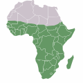
Descrision Map of sub-saharan Africa
Data (UTC)
Provenjiensa
Autore
Liçensa
(Ridoparar sto file)
Public Domain


Sta qua la xe na imagine ritocà, che vol dir che la xe stà modificà digitalmente rispeto a la so version original. Modifiche: Converted to SVG. L'original el se pol védar qua: Sub-Saharan-Africa.png. Modifiche fate da Lew Palm.

Licensa de doparasion:

Public domain Sto laoro el xe stà rilassià nel Publico Dominio dal so autor, Lew Palm. Questo el vale in tuto el mondo.

In serti paesi questo podarìa no èssar legalmente possibile, in sto caso:
Lew Palm el ghe dà a tuti quanti el dirito de doparar sto laoro par qualunque scopo, sensa nissuna condission, via de quele che sia richieste da la lege.

Registro original del caricamento

This image is a derivative work of the following images:

  • File:Sub-Saharan-Africa.png licensed with PD-user
    • 2011-07-09T21:40:56Z Maphobbyist 341x341 (6098 Bytes) South Sudan has become independent on July 9, 2011. Sudan and South Sudan are shown with the new international border between them.
    • 2007-04-08T16:20:00Z Ezeu 341x341 (3253 Bytes)
    • 2006-05-29T22:21:33Z Ezeu 341x341 (3868 Bytes) == Summary == Map of Sub [[Sub-Saharan Africa]]. Mod of [[:Image:BlankMap-Africa.png]]. == Licensing == ((self2|GFDL|cc-by-sa-2.5,2.0,1.0)) [[Category:Maps of Africa]]

Uploaded with derivativeFX

Didascalie

Aggiungi una brevissima spiegazione di ciò che questo file rappresenta

Elementi ritratti in questo file

raprezenta a

Istoria del file

Schicia so on grupo data/or pa vedare el file come che el se presentava in tel momento indegà.

Data/OraMiniaduraDimensionUtenteComento
In ultima14:13, 6 zen 2012Miniadura de la version de le 14:13, 6 zen 2012341 × 341 (65 KB)Lew Palm== ((int:filedesc)) == ((Information |Description=Map of sub-saharan Africa |Source=*File:Sub-Saharan-Africa.png |Date=2012-01-06 11:55 (UTC) |Author=*File:Sub-Saharan-Africa.png: Ezeu *derivative work: Lew Palm

Doparasion del file

Ła pajina che vien ła dopara sto file:

Doparasion globałe del file

St'altre wiki cua le dopara sto file:

Metadati

Traesto fora da Wikipèdia - L'ençiclopedia łìbara e cołaboradiva in łéngua Vèneta "https://vec.wikipedia.org/wiki/File:Sub-Saharan_Africa_with_borders.svg"
{{bottomLinkPreText}} {{bottomLinkText}}
File:Sub-Saharan Africa with borders.svg
Listen to this article

This browser is not supported by Wikiwand :(
Wikiwand requires a browser with modern capabilities in order to provide you with the best reading experience.
Please download and use one of the following browsers:

This article was just edited, click to reload
This article has been deleted on Wikipedia (Why?)

Back to homepage

Please click Add in the dialog above
Please click Allow in the top-left corner,
then click Install Now in the dialog
Please click Open in the download dialog,
then click Install
Please click the "Downloads" icon in the Safari toolbar, open the first download in the list,
then click Install
{{::$root.activation.text}}

Install Wikiwand

Install on Chrome Install on Firefox
Don't forget to rate us

Tell your friends about Wikiwand!

Gmail Facebook Twitter Link

Enjoying Wikiwand?

Tell your friends and spread the love:
Share on Gmail Share on Facebook Share on Twitter Share on Buffer

Our magic isn't perfect

You can help our automatic cover photo selection by reporting an unsuitable photo.

This photo is visually disturbing This photo is not a good choice

Thank you for helping!


Your input will affect cover photo selection, along with input from other users.

X

Get ready for Wikiwand 2.0 🎉! the new version arrives on September 1st! Don't want to wait?