پریزیڈینسی ڈویژن

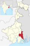
پریزیڈینسی ڈویژن (Presidency division) بھارت کی ریاست مغربی بنگال کا ایک انتظامی ڈویژن ہے۔ پریزیڈینسی ڈویژن صدر دفاتر اور سب سے بڑا شہر کولکاتا ہے جو ریاستی دار الحکومت بھی ہے۔
پریزیڈینسی ڈویژن کے پانچ اضلاع ہیں۔ [1]
| رمز[2] | ضلع | صدر مقام[3] | قیام[4] | ذیلی تقسیم[1] | رقبہ[3] | آبادی بمطابق 2001[update][3] | کثافتِ آبادی | نقشہ |
|---|---|---|---|---|---|---|---|---|
| HR | ہاوڑہ | ہاوڑہ | 1947 |
|
1,467 کلومیٹر2 (566 مربع میل) | 4,273,099 | 2,913/کلو میٹر2 (7,540/مربع میل) |  |
| KO | کولکاتا | کولکاتا | 1947 | — | 185 کلومیٹر2 (71 مربع میل) | 4,572,876 | 24,718/کلو میٹر2 (64,020/مربع میل) |  |
| NA | ندیا ضلع | Krishnanagar | 1947 |
|
3,927 کلومیٹر2 (1,516 مربع میل) | 4,604,827 | 1,173/کلو میٹر2 (3,040/مربع میل) |  |
| PN | North 24 Parganas | باراست | 1986[5] |
|
4,094 کلومیٹر2 (1,581 مربع میل) | 8,934,286 | 2,182/کلو میٹر2 (5,650/مربع میل) |  |
| PS | South 24 Parganas | علی پور، شمالی 24 پرگنہ | 1986[5] |
|
9,960 کلومیٹر2 (3,850 مربع میل) | 6,906,689 | 693/کلو میٹر2 (1,790/مربع میل) |  |
| کل | — | — | — | 21 | 24,957 کلومیٹر2 (9,636 مربع میل) | 35,158,346 | - |  |
حوالہ جات
[ترمیم]- ^ ا ب "Directory of District, Sub division, Panchayat Samiti/ Block and Gram Panchayats in West Bengal, March 2008"۔ West Bengal۔ National Informatics Centre, India۔ 2008-03-19۔ صفحہ: 1۔ 25 فروری 2009 میں اصل سے آرکائیو شدہ۔ اخذ شدہ بتاریخ 28 فروری 2009
- ↑ "NIC Policy on format of e-mail Address: Appendix (2): Districts Abbreviations as per ISO 3166–2" (PDF)۔ وزارت مواصلات و انفارمیشن ٹیکنالوجی، حکومت ہند, Government of India۔ 2004-08-18۔ صفحہ: 5–10۔ 11 ستمبر 2008 میں اصل (PDF) سے آرکائیو شدہ۔ اخذ شدہ بتاریخ 24 نومبر 2008
- ^ ا ب پ "Districts : West Bengal"۔ Government of India portal۔ اخذ شدہ بتاریخ 24 نومبر 2008
- ↑ Here 'Established' means year of establishment as a district of West Bengal. The state of West Bengal was established in 1947 with 14 districts of erstwhile Bengal province of British India.
- ^ ا ب Asim Kumar Mandal (2003)۔ The Sundarbans of India: A Development Analysis۔ Indus Publishing۔ صفحہ: 168–169۔ ISBN 81-7387-143-4۔ 06 جنوری 2019 میں اصل سے آرکائیو شدہ۔ اخذ شدہ بتاریخ 04 ستمبر 2008
22°34′00″N 88°22′00″E / 22.5667°N 88.3667°E
| ریاستی علامات |
| ||||||||||
|---|---|---|---|---|---|---|---|---|---|---|---|
| تاریخ |
| ||||||||||
| جغرافیہ |
| ||||||||||
| حکومت |
| ||||||||||
| حقوق کے گروپس |
| ||||||||||
| ڈویژن اور اضلاع |
| ||||||||||
| شہر اور قصبات |
| ||||||||||
| ثقافت |
| ||||||||||
| جغرافیائی اشارہ اشیا |
| ||||||||||
| آبادیات |
| ||||||||||
| شخصیات |
| ||||||||||
Text is available under the CC BY-SA 4.0 license; additional terms may apply.
Images, videos and audio are available under their respective licenses.
