Цильтендорф
Матеріал з Вікіпедії — вільної енциклопедії.
| Цильтендорф Ziltendorf |
|||
|---|---|---|---|
| — громада — | |||
|
|||
| Координати: 52°13′00″ пн. ш. 14°39′00″ сх. д. / 52.21667° пн. ш. 14.65000° сх. д. | |||
| Країна | |||
| Земля | Бранденбург | ||
| Район | Одер-Шпре | ||
| Об'єднання громад | Брісков-Фінкенгерд | ||
| Площа | |||
| - Повна | 29,21 км² | ||
| Висота над р.м. | 23 м | ||
| Населення (31 грудня 2020[1]) | |||
| - Усього | 1483 | ||
| - Густота | 50,8/км² | ||
| Часовий пояс | CET (UTC+1) | ||
| - Літній час | CEST (UTC+2) | ||
| Поштовий код | 15295 | ||
| Телефонний код(и) | 033653 | ||
| Ідентифікаційний код | 12 0 67 552 | ||
| Вебсайт: www.ziltendorf.com | |||
 |
|||
 Цильтендорф |
|||
 | |||

Цильтендорф (нім. Ziltendorf) — громада в Німеччині, розташована в землі Бранденбург. Входить до складу району Одер-Шпре. Складова частина об'єднання громад Брісков-Фінкенгерд.
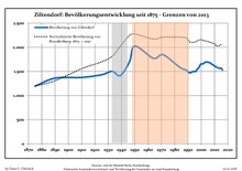
Площа — 29,21 км2. Населення становить 1483 ос. (станом на 31 грудня 2020).
|
|
|
|
- ↑ Bevölkerung im Land Brandenburg nach amtsfreien Gemeinden, Ämtern und Gemeinden 31. Dezember 2020 (XLSX-файл) (нім.)
- ↑ Джерела даних вказані на Wikimedia Commons.Population Projection Brandenburg at Wikimedia Commons
![]() Вікісховище має мультимедійні дані за темою: Цильтендорф
Вікісховище має мультимедійні дані за темою: Цильтендорф
- Офіційний сайт (нім.)
Міста і громади району Одер-Шпрее | ||
|---|---|---|
Айзенгюттенштадт · Бад-Зааров · Беркенбрюк · Беесков · Брізен · Брісков-Фінкенгерд · Вендіш-Ріц · Візенау · Вольтерсдорф · Гозен-Ной-Циттау · Грос-Ліндов · Грунов-Даммендорф · Грюнгайде · Дінсдорф-Радлов · Еркнер · Зідіхум · Лавіц · Лангеваль · Міксдорф · Мюльрозе · Найсемюнде · Нойцелле · Рагов-Мерц · Райхенвальде · Рауен · Ріц-Ноєндорф · Таухе · Фогельзанг · Фрідланд · Фюрстенвальде · Цильтендорф · Шенайхе · Шлаубеталь · Шпреенгаґен · Штайнгефель · Шторков · Якобсдорф |  | |
| Нормативний контроль |
|---|
| Це незавершена стаття з географії Німеччини. Ви можете допомогти проєкту, виправивши або дописавши її. |
Text is available under the CC BY-SA 4.0 license; additional terms may apply.
Images, videos and audio are available under their respective licenses.
Cover photo is available under {{::mainImage.info.license.name || 'Unknown'}} license.
Cover photo is available under {{::mainImage.info.license.name || 'Unknown'}} license.
Credit:
(see original file).
