Торре-де-Санта-Марія (Касерес)
Матеріал з Вікіпедії — вільної енциклопедії.
| Торре-де-Санта-Марія Torre de Santa María | ||
|---|---|---|
| ||
| Муніципалітет | ||
| Країна | ||
| Автономна спільнота | Естремадура | |
| Провінція | Касерес | |
| Координати | 39°15′14″ пн. ш. 6°07′01″ зх. д. / 39.254° пн. ш. 6.117° зх. д.Координати: 39°15′14″ пн. ш. 6°07′01″ зх. д. / 39.254° пн. ш. 6.117° зх. д. | |
| Площа | 19,07 км² | |
| Населення | 629 (2010) | |
| Густота | 32,98 ос./км² | |
| Висота | 490 м | |
| Код INE | 10188 | |
| Поштові індекси | 10186 | |
| Розташування | ||
 | ||
| Влада | ||
| Мер | Флорентіно Перес | |
| Офіційна сторінка | ||

Торре-де-Санта-Марія (ісп. Torre de Santa María) — муніципалітет в Іспанії, у складі автономної спільноти Естремадура, у провінції Касерес. Населення — 629 осіб (2010).
Муніципалітет розташований на відстані[1] близько 240 км на південний захід від Мадрида, 32 км на південний схід від Касереса.
Динаміка населення (INE[2][3] ):

-
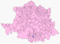 Розташування муніципалітету у провінції Касерес

- ↑ Фізичні відстані розраховані за координатами муніципалітетів
- ↑ Poblaciones de hecho desde 1900 hasta 1991. Cifras oficiales de los Censos respectivos (іспанською) . Національний інститут статистики Іспанії (INE). Процитовано 21 червня 2011.
- ↑ Series de población desde 1996. Cifras oficiales de la Revisión anual del Padrón municipal a 1 de enero de cada año (іспанською) . Національний інститут статистики Іспанії (INE). Процитовано 21 червня 2011.
| Це незавершена стаття з географії Іспанії. Ви можете допомогти проєкту, виправивши або дописавши її. |
Text is available under the CC BY-SA 4.0 license; additional terms may apply.
Images, videos and audio are available under their respective licenses.
Cover photo is available under {{::mainImage.info.license.name || 'Unknown'}} license.
Cover photo is available under {{::mainImage.info.license.name || 'Unknown'}} license.
Credit:
(see original file).
