О-Піно
Матеріал з Вікіпедії — вільної енциклопедії.
| О-Піно гал. O Pino, ісп. El Pino | ||
|---|---|---|
| ||
| Муніципалітет | ||
| Країна | ||
| Автономна спільнота | Галісія | |
| Провінція | Ла-Корунья | |
| Координати | 42°56′10″ пн. ш. 8°19′59″ зх. д. / 42.936° пн. ш. 8.333° зх. д.Координати: 42°56′10″ пн. ш. 8°19′59″ зх. д. / 42.936° пн. ш. 8.333° зх. д. | |
| Площа | 132,3 км² | |
| Населення | 4710 (2009) | |
| Густота | 35,6 ос./км² | |
| Висота | 287 м.н.р.м. | |
| Код INE | 15066 | |
| Поштові індекси | 15821 | |
| Розташування | ||
 | ||
| Влада | ||
| Мер | Мануель Табоада Віго | |
| Офіційна сторінка | ||

О-Піно (гал. O Pino, ісп. El Pino) — муніципалітет в Іспанії, у складі автономної спільноти Галісія, у провінції Ла-Корунья. Населення — 4710 осіб (2009).
Муніципалітет розташований на відстані[1] близько 477 км на північний захід від Мадрида, 48 км на південь від Ла-Коруньї.
Муніципалітет складається з таких паррокій: Арка, Будіньйо, Кастрофейто, Себрейро, Серседа, Феррейрос, Гонсар, Лардейрос, Медін, Пастор, Перейра, О-Піно, Сан-Мамеде-де-Феррейрос.
Через муніципалітет протікає річка Тамбре.
Динаміка населення (INE[2][3] ):

-
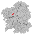 Розташування муніципалітету

- ↑ Фізичні відстані розраховані за координатами муніципалітетів
- ↑ Poblaciones de hecho desde 1900 hasta 1991. Cifras oficiales de los Censos respectivos (іспанською) . Національний інститут статистики Іспанії (INE). Процитовано 24 жовтня 2010.
- ↑ Series de población desde 1996. Cifras oficiales de la Revisión anual del Padrón municipal a 1 de enero de cada año (іспанською) . Національний інститут статистики Іспанії (INE). Процитовано 24 жовтня 2010.
| Це незавершена стаття з географії Іспанії. Ви можете допомогти проєкту, виправивши або дописавши її. |
Text is available under the CC BY-SA 4.0 license; additional terms may apply.
Images, videos and audio are available under their respective licenses.
Cover photo is available under {{::mainImage.info.license.name || 'Unknown'}} license.
Cover photo is available under {{::mainImage.info.license.name || 'Unknown'}} license.
Credit:
(see original file).
