Лаухар-де-Андаракс
Матеріал з Вікіпедії — вільної енциклопедії.
| Лаухар-де-Андаракс Láujar de Andarax | ||
|---|---|---|
| ||
| Муніципалітет | ||
| Країна | ||
| Автономна спільнота | Андалусія | |
| Провінція | Альмерія | |
| Координати | 36°58′59″ пн. ш. 2°52′59″ зх. д. / 36.983° пн. ш. 2.883° зх. д.Координати: 36°58′59″ пн. ш. 2°52′59″ зх. д. / 36.983° пн. ш. 2.883° зх. д. | |
| Площа | 92,0 км² | |
| Населення | 1799 (2010) | |
| Густота | 19,55 ос./км² | |
| Висота | 918 м.н.р.м. | |
| Код INE | 04057 | |
| Поштові індекси | 04470 | |
| Розташування | ||
 | ||
| Влада | ||
| Мер | Хосе Мартін Гонсалес (з 2011) | |
| Офіційна сторінка | ||

Лаухар-де-Андаракс (ісп. Láujar de Andarax) — муніципалітет в Іспанії, у складі автономної спільноти Андалусія, у провінції Альмерія. Населення — 1799 осіб (2010).
Муніципалітет розташований на відстані[1] близько 390 км на південь від Мадрида, 40 км на північний захід від Альмерії.
Динаміка населення (INE[2][3] ):

-
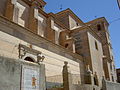 Церква Ла-Енкарнасьйон
 -
 Монастир Сан-Паскуаль-Байлон
 -
 Руїни алькасаби


- ↑ Фізичні відстані розраховані за координатами муніципалітетів
- ↑ Poblaciones de hecho desde 1900 hasta 1991. Cifras oficiales de los Censos respectivos (іспанською) . Національний інститут статистики Іспанії (INE). Процитовано 24 червня 2011.
- ↑ Series de población desde 1996. Cifras oficiales de la Revisión anual del Padrón municipal a 1 de enero de cada año (іспанською) . Національний інститут статистики Іспанії (INE). Процитовано 24 червня 2011.
| Це незавершена стаття з географії Іспанії. Ви можете допомогти проєкту, виправивши або дописавши її. |
Text is available under the CC BY-SA 4.0 license; additional terms may apply.
Images, videos and audio are available under their respective licenses.
Cover photo is available under {{::mainImage.info.license.name || 'Unknown'}} license.
Cover photo is available under {{::mainImage.info.license.name || 'Unknown'}} license.
Credit:
(see original file).
