Високі Татри
Матеріал з Вікіпедії — вільної енциклопедії.


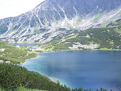
Висо́кі Та́три (Татри) — гірський масив, частина Західних Карпат. Розташовані на кордоні Словаччини та Польщі.
Масив простягається із заходу на схід, між долиною річки Ваг на півдні та річкою Дунаєць на півночі. Найвища точка — гора Герлаховський Штит (2655 м) на території Словаччини, що є найвищою горою країни. Тут же розташовані й інші високі вершини: друга за висотою гора в Словаччині — Ломницький Штит (2632 м) та найвища точка Польщі — гора Риси (2499 м).
Назву Високі Татри має також місто, розташоване в горах на території Словаччини. Населення міста становить 5,5 тис. жителів.
Найвідоміші вершини Високих Татр:
- Герлаховський Штит, 2655 м.
- Ломницький Штит, 2632 м.
- Мали Лядови Штит, 2632 м.
- Задній Герлах, 2616 м.
- Кривань, 2495 м.
- Квопровський Штит, 2363 м.
- Риси, 2499 м.
- Виходна Висока, 2429 м.
- Ягнячи Штит, 2230 м.
- 1989 Татри — астероїд, названий на честь гір[1].
- ↑ Lutz D. Schmadel. Dictionary of Minor Planet Names. — 5-th Edition. — Berlin, Heidelberg : Springer-Verlag, 2003. — 992 (XVI) с. — ISBN 3-540-00238-3.
- Official site of the town of High Tatras [Архівовано 22 травня 2019 у Wayback Machine.]
- Tatry Open Directory [Архівовано 25 червня 2011 у Wayback Machine.]
- Tatra Cable Railways [Архівовано 13 серпня 2006 у Wayback Machine.]
- High Tatras at Summitpost.org [Архівовано 7 січня 2009 у Wayback Machine.]
- Article about the High Tatras with nice photos (German)
- Високі Татри навесні (ФОТОрепортаж) [Архівовано 28 грудня 2012 у Wayback Machine.]
- Літо у Високих Татрах (ФОТОрепортаж) [Архівовано 14 серпня 2013 у Wayback Machine.]
- Various maps of the High Tatras at VysokeTatry.com [Архівовано 5 червня 2007 у Wayback Machine.]
- High Tatras pictures, calamity on 19 November, 2004: villages of High Tatras after the storm [Архівовано 26 березня 2009 у Wayback Machine.]
| Вікісховище має мультимедійні дані за темою: High Tatras |
|
| |||||||||||
| Це незавершена стаття з географії Словаччини. Ви можете допомогти проєкту, виправивши або дописавши її. |
| Це незавершена стаття з географії Польщі. Ви можете допомогти проєкту, виправивши або дописавши її. |
Text is available under the CC BY-SA 4.0 license; additional terms may apply.
Images, videos and audio are available under their respective licenses.


