Алкалалі
Матеріал з Вікіпедії — вільної енциклопедії.
| Алкалалі Alcalalí | ||
|---|---|---|
| ||
| Муніципалітет | ||
| Країна | ||
| Автономна спільнота | Валенсія | |
| Провінція | Аліканте | |
| Координати | 38°44′56″ пн. ш. 0°02′31″ зх. д. / 38.749° пн. ш. 0.042° зх. д.Координати: 38°44′56″ пн. ш. 0°02′31″ зх. д. / 38.749° пн. ш. 0.042° зх. д. | |
| Площа | 14,4 км² | |
| Населення | 1349 (01-01-2022) | |
| Густота | 93,68 ос./км² | |
| Висота | 230 м.н.р.м. | |
| Код INE | 03006 | |
| Поштові індекси | 03728 | |
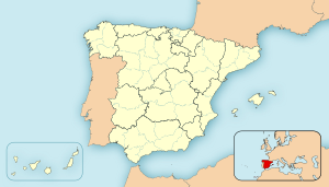
| Розташування | ||
 | ||
| Влада | ||
| Мер | Хосе Вісенте Марко Местре (з 2007) | |
| Офіційна сторінка | ||
Алкалалі, Алькалалі (валенс. Alcalalí, ісп. Alcalalí) — муніципалітет в Іспанії, у складі автономної спільноти Валенсія, у провінції Аліканте. Населення — 1349 осіб (1 січня 2022).[1]
Муніципалітет розташований на відстані[2] близько 360 км на південний схід від Мадрида, 60 км на північний схід від Аліканте.
На території муніципалітету розташовані такі населені пункти: (дані про населення за 2010 рік)[3]
- Алкалалі: 1308 осіб
- Льйоса-де-Камачо: 216 осіб
| ||||||||||||||||||||||||||||||||||||||||||||||||
Динаміка населення (INE[5][6] ):

-
Розташування муніципалітету Алкалалі у автономній спільноті Валенсія
-
Розташування муніципалітету Алкалалі у комарці Маріна-Альта
- ↑ Instituto Nacional de Estadística. (Spanish Statistical Institute). www.ine.es. Процитовано 3 жовтня 2023.
- ↑ Фізичні відстані розраховані за координатами муніципалітетів
- ↑ Nomenclátor. Relación de unidades poblacionales (іспанською) . Національний інститут статистики Іспанії (INE). Архів оригіналу за 9 липня 2013. Процитовано 7 липня 2011.
- ↑ NASA Earth Observations Data Set Index. NASA. Процитовано 30 січня 2016.
- ↑ Poblaciones de hecho desde 1900 hasta 1991. Cifras oficiales de los Censos respectivos (іспанською) . Національний інститут статистики Іспанії (INE). Процитовано 7 липня 2011.
- ↑ Series de población desde 1996. Cifras oficiales de la Revisión anual del Padrón municipal a 1 de enero de cada año (іспанською) . Національний інститут статистики Іспанії (INE). Процитовано 7 липня 2011.
| Це незавершена стаття з географії Іспанії. Ви можете допомогти проєкту, виправивши або дописавши її. |
Text is available under the CC BY-SA 4.0 license; additional terms may apply.
Images, videos and audio are available under their respective licenses.


