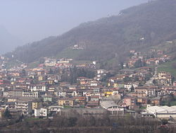
Colzate
Colzate | ||
|---|---|---|
| Comune di Colzate | ||
 Colzate | ||
| ||
| Mga koordinado: 45°49′N 9°52′E / 45.817°N 9.867°E | ||
| Bansa | Italya | |
| Rehiyon | Lombardia | |
| Lalawigan | Bergamo (BG) | |
| Mga frazione | Bondo di Colzate, Piani di Rezzo | |
| Lawak | ||
| • Kabuuan | 6.75 km2 (2.61 milya kuwadrado) | |
| Taas | 424 m (1,391 tal) | |
| Populasyon (2018-01-01)[2] | ||
| • Kabuuan | 1,638 | |
| • Kapal | 240/km2 (630/milya kuwadrado) | |
| Demonym | Colzatesi | |
| Sona ng oras | UTC+1 (CET) | |
| • Tag-init (DST) | UTC+2 (CEST) | |
| Kodigong Postal | 24020 | |
| Kodigo sa pagpihit | 035 | |

Ang Colzate (Bergamasque: Colgiàt) ay isang comune (komuna o munisipalidad) sa Lalawigan ng Bergamo sa rehiyon ng Lombardia, sa hilagang Italya, na matatagpuan mga 70 kilometro (43 mi) hilagang-silangan ng Milan at mga 20 kilometro (12 mi) hilagang-silangan ng Bergamo. Noong 31 Disyembre 2004, mayroon itong populasyon na 1,638 at may lawak na 6.7 square kilometre (2.6 mi kuw).[3]
Ang munisipalidad ng Colzate ay naglalaman ng mga frazione (mga pagkakahati, pangunahin na mga pamayanan at nayon) ng Bondo di Colzate at Piani di Rezzo.
Ang Colzate ay may hangganan sa mga sumusunod na munisipalidad: Casnigo, Gorno, Oneta, at Vertova.
Pisikal na heograpiya
[baguhin | baguhin ang wikitext]
Ang munisipal na lugar ay may iba't ibang heomorpolohikong aspeto, mula sa aluvial na kapatagan ng ilog Serio, na matatagpuan sa taas na humigit-kumulang 393 m. sa maliit na bahagyang itinaas na talampas kung saan umuunlad ang sentrong pangkasaysayan, sa mga nakapalibot na burol na kinabibilangan ng mga bundok ng Segredònt (1,555 m.), Tisa (1317 m.) at Cavlera. Ang huli, mula sa taas ng 1,320 m. nito, ay namumukod-tangi sa tinatahanang lugar, na naglalaman sa mga dalisdis nito ng mga nayon ng Bondo at Barbata, na nagpapanatili pa rin ng makatarungang bilang ng mga residente, at ang maliliit na nayon sa bundok ng Rezzo at Unì.
Ebolusyong demograpiko
[baguhin | baguhin ang wikitext]
Mga sanggunian
[baguhin | baguhin ang wikitext]- ↑ "Superficie di Comuni Province e Regioni italiane al 9 ottobre 2011". Istat. Nakuha noong 16 Marso 2019.
((cite web)): CS1 maint: date auto-translated (link) - ↑ "Popolazione Residente al 1° Gennaio 2018". Istat. Nakuha noong 16 Marso 2019.
((cite web)): CS1 maint: date auto-translated (link) - ↑ All demographics and other statistics: Italian statistical institute Istat.
Text is available under the CC BY-SA 4.0 license; additional terms may apply.
Images, videos and audio are available under their respective licenses.


