เทศมณฑลออเรนจ์
เทศมณฑลออเรนจ์ | |
|---|---|
เทศมณฑล | |
 แผนที่ของเทศมณฑลออเรนจ์ | |
 สถานที่ตั้งในรัฐแคลิฟอร์เนีย | |
| พิกัด: 33°40′N 117°47′W / 33.67°N 117.78°W | |
| ประเทศ | สหรัฐ |
| รัฐ | แคลิฟอร์เนีย |
| ภูมิภาค | เกรเทอร์ลอสแอนเจลิส |
| ตั้งเมือง | 1 สิงหาคม 1889[1] |
| ที่ตั้งเทศมณฑล | แซนตาแอนา |
| การปกครอง | |
| • ประเภท | ผู้บริหารสูงสุดสภา |
| • ประธาน | ดอนัลด์ พี. แวกเนอร์ (R) |
| พื้นที่ | |
| • ทั้งหมด | 948 ตร.ไมล์ (2,460 ตร.กม.) |
| • พื้นดิน | 799 ตร.ไมล์ (2,070 ตร.กม.) |
| • พื้นน้ำ | 157 ตร.ไมล์ (410 ตร.กม.) |
| ความสูงจุดสูงสุด[2] | 5,690 ฟุต (1,730 เมตร) |
| ประชากร (1 เมษายน 2020)[3] | |
| • ทั้งหมด | 3,186,989 คน |
| • ความหนาแน่น | 3,989 คน/ตร.ไมล์ (1,540 คน/ตร.กม.) |
| เดมะนิม | Orange Countian |
| เขตเวลา | UTC−8 |
| • ฤดูร้อน (เวลาออมแสง) | UTC−7 (เวลาออมแสงแปซิฟิก) |
| รหัสพื้นที่ | 562, 657/714, 949 |
| เว็บไซต์ | ocgov |
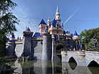
เทศมณฑลออเรนจ์ (อังกฤษ: Orange County) เป็นเทศมณฑลที่ตั้งอยู่ในเขตมหานครลอสแอนเจลิส เซาเทิร์นแคลิฟอร์เนีย สหรัฐ จากการสำรวจสำมะโนประชากรปี 2020 มีประชากร 3,186,989 คน[3] ทำให้เป็นเทศมณฑลที่มีประชากรมากเป็นอันดับสามของรัฐแคลิฟอร์เนีย เป็นเทศมณฑลที่มีประชากรมากเป็นอันดับหกของสหรัฐ และมีประชากรมากกว่า 19 รัฐของสหรัฐรวมถึงวอชิงตัน ดี.ซี. [4] แม้ว่าพื้นที่ส่วนใหญ่เป็นเขตชานเมือง แต่ก็เป็นเทศมณฑลที่มีประชากรหนาแน่นมากเป็นอันดับสองในรัฐรองจากเทศมณฑลซานฟรานซิสโก[5] เมืองที่มีประชากรมากที่สุดสามเมืองในเทศมณฑล ได้แก่ แอนะไฮม์ แซนตาแอนา และเออร์ไวน์ ซึ่งแต่ละเมืองมีประชากรมากกว่า 300,000 คน[6] แซนตาแอนายังเป็นที่ตั้งเทศมณฑลอีกด้วย
อ้างอิง
- ↑ "Orange County Historical Society: History Articles :: The Birth of Orange County". Orangecountyhistory.org. คลังข้อมูลเก่าเก็บจากแหล่งเดิมเมื่อ April 9, 2017. สืบค้นเมื่อ November 17, 2018.
- ↑ "Santiago Peak". Peakbagger.org. เก็บจากแหล่งเดิมเมื่อ March 25, 2015. สืบค้นเมื่อ January 30, 2015.
- ↑ 3.0 3.1 "Orange County, California". United States Census Bureau. เก็บจากแหล่งเดิมเมื่อ September 26, 2022. สืบค้นเมื่อ January 30, 2022.
- ↑ "American FactFinder". United States Census Bureau. สืบค้นเมื่อ July 10, 2014.
- ↑ "California Population Density County Rank". USA.com. เก็บจากแหล่งเดิมเมื่อ August 14, 2013. สืบค้นเมื่อ August 14, 2013.
- ↑ "Find a County". National Association of Counties. คลังข้อมูลเก่าเก็บจากแหล่งเดิมเมื่อ May 3, 2015. สืบค้นเมื่อ June 7, 2011.
Text is available under the CC BY-SA 4.0 license; additional terms may apply.
Images, videos and audio are available under their respective licenses.


