เกาะเชจู
ชื่อท้องถิ่น: 제주도 | |
|---|---|
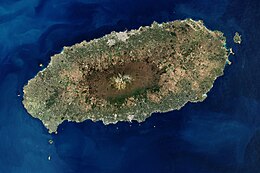
 ภาพถ่ายดาวเทียมของเกาะเชจู | |
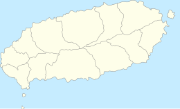
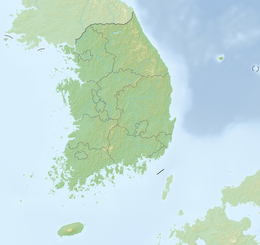
 แผนที่เกาะเชจู | |
| ภูมิศาสตร์ | |
| ที่ตั้ง | เอเชียตะวันออก |
| พิกัด | 33°23′N 126°32′E / 33.38°N 126.53°E |
| กลุ่มเกาะ | เชจู |
| พื้นที่ | 1,826[1] ตารางกิโลเมตร (705 ตารางไมล์) |
| ความยาว | 73 กม. (45.4 ไมล์) |
| ความกว้าง | 31 กม. (19.3 ไมล์) |
| ระดับสูงสุด | 1,950 ม. (6400 ฟุต) |
| จุดสูงสุด | Hallasan |
| การปกครอง | |
เกาหลีใต้ | |
| จังหวัดปกครองตนเองพิเศษ | เชจู |
| เมืองใหญ่สุด | นครเชจู (ประชากร 501,791 คน) |
เกาหลีเหนือ (อ้างสิทธิ์) | |
| จังหวัด | จังหวัดช็อลลาใต้ |
| ระดับเทศมณฑล | เกาะเชจู (แบ่งเป็น 1 ŭp และ 12 myŏn) |
| ประชากรศาสตร์ | |
| ประชากร | 695,519 (2020) |
| ความหนาแน่น | 316/กม.2 (818/ตารางไมล์) |
| ภาษา | เชจู, เกาหลี |
| กลุ่มชาติพันธุ์ | เชจู, เกาหลี |
| เกาะเชจู | |
| ฮันกึล | 제주도 |
|---|---|
| ฮันจา | 濟州島 |
| อาร์อาร์ | Jejudo |
| เอ็มอาร์ | Chejudo |
| บทความนี้อักษรเกาหลีปรากฏอยู่ คุณอาจเห็นเครื่องหมายคำถามหรือสัญลักษณ์อื่นแทนตัวอักษร หากคอมพิวเตอร์ของคุณไม่สามารถแสดงผลอักษรฮันกึลและอักษรฮันจาได้อย่างถูกต้อง |
เกาะเชจู (เกาหลี: 제주도; ฮันจา: 濟州島; สัทอักษรสากล: /tɕeːdzudo/) เป็นเกาะที่ใหญ่ที่สุดในประเทศเกาหลีใต้ กินพื้นที่ 1,833.2 km2 (707.8 sq mi) ซึ่งเท่ากับร้อยละ 1.83 ของพื้นที่ประเทศทั้งหมด และยังเป็นเกาะที่มีประชากรมากที่สุดของประเทศ ใน ค.ศ. 2020 มีประชากรตามทะเบียนราษฎร์อยู่บนเกาะนี้ประมาณ 670,000 คน[2][3] เกาะนี้ถือเป็นจังหวัดของตนเอง (จังหวัดปกครองตนเองพิเศษเชจู)
เกาะนี้ตั้งอยู่ในช่องแคบเกาหลี ซึ่งอยู่ทางใต้ของคาบสมุทรเกาหลี และจังหวัดช็อลลาใต้ เกาะนี้ตั้งอยู่ห่างจากจุดที่อยู่ใกล้คาบสมุทรสุด 82.8 km (51.4 mi)[4]
เกาะนี้ "ก่อกำเนิดจากการปะทุของภูเขาไฟใต้ทะเลประมาณ 2 ล้านปีที่แล้ว"[5] โดยเป็นที่ตั้งของแหล่งมรดกโลกตามธรรมชาติที่มีชื่อว่า เกาะภูเขาไฟเชจูและอุโมงค์ลาวา[6]
ภูมิประเทศ
[แก้]ภูมิอากาศ
[แก้]เชจูอยู่ในพื้นที่ภูมิอากาศแบบอบอุ่นชื้น โดยมีสี่ฤดูและอากาศอบอุ่นสบาย อุณหภูมิโดยเฉลี่ย 15 องศาเซลเซียส ตลอดทั้งปีและในฤดูร้อนอุณหภูมิโดยเฉลี่ยคือ 22-26 องศาเซลเซียส
ในเดือนมกราคม ค.ศ. 2016 มีคลื่นความหนาวส่งผลกระทบถึงที่นี่ หิมะและสภาพอากาศที่หนาวเย็นทำให้สายการบิน 1,200 แห่งยกเลิกเที่ยวบินไปเกาะเชจู ทำให้มีผู้โดยสารติดค้างประมาณ 90,300 คน[7]
| ข้อมูลภูมิอากาศของนครเชจู (ปกติ ค.ศ. 1991–2020, สูงสุด ค.ศ. 1923–ปัจจุบัน) | |||||||||||||
|---|---|---|---|---|---|---|---|---|---|---|---|---|---|
| เดือน | ม.ค. | ก.พ. | มี.ค. | เม.ย. | พ.ค. | มิ.ย. | ก.ค. | ส.ค. | ก.ย. | ต.ค. | พ.ย. | ธ.ค. | ทั้งปี |
| อุณหภูมิสูงสุดที่เคยบันทึก °C (°F) | 21.8 (71.2) |
24.5 (76.1) |
28.1 (82.6) |
30.9 (87.6) |
31.6 (88.9) |
34.5 (94.1) |
37.5 (99.5) |
37.4 (99.3) |
34.4 (93.9) |
32.1 (89.8) |
26.4 (79.5) |
23.3 (73.9) |
37.5 (99.5) |
| อุณหภูมิสูงสุดเฉลี่ย °C (°F) | 8.6 (47.5) |
9.9 (49.8) |
13.3 (55.9) |
18.0 (64.4) |
22.1 (71.8) |
24.9 (76.8) |
29.3 (84.7) |
30.1 (86.2) |
26.1 (79) |
21.6 (70.9) |
16.4 (61.5) |
11.0 (51.8) |
19.3 (66.7) |
| อุณหภูมิเฉลี่ยแต่ละวัน °C (°F) | 6.1 (43) |
6.8 (44.2) |
9.8 (49.6) |
14.2 (57.6) |
18.3 (64.9) |
21.7 (71.1) |
26.2 (79.2) |
27.2 (81) |
23.3 (73.9) |
18.6 (65.5) |
13.3 (55.9) |
8.3 (46.9) |
16.2 (61.2) |
| อุณหภูมิต่ำสุดเฉลี่ย °C (°F) | 3.7 (38.7) |
4.0 (39.2) |
6.6 (43.9) |
10.8 (51.4) |
15.0 (59) |
19.1 (66.4) |
23.7 (74.7) |
24.8 (76.6) |
20.9 (69.6) |
15.7 (60.3) |
10.4 (50.7) |
5.6 (42.1) |
13.4 (56.1) |
| อุณหภูมิต่ำสุดที่เคยบันทึก °C (°F) | -5.8 (21.6) |
-6.0 (21.2) |
-4.1 (24.6) |
-0.2 (31.6) |
4.0 (39.2) |
9.2 (48.6) |
15.0 (59) |
15.8 (60.4) |
9.8 (49.6) |
5.5 (41.9) |
0.5 (32.9) |
-3.6 (25.5) |
−6.0 (21.2) |
| หยาดน้ำฟ้า มม (นิ้ว) | 67.5 (2.657) |
57.2 (2.252) |
90.6 (3.567) |
89.7 (3.531) |
95.6 (3.764) |
171.2 (6.74) |
210.2 (8.276) |
272.3 (10.72) |
227.8 (8.969) |
95.1 (3.744) |
69.5 (2.736) |
55.6 (2.189) |
1,502.3 (59.146) |
| ความชื้นร้อยละ | 64.0 | 63.3 | 63.2 | 64.8 | 68.4 | 77.9 | 78.3 | 76.2 | 73.7 | 66.4 | 65.0 | 64.1 | 68.8 |
| วันที่มีหยาดน้ำฟ้าโดยเฉลี่ย (≥ 0.1 mm) | 12.2 | 10.2 | 10.3 | 9.4 | 9.8 | 11.7 | 11.8 | 13.2 | 11.2 | 6.7 | 9.8 | 11.5 | 127.8 |
| วันที่มีหิมะตกโดยเฉลี่ย | 7.2 | 4.2 | 1.0 | 0.0 | 0.0 | 0.0 | 0.0 | 0.0 | 0.0 | 0.0 | 0.4 | 5.3 | 18.1 |
| จำนวนชั่วโมงที่มีแดด | 70.2 | 110.0 | 166.0 | 196.5 | 212.2 | 159.7 | 189.8 | 195.1 | 158.9 | 173.3 | 123.7 | 79.1 | 1,834.5 |
| แหล่งที่มา: Korea Meteorological Administration (percent sunshine 1981–2010)[8][9][10][11][12] | |||||||||||||
| ข้อมูลภูมิอากาศของซอกวีโพ (ปกติ ค.ศ. 1991–2020, สูงสุด ค.ศ. 1961–ปัจจุบัน) | |||||||||||||
|---|---|---|---|---|---|---|---|---|---|---|---|---|---|
| เดือน | ม.ค. | ก.พ. | มี.ค. | เม.ย. | พ.ค. | มิ.ย. | ก.ค. | ส.ค. | ก.ย. | ต.ค. | พ.ย. | ธ.ค. | ทั้งปี |
| อุณหภูมิสูงสุดที่เคยบันทึก °C (°F) | 20.7 (69.3) |
20.4 (68.7) |
23.8 (74.8) |
28.5 (83.3) |
30.4 (86.7) |
31.5 (88.7) |
35.5 (95.9) |
35.9 (96.6) |
33.6 (92.5) |
30.9 (87.6) |
28.0 (82.4) |
21.9 (71.4) |
35.9 (96.6) |
| อุณหภูมิสูงสุดเฉลี่ย °C (°F) | 10.8 (51.4) |
11.8 (53.2) |
14.7 (58.5) |
18.6 (65.5) |
22.3 (72.1) |
24.7 (76.5) |
28.3 (82.9) |
30.1 (86.2) |
27.4 (81.3) |
23.5 (74.3) |
18.4 (65.1) |
13.1 (55.6) |
20.3 (68.5) |
| อุณหภูมิเฉลี่ยแต่ละวัน °C (°F) | 7.2 (45) |
8.2 (46.8) |
11.0 (51.8) |
15.0 (59) |
18.8 (65.8) |
21.8 (71.2) |
25.7 (78.3) |
27.2 (81) |
24.1 (75.4) |
19.6 (67.3) |
14.6 (58.3) |
9.4 (48.9) |
16.9 (62.4) |
| อุณหภูมิต่ำสุดเฉลี่ย °C (°F) | 4.1 (39.4) |
4.8 (40.6) |
7.5 (45.5) |
11.6 (52.9) |
15.8 (60.4) |
19.5 (67.1) |
23.8 (74.8) |
24.9 (76.8) |
21.5 (70.7) |
16.4 (61.5) |
11.2 (52.2) |
6.2 (43.2) |
13.9 (57) |
| อุณหภูมิต่ำสุดที่เคยบันทึก °C (°F) | -6.4 (20.5) |
-6.3 (20.7) |
-4.4 (24.1) |
0.2 (32.4) |
7.2 (45) |
11.9 (53.4) |
14.8 (58.6) |
16.8 (62.2) |
12.2 (54) |
6.8 (44.2) |
0.0 (32) |
-4.1 (24.6) |
−6.4 (20.5) |
| หยาดน้ำฟ้า มม (นิ้ว) | 60.7 (2.39) |
77.9 (3.067) |
130.3 (5.13) |
187.0 (7.362) |
223.6 (8.803) |
267.6 (10.535) |
275.8 (10.858) |
315.7 (12.429) |
208.8 (8.22) |
100.4 (3.953) |
86.2 (3.394) |
55.6 (2.189) |
1,989.6 (78.331) |
| ความชื้นร้อยละ | 63.0 | 62.5 | 62.4 | 65.2 | 70.6 | 80.7 | 86.1 | 80.9 | 73.6 | 64.8 | 64.7 | 63.2 | 69.8 |
| วันที่มีหยาดน้ำฟ้าโดยเฉลี่ย (≥ 0.1 mm) | 9.8 | 9.6 | 10.5 | 10.1 | 10.7 | 12.8 | 13.8 | 14.3 | 10.9 | 5.8 | 8.1 | 8.9 | 125.3 |
| วันที่มีหิมะตกโดยเฉลี่ย | 3.8 | 2.4 | 0.8 | 0.0 | 0.0 | 0.0 | 0.0 | 0.0 | 0.0 | 0.0 | 0.1 | 3.1 | 10.2 |
| จำนวนชั่วโมงที่มีแดด | 153.5 | 157.4 | 185.8 | 196.5 | 203.5 | 136.3 | 144.8 | 187.7 | 174.7 | 208.8 | 166.8 | 158.8 | 2,074.6 |
| แหล่งที่มา: Korea Meteorological Administration (percent sunshine 1981–2010) | |||||||||||||
| ข้อมูลภูมิอากาศของGosan-ri, Hangyeong-myeon, นครเชจู (ค.ศ. 1991–2020) | |||||||||||||
|---|---|---|---|---|---|---|---|---|---|---|---|---|---|
| เดือน | ม.ค. | ก.พ. | มี.ค. | เม.ย. | พ.ค. | มิ.ย. | ก.ค. | ส.ค. | ก.ย. | ต.ค. | พ.ย. | ธ.ค. | ทั้งปี |
| อุณหภูมิสูงสุดเฉลี่ย °C (°F) | 8.4 (47.1) |
9.4 (48.9) |
12.5 (54.5) |
16.7 (62.1) |
20.4 (68.7) |
23.7 (74.7) |
27.4 (81.3) |
29.3 (84.7) |
26.1 (79) |
21.4 (70.5) |
16.4 (61.5) |
11.0 (51.8) |
18.6 (65.5) |
| อุณหภูมิเฉลี่ยแต่ละวัน °C (°F) | 6.1 (43) |
6.6 (43.9) |
9.4 (48.9) |
13.4 (56.1) |
17.1 (62.8) |
20.7 (69.3) |
24.9 (76.8) |
26.4 (79.5) |
23.0 (73.4) |
18.5 (65.3) |
13.5 (56.3) |
8.5 (47.3) |
15.7 (60.3) |
| อุณหภูมิต่ำสุดเฉลี่ย °C (°F) | 3.8 (38.8) |
4.1 (39.4) |
6.5 (43.7) |
10.5 (50.9) |
14.3 (57.7) |
18.4 (65.1) |
22.9 (73.2) |
24.1 (75.4) |
20.6 (69.1) |
15.9 (60.6) |
10.9 (51.6) |
5.9 (42.6) |
13.2 (55.8) |
| หยาดน้ำฟ้า มม (นิ้ว) | 40.6 (1.598) |
47.8 (1.882) |
76.2 (3) |
94.7 (3.728) |
117.7 (4.634) |
158.1 (6.224) |
167.7 (6.602) |
201.9 (7.949) |
120.4 (4.74) |
56.9 (2.24) |
60.2 (2.37) |
40.7 (1.602) |
1,182.9 (46.571) |
| ความชื้นร้อยละ | 66.9 | 68.0 | 69.9 | 74.2 | 80.2 | 86.2 | 89.2 | 83.9 | 77.8 | 69.7 | 67.9 | 66.5 | 75.0 |
| วันที่มีหยาดน้ำฟ้าโดยเฉลี่ย (≥ 0.1 mm) | 10.6 | 9.0 | 10.2 | 9.0 | 9.6 | 11.3 | 11.3 | 13.1 | 9.6 | 6.3 | 8.6 | 10.4 | 119 |
| วันที่มีหิมะตกโดยเฉลี่ย | 5.9 | 3.0 | 1.3 | 0.0 | 0.0 | 0.0 | 0.0 | 0.0 | 0.0 | 0.0 | 0.3 | 4.0 | 14.5 |
| จำนวนชั่วโมงที่มีแดด | 95.4 | 131.0 | 175.4 | 196.3 | 205.3 | 156.0 | 172.6 | 219.7 | 187.4 | 206.6 | 150.7 | 106.3 | 2,002.7 |
| แหล่งที่มา: Korea Meteorological Administration (snow and percent sunshine 1981–2010) | |||||||||||||
| ข้อมูลภูมิอากาศของSeongsan-eup, ซอกวีโพ (ค.ศ. 1991–2020) | |||||||||||||
|---|---|---|---|---|---|---|---|---|---|---|---|---|---|
| เดือน | ม.ค. | ก.พ. | มี.ค. | เม.ย. | พ.ค. | มิ.ย. | ก.ค. | ส.ค. | ก.ย. | ต.ค. | พ.ย. | ธ.ค. | ทั้งปี |
| อุณหภูมิสูงสุดเฉลี่ย °C (°F) | 8.9 (48) |
10.1 (50.2) |
13.6 (56.5) |
18.0 (64.4) |
21.9 (71.4) |
24.2 (75.6) |
28.1 (82.6) |
29.7 (85.5) |
26.5 (79.7) |
22.0 (71.6) |
16.7 (62.1) |
11.2 (52.2) |
19.2 (66.6) |
| อุณหภูมิเฉลี่ยแต่ละวัน °C (°F) | 5.4 (41.7) |
6.3 (43.3) |
9.5 (49.1) |
13.8 (56.8) |
17.7 (63.9) |
20.9 (69.6) |
25.1 (77.2) |
26.5 (79.7) |
23.2 (73.8) |
18.2 (64.8) |
12.7 (54.9) |
7.5 (45.5) |
15.6 (60.1) |
| อุณหภูมิต่ำสุดเฉลี่ย °C (°F) | 2.1 (35.8) |
2.5 (36.5) |
5.2 (41.4) |
9.4 (48.9) |
13.7 (56.7) |
17.9 (64.2) |
22.6 (72.7) |
23.9 (75) |
20.2 (68.4) |
14.5 (58.1) |
8.8 (47.8) |
3.9 (39) |
12.1 (53.8) |
| หยาดน้ำฟ้า มม (นิ้ว) | 77.5 (3.051) |
83.2 (3.276) |
139.4 (5.488) |
161.3 (6.35) |
178.0 (7.008) |
231.9 (9.13) |
271.3 (10.681) |
343.2 (13.512) |
248.6 (9.787) |
114.0 (4.488) |
102.8 (4.047) |
78.8 (3.102) |
2,030.0 (79.921) |
| ความชื้นร้อยละ | 67.4 | 65.5 | 65.4 | 67.4 | 72.2 | 82.6 | 85.6 | 81.5 | 76.3 | 69.4 | 68.7 | 67.7 | 72.5 |
| วันที่มีหยาดน้ำฟ้าโดยเฉลี่ย (≥ 0.1 mm) | 11.0 | 9.8 | 10.4 | 9.4 | 9.8 | 12.8 | 12.7 | 13.3 | 10.8 | 6.3 | 9.0 | 10.1 | 125.4 |
| วันที่มีหิมะตกโดยเฉลี่ย | 6.1 | 3.7 | 0.7 | 0.1 | 0.0 | 0.0 | 0.0 | 0.0 | 0.0 | 0.0 | 0.2 | 3.8 | 14.6 |
| จำนวนชั่วโมงที่มีแดด | 128.6 | 145.5 | 181.5 | 198.0 | 208.7 | 141.1 | 160.3 | 192.6 | 167.2 | 192.0 | 156.7 | 134.7 | 2,006.9 |
| แหล่งที่มา: Korea Meteorological Administration (snow and percent sunshine 1981–2010) | |||||||||||||
| ข้อมูลภูมิอากาศของSeongpanak, Hallasan (ความสูง: 760 เมตร (2,490 ฟุต), ค.ศ. 1991–2020) | |||||||||||||
|---|---|---|---|---|---|---|---|---|---|---|---|---|---|
| เดือน | ม.ค. | ก.พ. | มี.ค. | เม.ย. | พ.ค. | มิ.ย. | ก.ค. | ส.ค. | ก.ย. | ต.ค. | พ.ย. | ธ.ค. | ทั้งปี |
| อุณหภูมิสูงสุดเฉลี่ย °C (°F) | 2.8 (37) |
4.7 (40.5) |
9.0 (48.2) |
14.5 (58.1) |
18.9 (66) |
21.4 (70.5) |
24.7 (76.5) |
24.7 (76.5) |
21.1 (70) |
16.6 (61.9) |
11.2 (52.2) |
5.2 (41.4) |
14.6 (58.3) |
| อุณหภูมิเฉลี่ยแต่ละวัน °C (°F) | -0.4 (31.3) |
1.0 (33.8) |
4.9 (40.8) |
10.2 (50.4) |
14.7 (58.5) |
17.7 (63.9) |
21.4 (70.5) |
21.6 (70.9) |
17.8 (64) |
12.8 (55) |
7.4 (45.3) |
1.9 (35.4) |
10.9 (51.6) |
| อุณหภูมิต่ำสุดเฉลี่ย °C (°F) | -3.1 (26.4) |
-2.3 (27.9) |
0.9 (33.6) |
5.9 (42.6) |
10.6 (51.1) |
14.3 (57.7) |
18.5 (65.3) |
18.9 (66) |
15.0 (59) |
9.3 (48.7) |
4.0 (39.2) |
-1.0 (30.2) |
7.6 (45.7) |
| หยาดน้ำฟ้า มม (นิ้ว) | 137.1 (5.398) |
182.4 (7.181) |
258.8 (10.189) |
414.9 (16.335) |
465.9 (18.343) |
451.7 (17.783) |
583.9 (22.988) |
717.0 (28.228) |
581.1 (22.878) |
237.2 (9.339) |
197.5 (7.776) |
153.5 (6.043) |
4,381.0 (172.48) |
| วันที่มีหยาดน้ำฟ้าโดยเฉลี่ย (≥ 0.1 mm) | 13.0 | 11.5 | 11.0 | 10.8 | 11.1 | 14.1 | 17.8 | 18.7 | 15.6 | 9.2 | 11.6 | 13.4 | 157.8 |
| แหล่งที่มา: Korea Meteorological Administration | |||||||||||||
| ข้อมูลภูมิอากาศของWitse Oreum, Hallasan (ความสูง: 1,672 เมตร (5,486 ฟุต), ค.ศ. 2003–2009 ) | |||||||||||||
|---|---|---|---|---|---|---|---|---|---|---|---|---|---|
| เดือน | ม.ค. | ก.พ. | มี.ค. | เม.ย. | พ.ค. | มิ.ย. | ก.ค. | ส.ค. | ก.ย. | ต.ค. | พ.ย. | ธ.ค. | ทั้งปี |
| อุณหภูมิสูงสุดเฉลี่ย °C (°F) | -1.6 (29.1) |
0.9 (33.6) |
3.4 (38.1) |
10.0 (50) |
14.9 (58.8) |
18.1 (64.6) |
20.3 (68.5) |
20.6 (69.1) |
18.1 (64.6) |
13.2 (55.8) |
6.8 (44.2) |
0.0 (32) |
10.4 (50.7) |
| อุณหภูมิเฉลี่ยแต่ละวัน °C (°F) | -5.9 (21.4) |
-3.5 (25.7) |
-0.8 (30.6) |
5.2 (41.4) |
10.3 (50.5) |
14.0 (57.2) |
17.4 (63.3) |
17.4 (63.3) |
14.2 (57.6) |
8.2 (46.8) |
2.2 (36) |
-3.5 (25.7) |
6.4 (43.5) |
| อุณหภูมิต่ำสุดเฉลี่ย °C (°F) | -9.1 (15.6) |
-7.5 (18.5) |
-5.1 (22.8) |
0.7 (33.3) |
5.7 (42.3) |
10.4 (50.7) |
14.7 (58.5) |
14.5 (58.1) |
11.0 (51.8) |
4.3 (39.7) |
-0.9 (30.4) |
-6.6 (20.1) |
2.7 (36.9) |
| หยาดน้ำฟ้า มม (นิ้ว) | 46.9 (1.846) |
128.0 (5.039) |
301.2 (11.858) |
426.1 (16.776) |
653.1 (25.713) |
651.9 (25.665) |
742.3 (29.224) |
836.4 (32.929) |
526.7 (20.736) |
126.5 (4.98) |
165.8 (6.528) |
64.6 (2.543) |
4,669.4 (183.835) |
| แหล่งที่มา: Jeju Regional Meteorological Administration[13] | |||||||||||||
การแบ่งเขตการปกครอง
[แก้]| แผนที่ | ลำดับที่ | ชื่อ | ฮันกึน | ฮันจา | จำนวนประชากร (2010) |
|---|---|---|---|---|---|

| |||||
| — เมือง — | |||||
| 1 | เชจู | 제주 | 濟州 | 401,192 | |
| 2 | Seogwipo | 서귀포 | 西歸浦 | 130,713 | |
ดูเพิ่ม
[แก้]- จังหวัดเชจู
- โคดำเชจู
- ม้าเชจู
- ภาษาเชจู
- เกาะเชจูและถ้ำลาวา
อ้างอิง
[แก้]- ↑ "Joshua Calder's World Island Info - Largest Islands of Selected Countries". Worldislandinfo.com. คลังข้อมูลเก่าเก็บจากแหล่งเดิมเมื่อ 2014-12-17. สืบค้นเมื่อ 2016-01-30.
- ↑ “120417(조간)_2012년도_지적통계연보_발간(지적기획과1)” (HWP). April 16, 2012. The total area of the Jeju Special Self-Governing Province is 1,849 km.
- ↑ Ministry of Public Administration and Security, September 30, 2020.
- ↑ Landsat/Copernicus; Data SIO; NOAA; United States Navy; NGA; GEBCO; TMap Mobility; TerraMetrics (2022). "Korea Strait" (Map). Google Earth. Alphabet. สืบค้นเมื่อ 15 May 2022.
- ↑ "Jeju Island". Business Traveller. February 2011.
- ↑ "Unesco names World Heritage sites". BBC News. June 28, 2007. สืบค้นเมื่อ May 6, 2010.
- ↑ Ap, Tiffany (January 25, 2016). "Deaths, travel disruption as bitter cold grips Asia". CNN. สืบค้นเมื่อ January 25, 2016.
- ↑ "Climatological Normals of Korea (1991 ~ 2020)" (PDF) (ภาษาเกาหลี). Korea Meteorological Administration. คลังข้อมูลเก่าเก็บจากแหล่งเดิม (PDF)เมื่อ 29 January 2022. สืบค้นเมื่อ 4 April 2022.
- ↑ 우리나라 기후평년값 - 파일셋 (ภาษาเกาหลี). Korea Meteorological Administration. สืบค้นเมื่อ 4 April 2022.
- ↑ 우리나라 기후평년값 - 그래프 (ภาษาเกาหลี). Korea Meteorological Administration. สืบค้นเมื่อ 4 April 2022.
- ↑ 순위값 - 구역별조회 (ภาษาเกาหลี). Korea Meteorological Administration. สืบค้นเมื่อ 4 April 2022.
- ↑ "Climatological Normals of Korea" (PDF). Korea Meteorological Administration. 2011. คลังข้อมูลเก่าเก็บจากแหล่งเดิม (PDF)เมื่อ 7 December 2016. สืบค้นเมื่อ 8 December 2016.
- ↑ "제주도상세기후특성집(2010) 윗세오름(871)". Jeju Regional Meteorological Administration. สืบค้นเมื่อ 2010-11-30.
แหล่งข้อมูลอื่น
[แก้]- Jeju Volcanic Island and Lava Tubes World Heritage site on Google Arts and Culture
 ดูข้อมูลทางภูมิศาสตร์ที่เกี่ยวข้องกับ เกาะเชจู ที่โอเพินสตรีตแมป
| นานาชาติ | |
|---|---|
| ประจำชาติ | |
| อื่น ๆ | |
Text is available under the CC BY-SA 4.0 license; additional terms may apply.
Images, videos and audio are available under their respective licenses.


