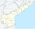
దస్త్రం:Andhra Pradesh locator map.svg
వికీపీడియా నుండి

అసలు దస్త్రం (SVG ఫైలు, నామమాత్రంగా 1,027 × 849 పిక్సెళ్ళు, ఫైలు పరిమాణం: 511 KB)
సారాంశం
[మార్చు]| Description |
English: Location map of Andhra Pradesh. Coordinates:
Copy of Commons permanent link as on 2021 Dec 23, for use in tewiki
|
|---|---|
| Source |
స్వంతకృతి |
| Date |
2021-06-07 |
| Author |
Milenioscuro, C1MM |
| Permission (Reusing this file) |
See below.
|
లైసెన్సింగ్
[మార్చు]| This work is licensed under the Creative Commons Attribution-ShareAlike 4.0 License. |
| The uploader or another editor requests that a local copy of this file be kept. This image or media file is available on the Wikimedia Commons as File:India_Andhra_Pradesh_location_map_(current).svg . While the license of this work may be compliant with the Wikimedia Commons, an editor has requested that the local copy be kept too because Copy of commons file for location marks with associated template ((Location map India Andhra Pradesh)) and మాడ్యూల్:Location map/data/India Andhra Pradesh మాడ్యూల్:Location map/data/Andhra Pradeshis used only in Telugu wikipedia. This file does not meet CSD F8, and should not be tagged as a Commons duplicate. If you desire to nominate it for deletion, please notify the tagging editor. |
ఫైలు చరితం
తేదీ/సమయం ను నొక్కి ఆ సమయాన ఫైలు ఎలా ఉండేదో చూడవచ్చు.
| తేదీ/సమయం | నఖచిత్రం | కొలతలు | వాడుకరి | వ్యాఖ్య | |
|---|---|---|---|---|---|
| ప్రస్తుత | 12:42, 23 డిసెంబరు 2021 |  | 1,027 × 849 (511 KB) | Arjunaraoc (చర్చ | రచనలు) | 11:55, 23 డిసెంబరు 2021 (UTC) నాటి కూర్పుకు తీసుకువెళ్ళాం |
| 12:12, 23 డిసెంబరు 2021 |  | 682 × 564 (439 KB) | Arjunaraoc (చర్చ | రచనలు) | 23:23, 28 మార్చి 2019 (UTC) నాటి కూర్పుకు తీసుకువెళ్ళాం | |
| 11:55, 23 డిసెంబరు 2021 |  | 1,027 × 849 (511 KB) | Arjunaraoc (చర్చ | రచనలు) | Using file from commons, as the district and state borders were not clean, due to use of different data sources in the earlier versions | |
| 23:23, 28 మార్చి 2019 |  | 682 × 564 (439 KB) | Arjunaraoc (చర్చ | రచనలు) | Using Plate Carree for Andhra Pradesh as Custom projection to attempt fixing push pin location errors. Proj4: Extent: -180.00, -90.00, 180.00, 90.00 Proj4: +proj=eqc +lat_ts=0 +lat_0=15.886 +lon_0=80.783E +x_0=0 +y_0=0 +datum=WGS84 +units=m +no_defs | |
| 13:55, 27 మార్చి 2019 |  | 603 × 500 (420 KB) | Arjunaraoc (చర్చ | రచనలు) | fixed margins as zero | |
| 12:59, 27 మార్చి 2019 |  | 792 × 591 (428 KB) | Arjunaraoc (చర్చ | రచనలు) | Update after Andhra Pradesh reorganisation. Same as File:Location map India Andhra Pradesh EN V2.svg for use in Telugu Wikipedia |
ఈ దస్త్రాన్ని మీరు తిరగరాయలేరు.
లింకులు
ఈ ఫైలును 100 కంటే ఎక్కువ పేజీలు వాడుతున్నాయి. ఈ ఫైలును మాత్రమే వాడుతున్న మొదటి 100 పేజీలను ఈ క్రింది జాబితా చూపిస్తుంది. పూర్తి జాబితా ఉంది.
- అయ్యవారిపల్లె (తాడిపత్రి)
- అల్లూరివారిపాలెం
- ఆంధ్రప్రదేశ్
- ఆంధ్రప్రదేశ్ పుణ్యక్షేత్రాల జాబితా
- ఆంధ్రప్రదేశ్ విమానాశ్రయాల జాబితా
- ఇసురాళ్ళపల్లి
- ఇసురాళ్ళపల్లె
- ఉడేగోళం (రాయదుర్గం మండలం)
- ఉల్లంపర్రు
- కడదరకుంట
- కడప విమానాశ్రయం
- కడమలకుంట
- కనపాక
- కమ్మవారిపాలెం (జలదంకి)
- కలవపాముల
- కళ్యాణదుర్గం
- కాశేపల్లి
- కుమారభీమారామం
- కొట్టాలపల్లి
- క్షీరారామం
- గంజికుంటపల్లి
- గంటావారిపాలెం
- గాంధీనగరం (నూజెండ్ల)
- గాజుల మల్లాపురం
- గాయంవారిపాలెం
- గార్లదిన్నె(పెద్దపప్పూరు మండలం)
- గుడ్డాలపల్లి (గార్లదిన్నె మండలం)
- గుదేవారి పాలెం
- గోనేపూడి
- గోపాలంవారిపాలెం
- గోపాలపురం (ఏ.కొండూరు)
- గోరంట్లవారిపాలెం (పెదనందిపాడు)
- చటాకాయ్
- చదలాడ
- చవటపల్లి
- చింతలాంపల్లి
- చింతలాయపల్లి
- చిట్టూరు రామరాజుపల్లి
- చినకంచర్ల
- చినతురకపాలెం
- చుక్కపల్లివారిపాలెం
- చెరువుకొమ్ము పాలెం (నందిగామ)
- చెరువుకొమ్ముపాలెం (నూజెండ్ల మండలం)
- చెర్లోపల్లె (పెద్దపప్పూరు)
- జాండ్రపేట
- జి.బి.కె.ఆర్.కాలనీ (వింజమూరు మండలం)
- టి.గుడిపాడు
- తాళ్లాయపాలెం
- తాళ్ళపాలెం (పొన్నూరు)
- తాళ్ళపూడి (ముత్తుకూరు)
- తిమ్మేపల్లి
- తిరుపతి విమానాశ్రయం
- తురకపల్లె(పెద్దపప్పూరు)
- తూర్పుపల్లి
- తెరన్నపల్లి
- తెల్లంవారి గూడెం
- తెల్లమిట్టపల్లి
- తోట్లపాలెం
- దీపాలదిన్నెపాలెం (సత్తెనపల్లి)
- దుర్గంపల్లి
- దుర్గాపురం
- నిదనవద
- పావురాళ్ళకొండ
- పుణ్యగిరి ఆలయం (శృంగవరపుకోట)
- పెద్దకొట్టాలపల్లి
- పెద్దపేట (యాడికి)
- పెద్దాపుర సంస్థానం
- బందర్లపల్లి
- బడవాండ్లపల్లి
- బుర్నాకుంట
- భీమారామం
- మలిచెర్ల
- మావుళ్ళమ్మ దేవస్థానం, భీమవరం
- ముకుందాపురం (గార్లదిన్నె మండలం)
- మురుగుల్ల
- యెంగంపేట (పెద్దపప్పూరు)
- రాజమండ్రి విమానాశ్రయం
- రేకులకుంట
- లక్షుంపల్లి
- లచ్చానుపల్లి
- వజ్జిరెడ్డి పల్లి
- విజయవాడ అంతర్జాతీయ విమానాశ్రయం
- విరుపాపల్లి
- విశాఖపట్నం అంతర్జాతీయ విమానాశ్రయం
- వెందోడు
- శావల్యాపురం
- శ్రీహరికోట
- సంజీవపురం (గార్లదిన్నె)
- సంతకవిటి
- హనుమంతునిపాలెం
- వాడుకరి:Arjunaraoc
- వాడుకరి:JVRKPRASAD
- వాడుకరి:JVRKPRASAD/ఉపపేజీ2299
- వాడుకరి:వైజాసత్య/ఇసుకపెట్టె10
- వికీపీడియా:పుస్తకాలు/ఆంధ్ర ప్రదేశ్ జిల్లా దర్శిని
- దస్త్రంపై చర్చ:Prakasammandals.jpg
- మూస:Location map Andhra Pradesh
- మూస:Location map India Andhra Pradesh
- మూస:ఆంధ్ర ప్రదేశ్ జిల్లాలు-ప్రాజెక్టు సభ్యులు
- మూస:ఆంధ్ర ప్రదేశ్ పుణ్యక్షేత్రాలు
ఈ ఫైలుకు ఉన్న మరిన్ని లింకులను చూపించు
మెటాడేటా
Text is available under the CC BY-SA 4.0 license; additional terms may apply.
Images, videos and audio are available under their respective licenses.
