Roggenstorf
| Roggenstorf | ||
| Kommun | ||
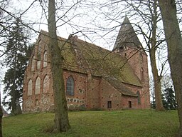
Kyrka i Roggenstorf.
| ||
|
||
| Land | ||
|---|---|---|
| Förbundsland | Mecklenburg-Vorpommern | |
| Kreis | Landkreis Nordwestmecklenburg | |
| Förvaltningsgemenskap | Amt Grevesmühlen-Land | |
| Höjdläge | 30 m ö.h. | |
| Koordinater | 53°54′50″N 11°03′59″Ö / 53.91385°N 11.06634°Ö | |
| Yta | 20,01 km² ()[1] | |
| Folkmängd | 437 ()[2] | |
| Befolkningstäthet | 22 inv./km² | |
| Postnummer | 23936 | |
| Riktnummer | (+49) 038824 | |
| Registreringsskylt | NWM | |
| Kommunkod | 13 0 74 069 | |
| Geonames | 6548217 | |
| OSM-karta | 1479628 | |
|
Läget för Roggenstorf i Tyskland
| ||
|
Läget för kommunen Roggenstorf i Landkreis Nordwestmecklenburg
| ||
| Webbplats: Roggenstorf | ||
Roggenstorf är en kommun och ort i Landkreis Nordwestmecklenburg i förbundslandet Mecklenburg-Vorpommern i Tyskland.
Kommunen ingår i kommunalförbundet Amt Grevesmühlen-Land tillsammans med kommunerna Bernstorf, Gägelow, Rüting, Stepenitztal, Testorf-Steinfort, Upahl och Warnow.[3]
Referenser
[redigera | redigera wikitext]- ^ Alle politisch selbständigen Gemeinden mit ausgewählten Merkmalen am 31.12.2018 (4. Quartal) (på tyska), Statistisches Bundesamt, läs online, läst: 10 mars 2019.[källa från Wikidata]
- ^ Alle politisch selbständigen Gemeinden mit ausgewählten Merkmalen am 31.12.2022, Statistisches Bundesamt, 21 september 2023, läs online, läst: 7 oktober 2023.[källa från Wikidata]
- ^ ”Alle politisch selbständigen Gemeinden mit ausgewählten Merkmalen am 31.03.2020” (Excel). Statistisches Bundesamt. 2020. Arkiverad från originalet den 8 mars 2021. https://web.archive.org/web/20210308004744/https://www.destatis.de/DE/Themen/Laender-Regionen/Regionales/Gemeindeverzeichnis/Administrativ/Archiv/GVAuszugQ/AuszugGV1QAktuell.xlsx?__blob=publicationFile. Läst 10 juli 2020.
|
Text is available under the CC BY-SA 4.0 license; additional terms may apply.
Images, videos and audio are available under their respective licenses.


