For faster navigation, this Iframe is preloading the Wikiwand page for Fil:Algeria map-sv.png.

Fil:Algeria map-sv.png

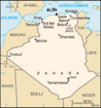
Algeria_map-sv.png(280 × 301 pixlar, filstorlek: 63 kbyte, MIME-typ: image/png)

Beskrivning
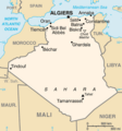
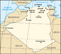
Map of Algeria, from the CIA World Factbook (with French text) :Same image, with English text, in Image:Ag-map.png
Datum (UTC)
Källa
Skapare
Andra versioner

[redigera]


Detta är en retuscherad eller på annat sätt behandlad bild, med vilket menas att den har redigerats digitalt från sitt original. Redigeringar: (({1))}. Originalet kan ses här: Algeria map-FR.png.


Public domain
This image is in the public domain because it contains materials that originally came from the United States Central Intelligence Agency's World Factbook.

Bahasa Indonesia  čeština  Deutsch  eesti  English  español  Esperanto  français  galego  hrvatski  italiano  Nederlands  norsk nynorsk  polski  português  sicilianu  slovenščina  suomi  Türkçe  Zazaki  беларуская (тарашкевіца)  македонски  русский  српски / srpski  українська  ქართული  বাংলা  தமிழ்  മലയാളം  한국어  日本語  中文  中文(简体)  中文(繁體)  العربية  +/−


Ursprunglig uppladdningslogg

This image is a derivative work of the following images:

  • File:Algeria_map-FR.png licensed with PD-USGov-CIA-WF
    • 2005-05-25T14:42:16Z Hégésippe Cormier 280x301 (68906 Bytes) ---- Map of '''[[:en:Algeria|]]''', from the ''CIA World Factbook'' (with French text) :Same image, with English text, in [[:Image:Algeria map-EN.png]] ((PD-USGov-CIA-WF))

Uploaded with derivativeFX

Bildtexter

Ingen bildtext har definierats

Objekt som porträtteras i den här filen

motiv

image/png

3498e8a7287e1a6eb84e9f50589c46ab3b7455db

64 585 byte

301 pixel

280 pixel

Filhistorik

Klicka på ett datum/klockslag för att se filen som den såg ut då.

Datum/TidMiniatyrbildDimensionerAnvändareKommentar
nuvarande23 januari 2010 kl. 13.37Miniatyrbild för versionen från den 23 januari 2010 kl. 13.37280 × 301 (63 kbyte)Inteloutside2((Information |Description=---- Map of '''Algeria''', from the ''CIA World Factbook'' (with French text) :Same image, with English text, in Image:Ag-map.png |Source=*File:Algeria_map-FR.png |Date=2010-01-23 11:35 (UTC) |Author=

Filanvändning

Följande sida använder den här filen:

Global filanvändning

Följande andra wikier använder denna fil:

{{bottomLinkPreText}} {{bottomLinkText}}
Fil:Algeria map-sv.png
Listen to this article

This browser is not supported by Wikiwand :(
Wikiwand requires a browser with modern capabilities in order to provide you with the best reading experience.
Please download and use one of the following browsers:

This article was just edited, click to reload
This article has been deleted on Wikipedia (Why?)

Back to homepage

Please click Add in the dialog above
Please click Allow in the top-left corner,
then click Install Now in the dialog
Please click Open in the download dialog,
then click Install
Please click the "Downloads" icon in the Safari toolbar, open the first download in the list,
then click Install
{{::$root.activation.text}}

Install Wikiwand

Install on Chrome Install on Firefox
Don't forget to rate us

Tell your friends about Wikiwand!

Gmail Facebook Twitter Link

Enjoying Wikiwand?

Tell your friends and spread the love:
Share on Gmail Share on Facebook Share on Twitter Share on Buffer

Our magic isn't perfect

You can help our automatic cover photo selection by reporting an unsuitable photo.

This photo is visually disturbing This photo is not a good choice

Thank you for helping!


Your input will affect cover photo selection, along with input from other users.

X

Get ready for Wikiwand 2.0 🎉! the new version arrives on September 1st! Don't want to wait?