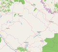
Датотека:Bjelovar-Bilogora County OpenStreetMap.svg

Оригинална датотека (SVG датотека, номинално 2.541 × 2.336 пиксела, величина: 18,29 MB)
Историја датотеке
Кликните на датум/време да бисте видели тадашњу верзију датотеке.
| Датум/време | Минијатура | Димензије | Корисник | Коментар | |
|---|---|---|---|---|---|
| тренутна | 15:54, 25. јул 2022. |  | 2.541 × 2.336 (18,29 MB) | Vedran V | Update of map |
| 08:00, 23. август 2016. |  | 2.581 × 2.339 (6,77 MB) | Vedran V | Updated version of map | |
| 01:31, 14. мај 2016. |  | 589 × 529 (751 kB) | Bonč | Reverted to version as of 18:44, 6 March 2010 (UTC) | |
| 14:25, 11. август 2015. |  | 2.628 × 2.333 (11,54 MB) | Vedran V | Wider bounding box | |
| 14:22, 11. август 2015. |  | 2.605 × 2.333 (11,35 MB) | Vedran V | A new and updated version of the map | |
| 20:44, 6. март 2010. |  | 589 × 529 (751 kB) | Ex13 | ((OpenStreetMap|location=Bjelovarsko-bilogorska županija)) Category:Bjelovar-Bilogora County Category:Maps of counties of Croatia |
Употреба датотеке
Више од 100 страница користи ову датотеку. Следећи списак приказује првих 100 страница које користе само ову датотеку. Доступан је и потпуни списак.
- Јакоповац
- Људевит Село
- Бастајски Брђани
- Батињани (Ђуловац)
- Батињска Ријека
- Бачковица
- Беговача
- Беденик
- Беденичка
- Бијела (Сирач)
- Благородовац
- Бреза (Бјеловар)
- Брезовац (Бјеловар)
- Булинац
- Велика Јасеновача
- Велика Барна
- Велика Дапчевица
- Велика Ператовица
- Велики Зденци
- Велико Вуковје
- Велико Кореново
- Врбовац (Дарувар)
- Галовац (Бјеловар)
- Горња Рашеница
- Горње Плавнице
- Горње Ровишће
- Горњи Дарувар
- Горњи Томаш
- Грбавац (Грубишно Поље)
- Гудовац
- Дапчевачки Брђани
- Даруварски Виногради
- Даутан
- Дијаковац
- Дијебала
- Доманкуш
- Дољани (Дарувар)
- Доња Вријеска
- Доња Рашеница
- Доњи Дарувар
- Дрљановац
- Жабјак
- Ждралови (Бјеловар)
- Звијерци
- Зрински Тополовац
- Иваново Село
- Какинац
- Клокочевац (Бјеловар)
- Ковачевац (Ровишће)
- Козаревац Рачански
- Кокинац
- Краљевац (Ровишће)
- Криж Горњи
- Купиновац (Бјеловар)
- Летичани
- Липовац Мајур
- Липовчани
- Лончарица
- Мала Јасеновача
- Мала Барна
- Мала Дапчевица
- Мала Ператовица
- Мала Циглена
- Мали Зденци
- Мало Кореново
- Марићи (Ровишће)
- Марковац (Дарувар)
- Међурача
- Муније
- Невинац
- Нова Рача
- Нови Пављани
- Новосељани (Бјеловар)
- Обровница
- Орловац (Нова Рача)
- Орловац Зденачки
- Патковац
- Подгорци (Ровишће)
- Пољани (Грубишно Поље)
- Пргомеље (Бјеловар)
- Предавац
- Прекобрдо
- Преспа (Бјеловар)
- Прокљувани
- Пуричани
- Растовац (Грубишно Поље)
- Рајић (Бјеловар)
- Ровишће
- Сасовац
- Словинска Ковачица
- Станчићи (Бјеловар)
- Стара Рача
- Старе Плавнице
- Стари Пављани
- Томаш
- Тоциљевац
- Треглава
- Тројствени Марковац
- Тук (Ровишће)
- Турчевић Поље
Прикажи још веза до ове датотеке.
Глобална употреба датотеке
Други викији који користе ову датотеку:
- Употреба на bs.wikipedia.org
- Употреба на hr.wikipedia.org
- Употреба на sh.wikipedia.org
Метаподаци
Text is available under the CC BY-SA 4.0 license; additional terms may apply.
Images, videos and audio are available under their respective licenses.
