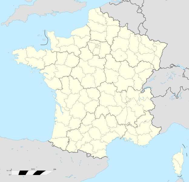
Datoteka:France location map-Regions and departements-2016.svg
Izvor: Wikipedija

Izvorna datoteka (SVG fajl, nominalno 2.000 × 1.922 piksela, veličina fajla: 551 kB)
Historija datoteke
Kliknite na datum/vrijeme da biste vidjeli tadašnju verziju datoteke.
| Datum/vrijeme | Minijatura | Dimenzije | Korisnik | Komentar | |
|---|---|---|---|---|---|
| aktualna | 15:46, 19 oktobar 2017 |  | 2.000 × 1.922 (551 kB) | Sting | No borders over the Lake of Constance |
| 11:11, 2 januar 2016 |  | 2.000 × 1.922 (546 kB) | Superbenjamin | User created page with UploadWizard |
Upotreba datoteke
Više od 100 stranica koristi ovu datoteku. Sljedeći popis prikazuje prvih 100 stranica koje koriste datoteku. Potpuni popis naći ćete ovdje.
- Aix-en-Provence
- Ajaccio
- Albertville
- Alette
- Amiens
- Angers
- Antibes
- Argenteuil
- Arles
- Asnières-sur-Seine
- Attigny, Ardennes
- Aubervilliers
- Aulnay-sous-Bois
- Autun
- Auxerre
- Avignon
- Bayeux
- Beaune
- Beauvais
- Besançon
- Bordeaux
- Boulogne-Billancourt
- Boulogne-sur-Mer
- Bourges
- Brest, Francuska
- Béziers
- Caen
- Calais
- Cannes
- Carcassonne
- Chamonix-Mont-Blanc
- Champigny-sur-Marne
- Chenonceaux
- Châlons-en-Champagne
- Clermont-Ferrand
- Colmar
- Colombes
- Colombey-les-Deux-Églises
- Courbevoie
- Créteil
- Destord
- Drancy
- Dunkerque
- Dvorac Fontainebleau
- Grand-Fougeray
- Jœuf
- Katedrala Notre-Dame u Amiensu
- La Ciotat
- La Rochelle
- Le Havre
- Le Mans
- Lille
- Limoges
- Luxeuil-les-Bains
- Lyon
- Marseille
- Melun
- Metz
- Montpellier
- Montreuil
- Mulhouse
- Nancy
- Nanterre
- Narbonne
- Nice
- Nîmes
- Opatija Fontenay
- Opatija Vézelay
- Orléans
- Pariz
- Pau
- Perpignan
- Poitiers
- Péronne, Somme
- Redon
- Reims
- Rennes
- Rimski spomenici u Orangeu
- Roubaix
- Rouen
- Rueil-Malmaison
- Saint-Denis
- Saint-Germain-en-Laye
- Saint-Josse
- Saint-Maur-des-Fossés
- Saint-Nazaire
- Saint-Quentin, Aisne
- Saint-Riquier
- Saint-Étienne
- Soissons
- Strasbourg
- Toulon
- Tourcoing
- Tours
- Val-d'Isère
- Valenciennes
- Vannes
- Versailles
- Villefranche-de-Rouergue
- Villeurbanne
Vidi ostale linkove prema ovoj datoteci.
Globalna upotreba datoteke
Ovu datoteku upotrebljavaju i sljedeći projekti:
- Upotreba na projektu af.wikipedia.org
- Rugbywêreldbeker 1999
- Mont-Saint-Michel
- Quimperlé
- Dinard
- Camembert (dorp)
- Dives-sur-Mer
- Deauville
- Crécy-en-Ponthieu
- Cannes
- Villeneuve-d'Ascq
- Antibes
- Menton
- Lascaux
- Rennes-le-Château
- Aigues-Mortes
- Cluny
- La Grande-Motte
- Grasse
- Avranches
- Saint-Jean-Cap-Ferrat
- Honfleur
- Monte Carlo
- Villefranche-sur-Saône
- Arles
- Saint-Dié-des-Vosges
- Vannes
- Pontivy
- Cassis
- Neuf-Brisach
- Val Thorens
- Indre
- Neuilly-sur-Seine
- Nanterre
- Millau
- Chamonix-Mont-Blanc
- Gourdon (Alpes-Maritimes)
- Le Faou
- La Roque-Gageac
- Riquewihr
- Locronan
- Eus
- Châteauneuf-du-Pape
- Arcachon
- Saint-Jean-de-Luz
- Apt (Vaucluse)
- Auray
- Nancy
- Rugbywêreldbeker 2007
- Lens, Pas-de-Calais
- Mont Ventoux
Metapodaci
Text is available under the CC BY-SA 4.0 license; additional terms may apply.
Images, videos and audio are available under their respective licenses.

