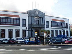
Santa Úrsula
Santa Úrsula | |
|---|---|
Municipality | |
 Toun Haw | |
| Coordinates: 28°25′31″N 16°29′30″W / 28.42528°N 16.49167°W | |
| Kintra | |
| Autonomous commonty | |
| Province | Tenerife |
| Island | Tenerife |
| Govrenment | |
| • Mayor | Milagros Pérez de León (PP) |
| Area | |
| • Total | 22.6 km2 (8.7 sq mi) |
| Elevation (AMSL) | 290 m (950 ft) |
| Population (2012) | |
| • Total | 14,374 |
| • Density | 640/km2 (1,600/sq mi) |
| Time zone | UTC+0 (CET) |
| • Summer (DST) | UTC+1 (CEST (GMT +1)) |
| Postal code | 38390 |
| Area code(s) | +34 (Spain) + 922 (Tenerife) |
| Website | www.santaursula.es |
Santa Úrsula (Spainish pronunciation: [ˈsanta uɾˈsula]; namit efter Saunt Ursula) is a municipality locatit on the north coast o Tenerife. It is locatit 9 km E o Puerto de la Cruz, aboot 29 km SSW o the island's caipital, Santa Cruz de Tenerife, NE o Los Cristianos an Las Américas o Arona an wast o the Tenerife North Airport.
The population is 11,959 (ISTAC, 2003), its density is 529.39/km² an the aurie is 22.59 km². The elevation is 290 m. Santa Úrsula is linkit wi the TF5 Motorwey an the auld heich-gate linkin Icod de los Vinos an the caipital. Fermlands are in the valley auries an athin the Atlantic, urban auries covers hintle o the aurie an the muntain an the hills are tae the sooth. Its climate is vegetation.
Hintle o the aurie wur made up o fermlands, maist o the fermlands are urbanisit while maist o the population shiftit frae landwart tae urban an tourism. The population are mainly urban the day an its industry are agricultur an tourism.
Historical population
[eedit | eedit soorce]| Year | Population | Chynge |
|---|---|---|
| 1991 | 8,599 | - |
| 1996 | 9,591 | - |
| 2001 | 10,803 | 586.63/km² |
| 2002 | 11,571 | - |
| 2003 | 11,959 | 529.39/km² |
| 2004 | 12, 237 | 538.36/km² |
Ither
[eedit | eedit soorce]Santa Úrsula haes schuils, a few lyceums, a gymnasia, kirks, a post office an a few square plazas.
See an aw
[eedit | eedit soorce]- Tenerife
- Leet o municipalities in Santa Cruz de Tenerife
| Northwest: Atlantic Ocean | North: Atlantic Ocean | Northeast: La Victoria de Acentejo |
| West: La Orotava | Santa Úrsula | East: Arafo |
| South: La Orotava an Arafo | Southeast: Arafo |
Template:Tenerife
Text is available under the CC BY-SA 4.0 license; additional terms may apply.
Images, videos and audio are available under their respective licenses.


