For faster navigation, this Iframe is preloading the Wikiwand page for File:India Uttarakhand location map.svg.

File:India Uttarakhand location map.svg
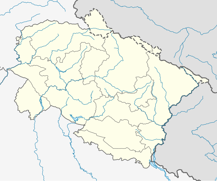
Oreeginal file(SVG file, nominallie 957 × 795 pixels, file size: 311 KB)

This file is fae Wikimedia Commons n micht be uised bi ither waurks. The descreeption oan its file descreeption page thaur is shawn ablo.

P9328056203

Ootline

Descreeption

Location map of Uttarakhand Geographic limits of the map:

  • 31.61°N
  • 28.50°N
  • 77.46°E
  • 81.19°E
Date
Soorce
Author

Licensin

I, the copyright holder of this work, hereby publish it under the following license:
w:en:Creative Commons
attribution share alik
This file is licensed unner the Creative Commons Attribution-Share Alike 3.0 Unported license.
Ye are free:
  • tae share – tae copy, distribute an transmit the wirk
  • tae remix – tae adapt the wirk
Unner the follaein condeetions:
  • attribution – Ye must attribute the wirk in the manner specified bi the author or licensor (but nae in ony way that suggests that thay endorse ye or yer uise o the wirk).
  • share alik – If ye alter, transform, or big upon this wirk, ye mey distribute the resultin wirk anly unner the same or seemilar license tae this ane.

Captions

Add a one-line explanation of what this file represents

Items portrayed in this file

depicts

image/svg+xml

File history

Clap oan ae date/time fer tae see the file aes it kithed at that time.

Date/TimeThummnailDimensionsUiserComment
current03:00, 23 Mey 2021Thumbnail fer version aes o 03:00, 23 Mey 2021957 × 795 (311 KB)C1MMCorrected rivers and dist boundaries
04:43, 27 Januar 2021Thumbnail fer version aes o 04:43, 27 Januar 20211,245 × 1,122 (161 KB)C1MMChanged line weights and regrouped rivers
04:13, 27 Januar 2021Thumbnail fer version aes o 04:13, 27 Januar 20211,245 × 1,122 (167 KB)C1MMIncreased line weight, district lines difficult to see in previous map
05:17, 22 Apryle 2020Thumbnail fer version aes o 05:17, 22 Apryle 20201,245 × 1,122 (167 KB)C1MMAdded rivers
18:42, 5 Julie 2014Thumbnail fer version aes o 18:42, 5 Julie 20141,245 × 1,122 (106 KB)Milenioscurolines
18:22, 5 Julie 2014Thumbnail fer version aes o 18:22, 5 Julie 20141,245 × 1,122 (106 KB)MilenioscuroUser created page with UploadWizard

Eimage airtins

The follaein pages airts tae this image:

Global file uisage

Metadata

{{bottomLinkPreText}} {{bottomLinkText}}
File:India Uttarakhand location map.svg
Listen to this article

This browser is not supported by Wikiwand :(
Wikiwand requires a browser with modern capabilities in order to provide you with the best reading experience.
Please download and use one of the following browsers:

This article was just edited, click to reload
This article has been deleted on Wikipedia (Why?)

Back to homepage

Please click Add in the dialog above
Please click Allow in the top-left corner,
then click Install Now in the dialog
Please click Open in the download dialog,
then click Install
Please click the "Downloads" icon in the Safari toolbar, open the first download in the list,
then click Install
{{::$root.activation.text}}

Install Wikiwand

Install on Chrome Install on Firefox
Don't forget to rate us

Tell your friends about Wikiwand!

Gmail Facebook Twitter Link

Enjoying Wikiwand?

Tell your friends and spread the love:
Share on Gmail Share on Facebook Share on Twitter Share on Buffer

Our magic isn't perfect

You can help our automatic cover photo selection by reporting an unsuitable photo.

This photo is visually disturbing This photo is not a good choice

Thank you for helping!


Your input will affect cover photo selection, along with input from other users.

X

Get ready for Wikiwand 2.0 🎉! the new version arrives on September 1st! Don't want to wait?