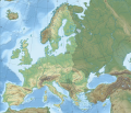
Файл:European Union relief laea location map.svg
Материал из Википедии — свободной энциклопедии

Исходный файл (SVG-файл, номинально 1401 × 1198 пкс, размер файла: 1018 КБ)
История файла
Нажмите на дату/время, чтобы посмотреть файл, который был загружен в тот момент.
| Дата/время | Миниатюра | Размеры | Участник | Примечание | |
|---|---|---|---|---|---|
| текущий | 23:20, 31 января 2020 |  | 1401 × 1198 (1018 КБ) | Nablicus | update |
| 01:32, 1 июля 2013 |  | 1401 × 1198 (809 КБ) | Seb az86556 | Reverted to version as of 11:50, 28 June 2013 | |
| 11:59, 28 июня 2013 |  | 1401 × 1198 (809 КБ) | Nablicus | Reverted to version as of 10:28, 7 April 2010. Its 2 days and 12 hours left. Croatia is not a member yet. | |
| 11:50, 28 июня 2013 |  | 1401 × 1198 (809 КБ) | Treehill | 1 day and less than 12 hours left, I think it's alright if we add it now. | |
| 10:28, 7 апреля 2010 |  | 1401 × 1198 (798 КБ) | Pethrus | ((Information |Description=((en|Topographic map of Europe with European Union highlighted * Projection: LAEA Europe, [http://spatialreference.org/ref/epsg/3035/ EPSG:3035] * Longitude of projection center: 10° E * Latitude of projection center: 52° N * |
Использование файла
Следующие 6 страниц используют этот файл:
Глобальное использование файла
Данный файл используется в следующих вики:
- Использование в ast.wikipedia.org
- Использование в ba.wikipedia.org
- Использование в be.wikipedia.org
- Использование в bxr.wikipedia.org
- Использование в cs.wikipedia.org
- Использование в de.wikipedia.org
- Europäische Union
- Liste der größten Städte der Europäischen Union
- Biathlon-Europameisterschaften 2012
- Demografie der Europäischen Union
- Biathlon-Europameisterschaften 2015
- Biathlon-Europameisterschaften 2017
- Biathlon-Junioreneuropameisterschaften 2016
- Biathlon-Junioreneuropameisterschaften 2017
- Biathlon-Weltcup 1987/88
- Biathlon-Junioreneuropameisterschaften 2022
- Benutzer:L.xschlag/Maps
- Biathlon-Junioreneuropameisterschaften 2023
- Biathlon-Junioreneuropameisterschaften 2024
- Использование в en.wikipedia.org
- Использование в eo.wikipedia.org
- Использование в es.wikipedia.org
- Использование в fa.wikipedia.org
- Использование в fr.wikipedia.org
- Использование в hu.wiktionary.org
- Использование в id.wikipedia.org
- Использование в it.wikipedia.org
- Использование в ku.wikipedia.org
- Использование в la.wikipedia.org
- Использование в mhr.wikipedia.org
- Использование в no.wikipedia.org
- Использование в pt.wikipedia.org
- Использование в sr.wikipedia.org
- Использование в sv.wikipedia.org
- Использование в ta.wikipedia.org
- Использование в uk.wikipedia.org
- Использование в vi.wikipedia.org
Метаданные
Text is available under the CC BY-SA 4.0 license; additional terms may apply.
Images, videos and audio are available under their respective licenses.

