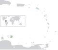
Файл:BES islands location map.svg
Материал из Википедии — свободной энциклопедии

Исходный файл (SVG-файл, номинально 1346 × 1156 пкс, размер файла: 177 КБ)
История файла
Нажмите на дату/время, чтобы посмотреть файл, который был загружен в тот момент.
| Дата/время | Миниатюра | Размеры | Участник | Примечание | |
|---|---|---|---|---|---|
| текущий | 16:21, 27 июня 2011 |  | 1346 × 1156 (177 КБ) | Thayts | Strokes tweak |
| 19:32, 7 марта 2011 |  | 1346 × 1156 (177 КБ) | Thayts | Strokes tweak | |
| 15:58, 6 марта 2011 |  | 1346 × 1156 (177 КБ) | Thayts | Strokes tweak | |
| 15:31, 6 марта 2011 |  | 1346 × 1156 (177 КБ) | Thayts | Darker gray | |
| 12:54, 6 марта 2011 |  | 1346 × 1156 (177 КБ) | Thayts | Minor changes | |
| 20:55, 5 марта 2011 |  | 1346 × 1156 (214 КБ) | Thayts | Minor changes | |
| 20:40, 5 марта 2011 |  | 1346 × 1156 (215 КБ) | Thayts | Made circles darker for better visibility | |
| 20:32, 5 марта 2011 |  | 1346 × 1156 (215 КБ) | Thayts | ((Information |Description=((en|Location map of the BES islands in the Lesser Antilles)) Equirectangular projection, N/S stretching 103 %. Geographic limits of the map: * N: 19.2° N * S: 9.7° N * W: 70.5° W * |
Использование файла
Следующие 3 страницы используют этот файл:
Глобальное использование файла
Данный файл используется в следующих вики:
- Использование в af.wikipedia.org
- Использование в ar.wikipedia.org
- Использование в arz.wikipedia.org
- Использование в awa.wikipedia.org
- Использование в azb.wikipedia.org
- Использование в az.wikipedia.org
- Использование в ban.wikipedia.org
- Использование в be.wikipedia.org
- Использование в bh.wikipedia.org
- Использование в blk.wikipedia.org
- Использование в bs.wikipedia.org
- Использование в ca.wikipedia.org
- Использование в ceb.wikipedia.org
- Использование в chy.wikipedia.org
- Использование в cs.wikipedia.org
- Использование в da.wikipedia.org
- Использование в de.wikipedia.org
- Использование в diq.wikipedia.org
- Использование в dtp.wikipedia.org
- Использование в el.wikipedia.org
- Использование в en.wikipedia.org
- Использование в en.wiktionary.org
- Использование в eo.wikipedia.org
- Использование в es.wikipedia.org
- Использование в fa.wikipedia.org
- Использование в fi.wikipedia.org
- Использование в fr.wikipedia.org
- Использование в fy.wikipedia.org
- Использование в ga.wikipedia.org
- Использование в gd.wiktionary.org
- Использование в gl.wikipedia.org
- Использование в he.wikipedia.org
- Использование в hi.wikipedia.org
- Использование в hr.wikipedia.org
- Использование в hu.wikipedia.org
- Использование в hy.wikipedia.org
- Использование в ia.wikipedia.org
Просмотреть глобальное использование этого файла.
Text is available under the CC BY-SA 4.0 license; additional terms may apply.
Images, videos and audio are available under their respective licenses.
