For faster navigation, this Iframe is preloading the Wikiwand page for Holsácia Oriental.

Holsácia Oriental

Holsácia Oriental
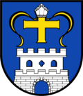
Brasão de Holsácia Oriental

brasão
Localização de Holsácia Oriental na Alemanha

mapa
Dados
Estado Schleswig-Holstein
Capital Eutin
Área 1.391,97 km²
População (31/12/2007) 205.688 hab.
Densidade 148 hab/km²
Placa de veículo OH
Website www.kreis-oh.de
Administração distrital
Endereço Lübecker Straße 41
23701 Eutin
Administrador Reinhard Sager
Partido CDU
Localização no Estado

A Holsácia Oriental (em alemão: Ostholstein) é um distrito (Kreis ou Landkreis) da Alemanha localizado no estado de Schleswig-Holstein.[1][2]

Cidades e Municípios

[editar | editar código-fonte]

Populações em 31 de dezembro de 2006:

Cidades:
  1. Bad Schwartau (19.794)
  2. Eutin (17.334)
  3. Fehmarn (12.930)
  4. Heiligenhafen (9227)
  5. Neustadt in Holstein (16.471)
  6. Oldemburgo * (9786)
Municípios:
  1. Ahrensbök (8629)
  2. Dahme (1188)
  3. Grömitz (7784)
  4. Grube (1034)
  5. Kellenhusen (Ostsee) (1100)
  6. Malente (10.876)
  7. Ratekau (15.750)
  8. Scharbeutz (11.862)
  9. Stockelsdorf (16.506)
  10. Süsel (5432)
  11. Timmendorfer Strand (9043)

Estas cidades e municípios são chamados Amtsfreie Städte ou Amtsfreie Gemeinden por não pertencerem a nenhum Amt (vide abaixo). A cidade indicada por asterisco (*) é sede de um Amt.

Ämter (singular: Amt; português: ofício, escritório, secretaria), e seus municípios membros:

  • 1. Lensahn
    [sede: Lensahn]
  1. Beschendorf (554)
  2. Damlos (699)
  3. Harmsdorf (721)
  4. Kabelhorst (451)
  5. Lensahn (5007)
  6. Manhagen (414)
  7. Riepsdorf (1016)
  • 2. Oldemburgo-Land
    [sede: Oldemburgo in Holstein]
  1. Göhl (1217)
  2. Gremersdorf (1493)
  3. Großenbrode (2213)
  4. Heringsdorf (1087)
  5. Neukirchen (1172)
  6. Wangels (2333)
  • 3. Ostholstein-Mitte
    [sede: Schönwalde am Bungsberg]
  1. Altenkrempe (1103)
  2. Kasseedorf (1552)
  3. Schashagen (2529)
  4. Schönwalde am Bungsberg (2526)
  5. Sierksdorf (1579)

O município de Bosau (3.549 habitantes), apesar de estar localizado territorialmente no distrito da Holsácia Oriental, é membro do Amt Großer Plöner See, localizado no distrito de Plön.

Cidades, municípios e Ämter do distrito da Holsácia Oriental.

Referências

Este artigo sobre geografia da Alemanha é um esboço. Você pode ajudar a Wikipédia expandindo-o.vde
{{bottomLinkPreText}} {{bottomLinkText}}
Holsácia Oriental
Listen to this article

This browser is not supported by Wikiwand :(
Wikiwand requires a browser with modern capabilities in order to provide you with the best reading experience.
Please download and use one of the following browsers:

This article was just edited, click to reload
This article has been deleted on Wikipedia (Why?)

Back to homepage

Please click Add in the dialog above
Please click Allow in the top-left corner,
then click Install Now in the dialog
Please click Open in the download dialog,
then click Install
Please click the "Downloads" icon in the Safari toolbar, open the first download in the list,
then click Install
{{::$root.activation.text}}

Install Wikiwand

Install on Chrome Install on Firefox
Don't forget to rate us

Tell your friends about Wikiwand!

Gmail Facebook Twitter Link

Enjoying Wikiwand?

Tell your friends and spread the love:
Share on Gmail Share on Facebook Share on Twitter Share on Buffer

Our magic isn't perfect

You can help our automatic cover photo selection by reporting an unsuitable photo.

This photo is visually disturbing This photo is not a good choice

Thank you for helping!


Your input will affect cover photo selection, along with input from other users.

X

Get ready for Wikiwand 2.0 🎉! the new version arrives on September 1st! Don't want to wait?