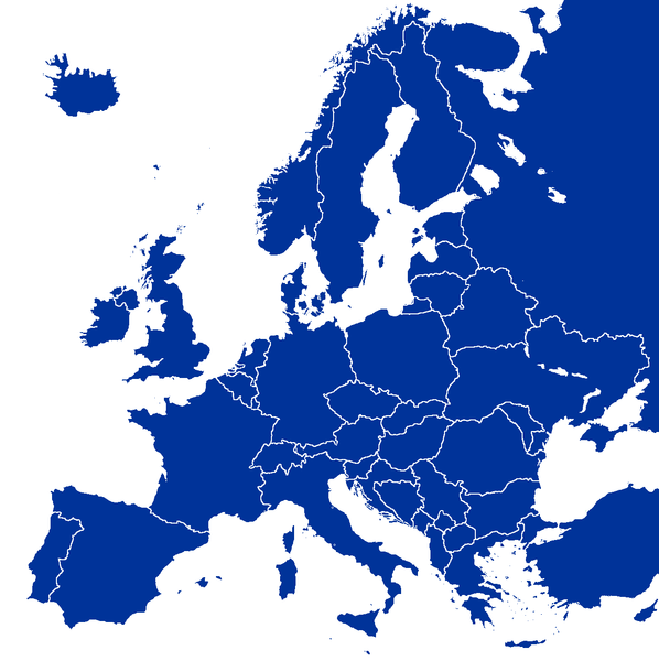
Ficheiro:Europe map.png

Imagem numa resolução maior (1 245 × 1 249 píxeis, tamanho: 77 kB, tipo MIME: image/png)
Histórico do ficheiro
Clique uma data e hora para ver o ficheiro tal como ele se encontrava nessa altura.
| Data e hora | Miniatura | Dimensões | Utilizador | Comentário | |
|---|---|---|---|---|---|
| atual | 15h35min de 30 de novembro de 2013 |  | 1 245 × 1 249 (77 kB) | Denniss | Reverted to version as of 08:19, 30 November 2013 |
| 16h27min de 29 de novembro de 2013 |  | 1 245 × 1 249 (77 kB) | No More Cats | thejournalist.ie/lifestyle-2/society-inside-kosovo-glimpse-europes-youngest-country-eager-break-open-doors/ | |
| 10h36min de 2 de agosto de 2008 |  | 1 245 × 1 245 (78 kB) | Olahus | Reverted to version as of 14:52, 31 July 2008 | |
| 14h52min de 31 de julho de 2008 |  | 1 245 × 1 245 (78 kB) | Avala | ||
| 09h27min de 24 de julho de 2008 |  | 1 245 × 1 249 (77 kB) | Aegean Boy~commonswiki | ((Information |Description= |Source= |Date= |Author= |Permission= |other_versions= )) | |
| 21h59min de 22 de março de 2008 |  | 1 245 × 1 245 (78 kB) | Nightstallion | Reverted to version as of 16:34, 13 March 2008 | |
| 19h36min de 19 de março de 2008 |  | 1 245 × 1 245 (78 kB) | Patstuart | Reverted to version as of 18:16, 11 March 2008 - see Image talk:BlankMap-World-v6.png#As stated in reversion | |
| 16h34min de 13 de março de 2008 |  | 1 245 × 1 245 (78 kB) | Nightstallion | Reverted to version as of 13:upload a variant if you wish, but the majority in Europe recognises or will recognise.44, 24 February 2008 | |
| 18h16min de 11 de março de 2008 |  | 1 245 × 1 245 (78 kB) | Avala | there is no consensus in Europe | |
| 13h44min de 24 de fevereiro de 2008 |  | 1 245 × 1 245 (78 kB) | Hoshie | Added Kosovo since it has been internationally recognized |
Utilização local do ficheiro
Mais de 100 páginas usam este ficheiro. A lista abaixo apresenta apenas as primeiras 100 páginas. Encontra-se disponível uma lista completa.
- Afeganistão nos Jogos Olímpicos
- Alemanha nos Jogos Olímpicos
- Alto Volta nos Jogos Olímpicos de Verão de 1972
- Angola nos Jogos Olímpicos
- Antártida
- Antígua e Barbuda nos Jogos Olímpicos
- Argélia nos Jogos Olímpicos
- Australásia nos Jogos Olímpicos
- Bangladesh nos Jogos Olímpicos
- Benim nos Jogos Olímpicos
- Bolívia nos Jogos Olímpicos
- Bornéu do Norte nos Jogos Olímpicos de Verão de 1956
- Botsuana nos Jogos Olímpicos
- Brasil nos Jogos Olímpicos
- Burquina Fasso nos Jogos Olímpicos
- Butão nos Jogos Olímpicos
- Bósnia e Herzegovina nos Jogos Olímpicos
- Cabo Verde nos Jogos Olímpicos
- Calaári
- Camboja nos Jogos Olímpicos
- Chade nos Jogos Olímpicos
- Circunscrições eclesiásticas católicas da Argentina
- Circunscrições eclesiásticas católicas da Espanha
- Circunscrições eclesiásticas católicas da Itália
- Circunscrições eclesiásticas católicas de Cabo Verde
- Circunscrições eclesiásticas católicas de Moçambique
- Circunscrições eclesiásticas católicas de Portugal
- Circunscrições eclesiásticas católicas de Timor-Leste
- Circunscrições eclesiásticas católicas do Haiti
- Comores nos Jogos Olímpicos
- Congo nos Jogos Olímpicos
- Coroa de Portugal
- Costa do Marfim nos Jogos Olímpicos
- Croácia nos Jogos Olímpicos
- Deserto
- Deserto Pintado (Estados Unidos)
- Deserto da Arábia
- Deserto da Líbia
- Deserto de Atacama
- Deserto de Baiuda
- Deserto de Caracum
- Deserto de Chihuahua
- Deserto de Cholistão
- Deserto de Danakil
- Deserto de Dzoosotoyn Elisen
- Deserto de Gobi
- Deserto de Mojave
- Deserto de Rangipo
- Deserto de Sechura
- Deserto do Namibe
- Deserto do Saara
- Deserto do Thar
- Equipa Unificada nos Jogos Olímpicos
- Equipe Unificada da Alemanha nos Jogos Olímpicos
- Equipe mista
- Essuatíni nos Jogos Olímpicos
- Estônia nos Jogos Olímpicos
- Grande Bacia
- Grande Deserto de Vitória
- História da Síria
- História de Portugal
- História do Brasil
- Ilhas Cayman nos Jogos Olímpicos
- Ilhas Cook nos Jogos Olímpicos
- Ilhas Virgens Britânicas nos Jogos Olímpicos
- Indonésia nos Jogos Olímpicos
- Israel nos Jogos Olímpicos
- Iêmen nos Jogos Olímpicos
- Jogos Olímpicos
- Jornada del Muerto
- Judeia
- Kiribati nos Jogos Olímpicos
- Líbano nos Jogos Olímpicos
- Malta nos Jogos Olímpicos
- Mauritânia nos Jogos Olímpicos
- Moçambique nos Jogos Olímpicos
- Neguev
- Nicarágua nos Jogos Olímpicos
- Omã nos Jogos Olímpicos
- Oásis de Farafra
- Paisagem cultural e botânica de Richtersveld
- Países Baixos nos Jogos Olímpicos
- Península de La Guajira
- Planície de Nullarbor
- Portugal nos Jogos Olímpicos
- Quizilcum
- República Centro-Africana nos Jogos Olímpicos
- Ruanda nos Jogos Olímpicos
- Rub' al-Khali
- Samoa Americana nos Jogos Olímpicos
- Samoa nos Jogos Olímpicos
- Somália nos Jogos Olímpicos
- Taclamacã
- Timor-Leste nos Jogos Olímpicos
- Turcomenistão nos Jogos Olímpicos
- Tuvalu nos Jogos Olímpicos
- Ténéré
- Ustyurt
- Vanuatu nos Jogos Olímpicos
- Predefinição:Desertos do mundo
Ver a lista completa de páginas que contêm hiperligações para este ficheiro.
Utilização global do ficheiro
As seguintes wikis usam este ficheiro:
- ar.wikipedia.org
- bg.wikipedia.org
- Европа
- Курганна култура
- Каролинги
- Алпиди
- Лужишка култура
- Контрареформация
- Eurostar
- Тридесетте славни години
- Европейски първенства
- Дървар
- Европейски химн
- Шаблон:Теми свързани с Европа
- Европейски път Е67
- Халщатска епоха
- Европейски път Е851
- Европейски път Е671
- Държавно устройство на страните в Европа
- Афроевропейци
- Европейски езици
- Еманципация на евреите
- Хаскала
- Латенска култура
- Европейски фонд за финансова стабилност
- Европейски стабилизационен механизъм
- Европейски маршрути за пешеходен туризъм
- Докелтски период
- Култура на полетата с погребални урни
- Европейски концерт
- Ислям в Европа
- Християнство в Европа
- Обща криза
- География на Европа
- Принудителен труд в Нацистка Германия
- Континентална Европа
- Кубанска народна република
- cs.wikipedia.org
Ver mais utilizações globais deste ficheiro.
Metadados
Text is available under the CC BY-SA 4.0 license; additional terms may apply.
Images, videos and audio are available under their respective licenses.


