Ficheiro:Czech Republic districts.png
Dimensões desta antevisão: 800 × 540 píxeis. Outras resoluções: 320 × 216 píxeis | 640 × 432 píxeis | 1 024 × 692 píxeis | 1 300 × 878 píxeis.
Imagem numa resolução maior (1 300 × 878 píxeis, tamanho: 42 kB, tipo MIME: image/png)
|
|
Esta imagem provém do Wikimedia Commons, um acervo de conteúdo livre da Wikimedia Foundation que pode ser utilizado por outros projetos.
|
Descrição do ficheiro
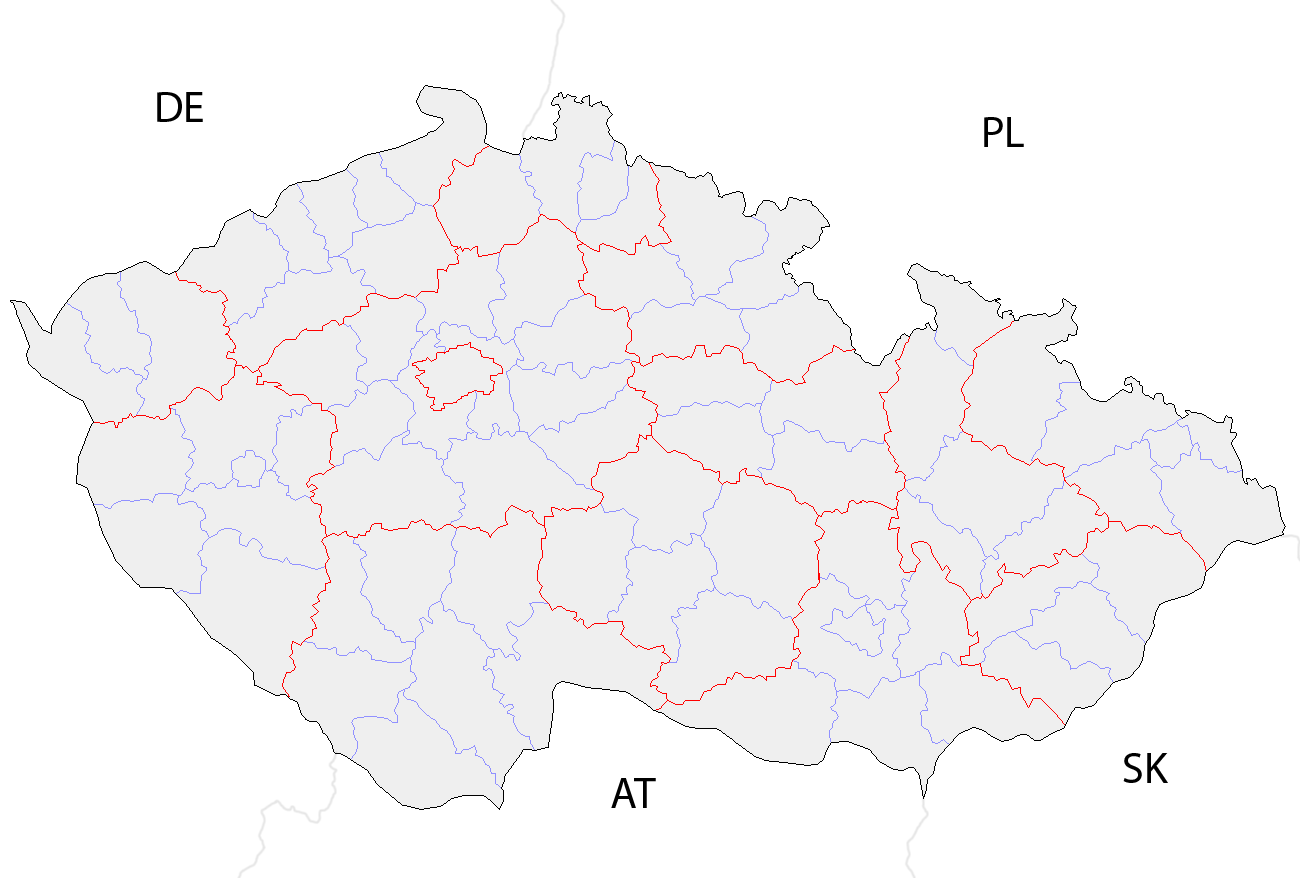
| Descrição | Map of the districts of the Czech Republic showing former district borders before December 31, 2006. Created by Rarelibra 18:42, 29 December 2006 (UTC) for public domain use, using MapInfo Professional v8.5 and various mapping resources. |
| Data | 29 de dezembro de 2006 (data de carregamento original) |
| Origem | A fonte não foi fornecida de forma legível por computadores. Presume-se que seja obra própria (com base nos direitos de autor reivindicados). |
| Autor | O autor não foi fornecido de forma legível por computadores. Presume-se que seja Rarelibra (com base nos direitos de autor reivindicados). |
Licenciamento
| Eu, titular dos direitos de autor desta obra, dedico-a ao domínio público, com aplicação em todo o mundo. Nalguns países isto pode não ser legalmente possível; se assim for: Concedo a todos o direito de usar esta obra para qualquer fim, sem quaisquer condições, a menos que tais condições sejam impostas por lei. |
Histórico do ficheiro
Clique uma data e hora para ver o ficheiro tal como ele se encontrava nessa altura.
| Data e hora | Miniatura | Dimensões | Utilizador | Comentário | |
|---|---|---|---|---|---|
| atual | 10h14min de 2 de outubro de 2008 | | 1 300 × 878 (42 kB) | Happenstance | rv myself |
| 10h05min de 2 de outubro de 2008 |  | 1 300 × 878 (42 kB) | Happenstance | lightening country codes | |
| 10h02min de 2 de outubro de 2008 |  | 1 300 × 878 (42 kB) | Happenstance | added transparency, foreign borders and country codes, separated borders between okresy and borders between kraje | |
| 18h42min de 29 de dezembro de 2006 |  | 1 281 × 878 (30 kB) | Rarelibra | Map of the districts of the Czech Republic. Created by ~~~~ for public domain use, using MapInfo Professional v8.5 and various mapping resources. |
Utilização local do ficheiro
As seguintes 2 páginas usam este ficheiro:
Utilização global do ficheiro
As seguintes wikis usam este ficheiro:
- br.wikipedia.org
- da.wikipedia.org
- en.wikipedia.org
- eo.wikipedia.org
- es.wikipedia.org
- fa.wikipedia.org
- gl.wikipedia.org
- hu.wikipedia.org
- it.wikipedia.org
- ko.wikipedia.org
- la.wikipedia.org
- lmo.wikipedia.org
- ms.wikipedia.org
- nl.wikipedia.org
- or.wikipedia.org
- pa.wikipedia.org
- pl.wikipedia.org
- pnb.wikipedia.org
- ro.wikipedia.org
- sh.wikipedia.org
- sq.wikipedia.org
- sv.wikipedia.org
- tr.wikipedia.org
- uk.wikipedia.org
- ur.wikipedia.org
- vi.wikipedia.org
- zh.wikipedia.org
Text is available under the CC BY-SA 4.0 license; additional terms may apply.
Images, videos and audio are available under their respective licenses.
Cover photo is available under {{::mainImage.info.license.name || 'Unknown'}} license.
Cover photo is available under {{::mainImage.info.license.name || 'Unknown'}} license.
Credit:
(see original file).
