For faster navigation, this Iframe is preloading the Wikiwand page for Hidalgo (estado).

Hidalgo (estado)

ESTADO DE HIDALGO


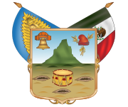
Escudo do Estado de Hidalgo


Outros Estados mexicanos

Capital Pachuca
Outras cidades primárias Tulancingo
Municípios 84
Gentílico Hidalguense
(em espanhol)
Área
Posição
20,813 km²
26°
População (censo de 2010)
Posição
2.665,018
17°
Densidade (censo de 2010)
Posição
128 Hab km²
IDH (censo de 2010)
Posição
0.7124
23°
Fuso Horário UTC-6
Altitude 3.350 msnm
Latitude 21º 24' - 19º 31'
Longitude 97º 58' - 99º 54'
ISO 3166-2
Abreviação postal
MX-HID
Hgo.

Hidalgo é um dos 31 estados do México. Sua área é de 20,813 km², e sua população é de 2.665,018 habitantes. A capital do Estado é a cidade de Pachuca. Seu nome é uma homenagem a Miguel Hidalgo, um defensor da independência mexicana.

Municípios do Estado

[editar | editar código-fonte]
  • Acatlán
  • Acaxochitlán
  • Actopan
  • Agua Blanca de Iturbide
  • Ajacuba
  • Alfajayucan
  • Almoloya
  • Apan
  • Atitalaquia
  • Atlapexco
  • Atotonilco de Tula
  • Atotonilco el Grande
  • Calnali
  • Cardonal
  • Chapantongo
  • Chapulhuacán
  • Chilcuautla
  • Cuautepec de Hinojosa
  • El Arenal
  • Eloxochitlán
  • Emiliano Zapata
  • Epazoyucan
  • Francisco I. Madero
  • Huasca de Ocampo
  • Huautla
  • Huazalingo
  • Huehuetla
  • Huejutla de Reyes
  • Huichapan
  • Ixmiquilpan
  • Jacala de Ledezma
  • Jaltocán
  • Juárez Hidalgo
  • La Misión
  • Lolotla
  • Metepec
  • Metztitlán
  • Mineral de la Reforma
  • Mineral del Chico
  • Mineral del Monte
  • Mixquiahuala de Juárez
  • Molango de Escamilla
  • Nicolás Flores
  • Nopala de Villagrán
  • Omitlán de Juárez
  • Pachuca de Soto
  • Pacula
  • Pisaflores
  • Progreso de Obregón
  • San Agustín Metzquititlán
  • San Agustín Tlaxiaca
  • San Bartolo Tutotepec
  • San Felipe Orizatlán
  • San Salvador
  • Santiago de Anaya
  • Santiago Tulantepec de Lugo Guerre
  • Singuilucan
  • Tasquillo
  • Tecozautla
  • Tenango de Doria
  • Tepeapulco
  • Tepehuacán de Guerrero
  • Tepeji del Río de Ocampo
  • Tepetitlán
  • Tetepango
  • Tezontepec de Aldama
  • Tianguistengo
  • Tizayuca
  • Tlahuelilpan
  • Tlahuiltepa
  • Tlanalapa
  • Tlanchinol
  • Tlaxcoapan
  • Tolcayuca
  • Tula de Allende
  • Tulancingo de Bravo
  • Villa de Tezontepec
  • Xochiatipan
  • Xochicoatlán
  • Yahualica
  • Zacualtipán de Angeles
  • Zapotlán de Juárez
  • Zempoala
  • Zimapán
O Commons possui uma categoria com imagens e outros ficheiros sobre Hidalgo (estado)
Este artigo sobre Geografia do México é um esboço. Você pode ajudar a Wikipédia expandindo-o.
{{bottomLinkPreText}} {{bottomLinkText}}
Hidalgo (estado)
Listen to this article

This browser is not supported by Wikiwand :(
Wikiwand requires a browser with modern capabilities in order to provide you with the best reading experience.
Please download and use one of the following browsers:

This article was just edited, click to reload
This article has been deleted on Wikipedia (Why?)

Back to homepage

Please click Add in the dialog above
Please click Allow in the top-left corner,
then click Install Now in the dialog
Please click Open in the download dialog,
then click Install
Please click the "Downloads" icon in the Safari toolbar, open the first download in the list,
then click Install
{{::$root.activation.text}}

Install Wikiwand

Install on Chrome Install on Firefox
Don't forget to rate us

Tell your friends about Wikiwand!

Gmail Facebook Twitter Link

Enjoying Wikiwand?

Tell your friends and spread the love:
Share on Gmail Share on Facebook Share on Twitter Share on Buffer

Our magic isn't perfect

You can help our automatic cover photo selection by reporting an unsuitable photo.

This photo is visually disturbing This photo is not a good choice

Thank you for helping!


Your input will affect cover photo selection, along with input from other users.

X

Get ready for Wikiwand 2.0 🎉! the new version arrives on September 1st! Don't want to wait?