Westminster (Kolorado)
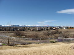
 Panorama Wesminster na tle Gór Skalistych. | |||
| |||
| Państwo | |||
|---|---|---|---|
| Stan | |||
| Hrabstwo | |||
| Data założenia |
1859 | ||
| Prawa miejskie |
1911 | ||
| Zarządzający |
Nancy McNally↗ | ||
| Powierzchnia |
87,8 km² | ||
| Wysokość |
1641 m n.p.m. | ||
| Populacja (2020) • liczba ludności • gęstość |
| ||
| Kod pocztowy |
80003, 80005, 80020-80021, 80023, 80030-80031, 80035-80036, 80221, 80234, 80241, 80260[1] | ||
| Strefa czasowa | |||
Położenie na mapie Kolorado  | |||
Położenie na mapie Stanów Zjednoczonych  | |||
| Strona internetowa | |||
Westminster – miasto w Stanach Zjednoczonych, w stanie Kolorado, w hrabstwach Adams i Jefferson położone 14 km na północ od Denver. Według spisu w 2020 roku liczy 116,3 tys. mieszkańców, w tym 61,2% należało do hrabstwa Adams[2][3]. Jest częścią obszaru metropolitalnego Denver.
Historia
[edytuj | edytuj kod]Początki osadnictwa na terenie obecnego miasta Westminster miały miejsce w okresie Gorączki Złota w latach 1858-62 (w związku z odkryciem złóż w okolicach South Platte River Valley). Istnieją dowody, że przed białymi osadnikami obszar ten zamieszkiwany był przez Indian Arapaho. Już w 1881 r. wybudowano pierwszy dworzec kolejowy.
Pierwotna osada nosiła nazwę Harris od imienia dewelopera z Connecticut, który przybył do miasta w 1885 r. i wykupił większość gruntów miejskich. Ostatecznie w 1911 r. przemianowano Harris na współczesne Westminster.
Galeria
[edytuj | edytuj kod]-
Westminster University, znany również jako Zamek Westminsterski
-
Biblioteka publiczna
-
Pawilon motyli
Linki zewnętrzne
[edytuj | edytuj kod]Przypisy
[edytuj | edytuj kod]- ↑ ZIP Code Lookup, Westminster, CO. United States Postal Service. [dostęp 2014-05-08]. (ang.).
- ↑ U.S. Census Bureau QuickFacts: Westminster city, Colorado; Colorado [online], www.census.gov [dostęp 2022-02-03] (ang.).
- ↑ US Census Bureau, Decennial Census P.L. 94-171 Redistricting Data [online], Census.gov [dostęp 2022-02-03].
Text is available under the CC BY-SA 4.0 license; additional terms may apply.
Images, videos and audio are available under their respective licenses.


