Saint-Genis
| miejscowość | |
| Państwo | |
|---|---|
| Region | |
| Departament | |
| Okręg | |
| Kanton |
Serres |
| Kod INSEE |
05143 |
| Mer |
Daniel Nussas (2008-2020) |
| Powierzchnia |
18,32 km² |
| Wysokość |
591-1422 m n.p.m. |
| Populacja (2013) • liczba ludności |
|
| Kod pocztowy |
05300 |
Położenie na mapie Alp Wysokich 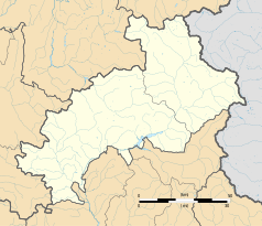 | |
Położenie na mapie Francji  | |
Położenie na mapie regionu Prowansja-Alpy-Lazurowe Wybrzeże  | |
Saint-Genis – miejscowość i dawna gmina we Francji, w regionie Prowansja-Alpy-Lazurowe Wybrzeże, w departamencie Alpy Wysokie. W dniu 1 stycznia 2016 roku z połączenia trzech ówczesnych gmin – Eyguians, Lagrand oraz Saint-Genis – powstała nowa gmina Garde-Colombe[1]. W 2013 roku populacja Saint-Genis wynosiła 50 mieszkańców[2]. Nazwa miejscowości pochodzi od imienia św. Genezjusza[3].
Przypisy
[edytuj | edytuj kod]- ↑ Recueil des Actes Administratif. hautes-alpes.gouv.fr. [dostęp 2016-11-16]. (fr.).
- ↑ Populations légales 2013 - 05143-Saint-Genis. INSEE. [dostęp 2016-11-16]. (fr.).
- ↑ Longnon A., Les noms de lieu de la France; leur origine, leur signification, leurs transformations, Paryż 1973, ISBN 0-8337-2142-9
Text is available under the CC BY-SA 4.0 license; additional terms may apply.
Images, videos and audio are available under their respective licenses.
Cover photo is available under {{::mainImage.info.license.name || 'Unknown'}} license.
Cover photo is available under {{::mainImage.info.license.name || 'Unknown'}} license.
Credit:
(see original file).
