Saint-Cyr (Manche)
| miejscowość i gmina | |

| |
| Państwo | |
|---|---|
| Region | |
| Departament | |
| Okręg | |
| Kod INSEE |
50461 |
| Powierzchnia |
5,72 km² |
| Populacja (1990) • liczba ludności |
|
| • gęstość |
29 os./km² |
| Kod pocztowy |
50310 |
Położenie na mapie Manche  | |
Położenie na mapie Francji  | |
Położenie na mapie Normandii 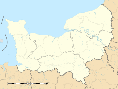 | |
Saint-Cyr – miejscowość i gmina we Francji, w regionie Normandia, w departamencie Manche.
Według danych na rok 1990 gminę zamieszkiwało 166 osób, a gęstość zaludnienia wynosiła 29 osób/km² (wśród 1815 gmin Dolnej Normandii Saint-Cyr plasuje się na 720. miejscu pod względem liczby ludności, natomiast pod względem powierzchni na miejscu 822.).
Bibliografia
[edytuj | edytuj kod]- Francuski urząd statystyczny. (fr.).
Text is available under the CC BY-SA 4.0 license; additional terms may apply.
Images, videos and audio are available under their respective licenses.
Cover photo is available under {{::mainImage.info.license.name || 'Unknown'}} license.
Cover photo is available under {{::mainImage.info.license.name || 'Unknown'}} license.
Credit:
(see original file).
