Sławjanin
| Państwo | |
|---|---|
| Obwód | |
| Gmina | |
| Powierzchnia |
20,253 km² |
| Wysokość |
404 m n.p.m. |
| Populacja (2011) • liczba ludności |
|
| Nr kierunkowy |
04137 |
| Kod pocztowy |
6236[2] |
| Tablice rejestracyjne |
CT (Сз) |
Położenie na mapie Bułgarii 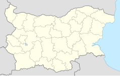 | |
Sławjanin (bułg. Славянин[3]) – wieś w południowej Bułgarii, w obwodzie Stara Zagora, w gminie Bratja Daskałowi. Według danych Narodowego Instytutu Statystycznego, 31 grudnia 2011 roku wieś liczyła 36 mieszkańców. Dawniej nazywała się Machmutłare.
Demografia
[edytuj | edytuj kod]
Liczba mieszkańców[1]
Przypisy
[edytuj | edytuj kod]- ↑ a b Справка за населението на с. Славянин, общ. Братя Даскалови, обл. Стара Загора. Код по ЕКАТТЕ - 67074. nsi.bg. [dostęp 2013-11-01]. (bułg.).
- ↑ Baza kodów Pocztowych – Bułgaria. geopostcodes.com. [dostęp 2013-11-01]. [zarchiwizowane z tego adresu (2013-10-29)]. (bułg.).
- ↑ Komisja Standaryzacji Nazw Geograficznych poza Granicami Rzeczypospolitej Polskiej: Nazewnictwo geograficzne świata. Europa – część I. Warszawa: Główny Urząd Geodezji i Kartografii, 2009, s. 57. [dostęp 2013-11-01]. (pol.).
Linki zewnętrzne
[edytuj | edytuj kod]
Text is available under the CC BY-SA 4.0 license; additional terms may apply.
Images, videos and audio are available under their respective licenses.
Cover photo is available under {{::mainImage.info.license.name || 'Unknown'}} license.
Cover photo is available under {{::mainImage.info.license.name || 'Unknown'}} license.
Credit:
(see original file).
