Rotenburg an der Fulda

| |||
| |||
| Państwo | |||
|---|---|---|---|
| Kraj związkowy | |||
| Rejencja | |||
| Powiat | |||
| Powierzchnia |
79,84 km² | ||
| Wysokość |
183 m n.p.m. | ||
| Populacja (2015-12-31) • liczba ludności • gęstość |
| ||
| Nr kierunkowy |
06623 | ||
| Kod pocztowy |
36199 | ||
| Tablice rejestracyjne |
HEF, ROF | ||
Położenie na mapie Hesji 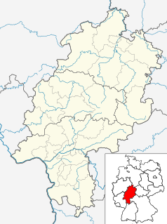 | |||
Położenie na mapie Niemiec  | |||
| Strona internetowa | |||

Rotenburg an der Fulda, Rotenburg a. d. Fulda – miasto w Niemczech, w północnej części kraju związkowym Hesja, w rejencji Kassel, w powiecie Hersfeld-Rotenburg, nad rzeką Fuldą.
Historia
[edytuj | edytuj kod]Pierwsze wzmianki pochodzą z roku 769. Miasto było stolicą księstwa Hesji-Rotenburga (1627–1815). Zaraz po II wojnie światowej nastąpił duży napływ uchodźców z Prus Wschodnich, Sudetów oraz Górnego i Dolnego Śląska. Tylko w 1946 r. przyrost ludności wynosił ok. 2 tys.
Współpraca
[edytuj | edytuj kod]Miejscowości partnerskie[2]:
 Argentan, Francja
 Czerwieńsk, Polska
 Gedling, Wielka Brytania
 Rotenburg (Wümme), Dolna Saksonia
 Rothenburg, Szwajcaria
- Rothenburg – dzielnica Wettin-Löbejün, Saksonia-Anhalt
- Rothenburg/O.L., Saksonia
- Rothenburg ob der Tauber, Bawaria
Zobacz też
[edytuj | edytuj kod]Przypisy
[edytuj | edytuj kod]- ↑ Die Bevölkerung in Hessen am 31.12.2015. statistik.hessen.de. [dostęp 2017-02-17]. (niem.).
- ↑ Współpraca.

Text is available under the CC BY-SA 4.0 license; additional terms may apply.
Images, videos and audio are available under their respective licenses.
Cover photo is available under {{::mainImage.info.license.name || 'Unknown'}} license.
Cover photo is available under {{::mainImage.info.license.name || 'Unknown'}} license.
Credit:
(see original file).
