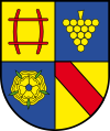
Landkreis Rastatt
| powiat | |||||
| |||||
| Państwo | |||||
|---|---|---|---|---|---|
| Kraj związkowy | |||||
| Rejencja | |||||
| Siedziba | |||||
| Kod statystyczny |
08 2 16 | ||||
| Powierzchnia |
738,83 km² | ||||
| Populacja (31 grudnia 2010) • liczba ludności |
| ||||
| • gęstość |
307 os./km² | ||||
| Tablice rejestracyjne |
RA, BH | ||||
Adres urzędu: Herrenstraße 1576437 Rastatt | |||||
| Szczegółowy podział administracyjny | |||||
| Liczba gmin |
23 | ||||
Położenie na mapie Niemiec
| |||||
Położenie na mapie Badenii-Wirtembergii
| |||||
| Strona internetowa | |||||
Landkreis Rastatt – powiat w Niemczech, w kraju związkowym Badenia-Wirtembergia, w rejencji Karlsruhe, w regionie Mittlerer Oberrhein. Stolicą powiatu jest miasto Rastatt.
Podział administracyjny
[edytuj | edytuj kod]W skład powiatu wchodzi:
- sześć gmin miejskich (Stadt)
- 17 (pozostałych) gmin (Gemeinde)
- cztery wspólnoty administracyjne (Vereinbarte Verwaltungsgemeinschaft)
- trzy związki gmin (Gemeindeverwaltungsverband)
Miasta:
| Lp. | Nazwa miasta | Ludność (31.12.2010) | Powierzchnia km² |
|---|---|---|---|
| 1 | Bühl | 29 452 | 73,21 |
| 2 | Gaggenau | 29 032 | 63,05 |
| 3 | Gernsbach | 14 289 | 82,09 |
| 4 | Kuppenheim | 7839 | 18,08 |
| 5 | Lichtenau | 4980 | 27,62 |
| 6 | Rastatt | 47 554 | 59,02 |
Gminy (pozostałe):
| Lp. | Nazwa gminy | Ludność (31.12.2010) | Powierzchnia km² |
|---|---|---|---|
| 1 | Au am Rhein | 3350 | 13,29 |
| 2 | Bietigheim | 5976 | 13,90 |
| 3 | Bischweier | 3100 | 4,59 |
| 4 | Bühlertal | 7946 | 17,68 |
| 5 | Durmersheim | 12 189 | 26,15 |
| 6 | Elchesheim-Illingen | 3290 | 10,14 |
| 7 | Forbach | 5291 | 131,82 |
| 8 | Hügelsheim | 4891 | 14,97 |
| 9 | Iffezheim | 4897 | 19,95 |
| 10 | Loffenau | 2575 | 17,07 |
| 11 | Muggensturm | 6139 | 11,56 |
| 12 | Ötigheim | 4493 | 10,97 |
| 13 | Ottersweier | 6135 | 29,21 |
| 14 | Rheinmünster | 6646 | 42,47 |
| 15 | Sinzheim | 11 222 | 28,50 |
| 16 | Steinmauern | 2942 | 12,40 |
| 17 | Weisenbach | 2561 | 9,07 |
| Lp. | Nazwa wspólnoty administracyjnej | Ludność (31.12.2010) | Powierzchnia km² | Liczba gmin |
|---|---|---|---|---|
| 1 | Bühl | 35 587 | 102,42 | 2 |
| 2 | Gernsbach | 19 425 | 108,23 | 3 |
| 3 | Rastatt | 66 025 | 113,90 | 5 |
| 4 | Sinzheim | 16 113 | 43,47 | 2 |
| Lp. | Nazwa związku gmin | Ludność (31.12.2010) | Powierzchnia km² | Liczba gmin |
|---|---|---|---|---|
| 1 | Durmersheim | 24 805 | 63,48 | 4 |
| 2 | Gemeindeverwaltungsverband Nachbarschaftsverband Bischweier-Kuppenheim | 10 939 | 22,67 | 2 |
| 3 | Gemeindeverwaltungsverband Rheinmünster-Lichtenau | 11 626 | 63,48 | 2 |
Text is available under the CC BY-SA 4.0 license; additional terms may apply.
Images, videos and audio are available under their respective licenses.


