Powersville
| Village | |
| Państwo | |
|---|---|
| Stan | |
| Hrabstwo | |
| Powierzchnia |
1,46 km² |
| Wysokość |
306 m n.p.m. |
| Populacja • liczba ludności |
|
| Kod pocztowy |
64672 |
| Strefa czasowa | |
Położenie na mapie Missouri 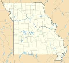 | |
Położenie na mapie Stanów Zjednoczonych  | |
Powersville – wieś w Stanach Zjednoczonych, w stanie Missouri, w hrabstwie Putnam.
Text is available under the CC BY-SA 4.0 license; additional terms may apply.
Images, videos and audio are available under their respective licenses.
Cover photo is available under {{::mainImage.info.license.name || 'Unknown'}} license.
Cover photo is available under {{::mainImage.info.license.name || 'Unknown'}} license.
Credit:
(see original file).
