For faster navigation, this Iframe is preloading the Wikiwand page for Panchkula.

Panchkula

Panchkula
ilustracja
Państwo

 Indie

Stan

Hariana

Kod pocztowy

134 109 - 134 114

Położenie na mapie Hariany
Mapa konturowa Hariany, blisko górnej krawiędzi po prawej znajduje się punkt z opisem „Panchkula”
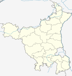
Położenie na mapie Indii
Mapa konturowa Indii, u góry nieco na lewo znajduje się punkt z opisem „Panchkula”
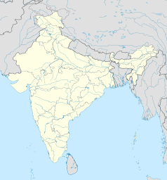
30°41′40″N 76°51′01″E/30,694444 76,850278
Strona internetowa

Panchkula – miasto w Indiach, w stanie Hariana. W 2011 roku liczyło 211 355 mieszkańców.

{{bottomLinkPreText}} {{bottomLinkText}}
Panchkula
Listen to this article

This browser is not supported by Wikiwand :(
Wikiwand requires a browser with modern capabilities in order to provide you with the best reading experience.
Please download and use one of the following browsers:

This article was just edited, click to reload
This article has been deleted on Wikipedia (Why?)

Back to homepage

Please click Add in the dialog above
Please click Allow in the top-left corner,
then click Install Now in the dialog
Please click Open in the download dialog,
then click Install
Please click the "Downloads" icon in the Safari toolbar, open the first download in the list,
then click Install
{{::$root.activation.text}}

Install Wikiwand

Install on Chrome Install on Firefox
Don't forget to rate us

Tell your friends about Wikiwand!

Gmail Facebook Twitter Link

Enjoying Wikiwand?

Tell your friends and spread the love:
Share on Gmail Share on Facebook Share on Twitter Share on Buffer

Our magic isn't perfect

You can help our automatic cover photo selection by reporting an unsuitable photo.

This photo is visually disturbing This photo is not a good choice

Thank you for helping!


Your input will affect cover photo selection, along with input from other users.

X

Get ready for Wikiwand 2.0 🎉! the new version arrives on September 1st! Don't want to wait?