Molenwaard

| |||||
| |||||
| Państwo | |||||
|---|---|---|---|---|---|
| Prowincja | |||||
| Powierzchnia |
126,47 km² | ||||
| Populacja (2014) • liczba ludności |
| ||||
| Nr kierunkowy |
184 | ||||
| Kod pocztowy |
2957–2977 | ||||
| Tablice rejestracyjne |
H | ||||
Położenie na mapie Holandii Południowej 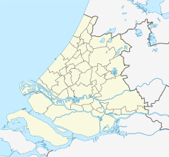 | |||||
Położenie na mapie Holandii  | |||||
| Strona internetowa | |||||


Molenwaard – dawna gmina w Holandii, w prowincji Holandia Południowa. Utworzona 1 stycznia 2013 z połączenia gmin Graafstroom, Liesveld i Nieuw-Lekkerland. Gminę zniesiono 1 stycznia 2019, łącząc ją z gminą Giessenlanden. Nowo powstała gmina nosi nazwę Molenlanden[2].
Przypisy
[edytuj | edytuj kod]- ↑ Alle 408 gemeenten in 2013. kpn.nl. [dostęp 2013-11-09]. (niderl.).
- ↑ alblasserdamsnieuws.nl: Fusiegemeente Molenwaard / Giesenlanden heet vanaf 2019 Molenlanden. 2018-09-25. [dostęp 2019-06-16]. (niderl.).
Linki zewnętrzne
[edytuj | edytuj kod]![]()
Text is available under the CC BY-SA 4.0 license; additional terms may apply.
Images, videos and audio are available under their respective licenses.
Cover photo is available under {{::mainImage.info.license.name || 'Unknown'}} license.
Cover photo is available under {{::mainImage.info.license.name || 'Unknown'}} license.
Credit:
(see original file).
