Gaborone

| |||
| |||
| Państwo | |||
|---|---|---|---|
| Dystrykt | |||
| Burmistrz |
Haskins Nkayigwa (BMD)[1] | ||
| Populacja (2011) • liczba ludności |
| ||
| Nr kierunkowy |
00267 | ||
Położenie na mapie Botswany 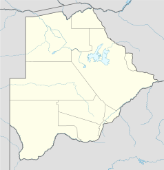 | |||
| Strona internetowa | |||

Gaborone – stolica i największe miasto Botswany, ośrodek administracyjny Dystryktu South East.
W 2011 roku liczba mieszkańców wynosiła 227 333[2].
Historia
[edytuj | edytuj kod]Geografia
[edytuj | edytuj kod]Gaborone to stolica i największe miasto Botswany. Miasto znajduje się południowo-wschodniej części kraju. Znajduje się około 15 km od granicy z RPA. Gaborone zostało wybrane na stolicę ze względu na strategiczne położenie, bliskość linii kolejowej oraz Pretorii[3].
Klimat
[edytuj | edytuj kod]Ze względu na bliskość pustyni Kalahari, Gaborone charakteryzuje się suchym klimatem subtropikalnym, z okazjonalnymi burzami w czasie pory deszczowej. Pora deszczowa trwa zazwyczaj od listopada do marca.
Gospodarka
[edytuj | edytuj kod]Duży ośrodek przemysłowy. Przemysł: maszynowy, samochodowy (montownia Chryslera), rafineryjny (niewielkie złoża ropy naftowej), spożywczy (cukrownie).
Transport
[edytuj | edytuj kod]W mieście znajduje się międzynarodowy port lotniczy Gaborone.
Edukacja
[edytuj | edytuj kod]- dwa uniwersytety (zał. 1976 i 1988)
- politechnika (zał. 1961)
- Muzeum Narodowe Botswany (zał. 1967)[4]
Turystyka
[edytuj | edytuj kod]Ważny ośrodek turystyczny Botswany. W mieście znajdują się dwa muzea, ogród botaniczny oraz zoologiczny.
Zabytki
[edytuj | edytuj kod]- pozostałości brytyjskiego fortu z końca XVIII wieku.
- cytadela
- ratusz z 1901 roku
Sport
[edytuj | edytuj kod]W mieście działa piłkarski klub sportowy Township Rollers, wielokrotny mistrz kraju. W 2011 odbyły się tutaj mistrzostwa Afryki juniorów w lekkoatletyce[5].
Przypisy
[edytuj | edytuj kod]- ↑ Ephraim Keoreng: New Gaborone Mayor seeks power to hire and fire. Mmegi Online, 2011-10-05. [dostęp 2011-10-16]. [zarchiwizowane z tego adresu (2011-11-04)].
- ↑ a b Botswana: largest cities and towns and statistics of their population. World Gazetteer. [dostęp 2020-05-18]. (ang.).
- ↑ Phakalane a Suburb of Gaborone | Phakalane Estates [online], www.phakalane.com [dostęp 2020-10-23] [zarchiwizowane z adresu 2011-04-18] (ang.).
- ↑ Botswana National Museum [online], web.archive.org, 5 lipca 2008 [dostęp 2023-12-04] [zarchiwizowane z adresu 2008-07-05].
- ↑ AfrC Gaborone BOT 12 - 15 May 2011 / 10th African Junior Championships in Athletics [online], tilastopaja.org [dostęp 2011-05-17] (ang.).
Text is available under the CC BY-SA 4.0 license; additional terms may apply.
Images, videos and audio are available under their respective licenses.
