Ceredigion
| hrabstwo | |||||

| |||||
| |||||
| Dewiza: Golud Gwlad Rhyddid (walijski: Bogactwem kraju jest jego wolność) | |||||
| Państwo | |||||
|---|---|---|---|---|---|
| Księstwo | |||||
| Siedziba | |||||
| Powierzchnia |
1795 km² | ||||
| Populacja • liczba ludności |
| ||||
| • gęstość |
44 os./km² | ||||
Położenie na mapie Walii
| |||||
| Strona internetowa | |||||


Ceredigion (hist. Cardiganshire[1]) – hrabstwo w zachodniej Walii, położone nad zatoką Cardigan. Ośrodkiem administracyjnym jest Aberaeron.
Graniczy od północy z hrabstwem Gwynedd, od wschodu z Powys, a od południa z Carmarthenshire i Pembrokeshire.
Miejscowości
[edytuj | edytuj kod]Na terenie hrabstwa znajdują się następujące miejscowości[2][3] (w nawiasach liczba ludności w 2011[4]):
- Aberystwyth (18 093)
- Cardigan (4184)
- Lampeter (2970)
- Bow Street (1572)
- Llandysul (1484)
- Aberaeron (1422)
- Penrhyn-coch (1316)
- Borth (1269)
- Aberporth (1241)
- Tregaron (1213)
- Llanilar (1085)
- Llechryd (875)
- Pontrhydfendigaid (712)
- New Quay (694)
- Llandre (679)
- Tal-y-bont (662)
- Llanbadarn Fawr (656)
- Llanrhystud (646)
- Llanddewi Brefi (640)
- Llanon (598)
- Ystrad Aeron (596)
- Penrhiw-llan (521)
- Henfynyw (512)
- Llanarth (503)
- Penparc (470)
- Parcllyn (407)
- Hengell Uchaf Estate (388)
- Cross Inn (292)
- Capel Bangor (256)
- Blaenannerch (131)
Mapa
[edytuj | edytuj kod]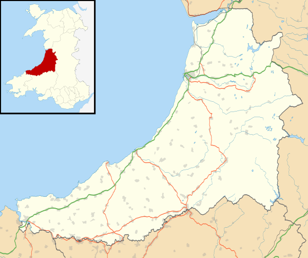
Przypisy
[edytuj | edytuj kod]- ↑ Ceredigion, [w:] Encyclopædia Britannica [dostęp 2019-02-08] (ang.).
- ↑ a b Office for National Statistics: Built-up Area to Local Authority District (December 2011) Lookup in England and Wales. [w:] Open Geography Portal [on-line]. [dostęp 2022-06-05]. (ang.).
- ↑ a b Office for National Statistics: Built-up Area Sub Divisions (December 2011) Boundaries. [w:] Open Geography Potal [on-line]. [dostęp 2022-06-05]. (ang.).
- ↑ a b Office for National Statistics: KS101EW - Usual resident population. [w:] 2011 Census [on-line]. Nomis – Official labour market statistics, 2013-02-12. [dostęp 2022-06-05]. (ang.).

Text is available under the CC BY-SA 4.0 license; additional terms may apply.
Images, videos and audio are available under their respective licenses.
Cover photo is available under {{::mainImage.info.license.name || 'Unknown'}} license.
Cover photo is available under {{::mainImage.info.license.name || 'Unknown'}} license.
Credit:
(see original file).
