Bray Island

| |
| Kontynent | |
|---|---|
| Państwo | |
| Terytorium | |
| Akwen | |
| Archipelag | |
| Powierzchnia |
689 km² |
| Długość linii brzegowej |
166 km[1] |
| Populacja • liczba ludności |
|
Położenie na mapie Nunavut 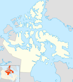 | |
Położenie na mapie Kanady  | |
Bray Island – niezamieszkana wyspa w Basenie Foxe’a, w Archipelagu Arktycznym, w regionie Qikiqtaaluk, na terytorium Nunavut, w Kanadzie[2]. Jej powierzchnia wynosi 689 km²[1].
Podczas zimnej wojny na wyspie znajdowała się stacja Distant Early Warning Line – FOX-A, obecnie będąca częścią North Warning System.
Przypisy
[edytuj | edytuj kod]- ↑ a b Sea Islands. [w:] The Atlas of Canada [on-line]. Natural Resources Canada. [dostęp 2020-01-18]. [zarchiwizowane z tego adresu (2013-01-22)]. (ang.).
- ↑ Traveling Luck for Bray Island, Nunavut, Canada. travelingluck.com. [dostęp 2015-03-07]. (ang.).
Text is available under the CC BY-SA 4.0 license; additional terms may apply.
Images, videos and audio are available under their respective licenses.
Cover photo is available under {{::mainImage.info.license.name || 'Unknown'}} license.
Cover photo is available under {{::mainImage.info.license.name || 'Unknown'}} license.
Credit:
(see original file).
