Agur (moszaw)

| |
| Państwo | |
|---|---|
| Dystrykt | |
| Wysokość |
222 m n.p.m. |
| Populacja (2007) • liczba ludności |
|
Położenie na mapie Izraela 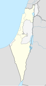 | |
Agur (hebr.: עגור) – moszaw położony w samorządzie regionu Matte Jehuda, w Dystrykcie Jerozolimy, w Izraelu.
Leży w górach Judei.
Historia
[edytuj | edytuj kod]Moszaw został założony w 1950 przez imigrantów z Kurdystanu.
Gospodarka
[edytuj | edytuj kod]Gospodarka moszawu opiera się na rolnictwie i sadownictwie.
Linki zewnętrzne
[edytuj | edytuj kod]- Zdjęcie satelitarne moszawu Agur Google Maps
- Mapa moszawu Agur
![]()
Text is available under the CC BY-SA 4.0 license; additional terms may apply.
Images, videos and audio are available under their respective licenses.
Cover photo is available under {{::mainImage.info.license.name || 'Unknown'}} license.
Cover photo is available under {{::mainImage.info.license.name || 'Unknown'}} license.
Credit:
(see original file).
