ਤਸਵੀਰ:Topografic map of Tibetan Plateau.png
ਇਸ ਝਾਤ ਦਾ ਅਕਾਰ: 800 × 429 ਪਿਕਸਲ. ਹੋਰ ਰੈਜ਼ੋਲਿਊਸ਼ਨਜ਼: 320 × 172 ਪਿਕਸਲ | 640 × 343 ਪਿਕਸਲ | 1,365 × 732 ਪਿਕਸਲ.
ਅਸਲ ਫ਼ਾਈਲ (1,365 × 732 ਪਿਕਸਲ, ਫ਼ਾਈਲ ਅਕਾਰ: 663 KB, MIME ਕਿਸਮ: image/png)
| ਵੇਰਵਾ |
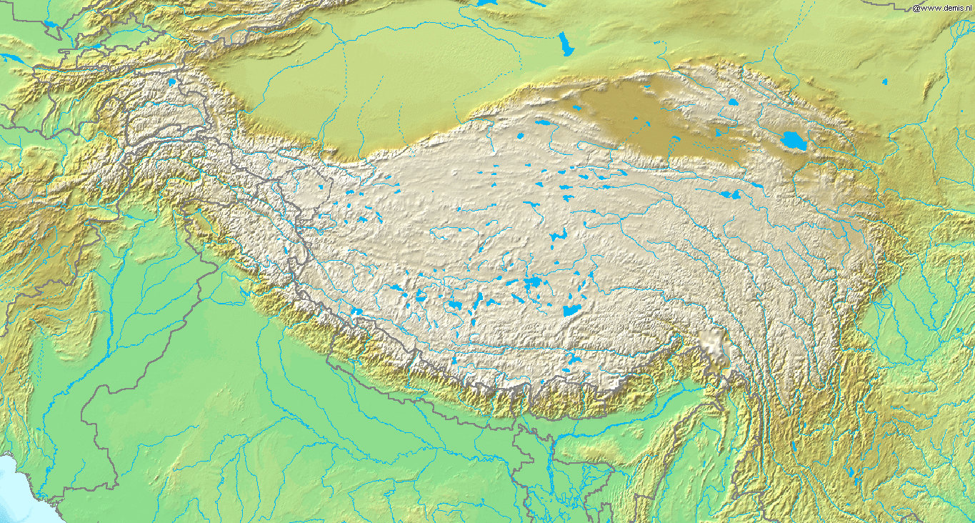
English: Topografic map of the Tibetan Plateau in Asia.
Français : Carte topographique du plateau tibetain.
|
||||
| ਮਿਤੀ | ਅਣਪਛਾਤੀ ਮਿਤੀ | ||||
| ਸਰੋਤ | http://www.demis.nl/home/pages/Gallery/examples.htm | ||||
| ਲਿਖਾਰੀ | Unknown author | ||||
| ਇਜਾਜ਼ਤ (ਇਸ ਫ਼ਾਈਲ ਦੀ ਮੁੜਵਰਤੋਂ ਕਰੋ) |
|
ਫ਼ਾਈਲ ਦਾ ਅਤੀਤ
ਤਾਰੀਖ/ਸਮੇਂ ’ਤੇ ਕਲਿੱਕ ਕਰੋ ਤਾਂ ਉਸ ਸਮੇਂ ਦੀ ਫਾਈਲ ਪੇਸ਼ ਹੋ ਜਾਵੇਗੀ।
| ਮਿਤੀ/ਸਮਾਂ | ਨਮੂਨਾ | ਨਾਪ | ਵਰਤੋਂਕਾਰ | ਟਿੱਪਣੀ | |
|---|---|---|---|---|---|
| ਮੌਜੂਦਾ | 19:51, 26 ਮਾਰਚ 2009 | | 1,365 × 732 (663 KB) | Botev | borders bold, lakes filled in blue |
| 19:02, 2 ਸਤੰਬਰ 2005 |  | 1,365 × 732 (710 KB) | Mats Halldin~commonswiki | Map of Himalaya Bounding box West 66°, South 23°, East 108°, North 42°. ((demis-pd)) category:maps of Himalaya |
ਫ਼ਾਈਲ ਦੀ ਵਰਤੋਂ
ਇਹ ਫਾਈਲ ਹੇਠਾਂ ਦਿੱਤਾ ਸਫ਼ਾ ਵਰਤਦਾ ਹੈ:
ਫ਼ਾਈਲ ਦੀ ਵਿਆਪਕ ਵਰਤੋਂ
ਇਸ ਫ਼ਾਈਲ ਨੂੰ ਹੋਰ ਹੇਠ ਲਿਖੇ ਵਿਕੀ ਵਰਤਦੇ ਹਨ:
- ar.wikipedia.org ਉੱਤੇ ਵਰਤੋਂ
- ba.wikipedia.org ਉੱਤੇ ਵਰਤੋਂ
- be-tarask.wikipedia.org ਉੱਤੇ ਵਰਤੋਂ
- bn.wikipedia.org ਉੱਤੇ ਵਰਤੋਂ
- ceb.wikipedia.org ਉੱਤੇ ਵਰਤੋਂ
- ce.wikipedia.org ਉੱਤੇ ਵਰਤੋਂ
- da.wikipedia.org ਉੱਤੇ ਵਰਤੋਂ
- de.wikipedia.org ਉੱਤੇ ਵਰਤੋਂ
- en.wikipedia.org ਉੱਤੇ ਵਰਤੋਂ
- Gyachung Kang
- 1950 Assam–Tibet earthquake
- Geladaindong Peak
- Karuo culture
- Haba Snow Mountain
- Anisodus tanguticus
- Outline of Tibet
- Alpine steppe
- Kang Yatze
- Module:Location map/data/Tibetan Plateau/doc
- User:BIO341prj
- 1927 Gulang earthquake
- 1932 Changma earthquake
- Pauhunri
- Guozha Lake
- User:HueSatLum/II
- Singhi Kangri
- Module:Location map/data/Tibetan Plateau
- Gasherbrum VI
- Phrynocephalus vlangalii
- eu.wikipedia.org ਉੱਤੇ ਵਰਤੋਂ
- fa.wikipedia.org ਉੱਤੇ ਵਰਤੋਂ
- fo.wikipedia.org ਉੱਤੇ ਵਰਤੋਂ
- fr.wikipedia.org ਉੱਤੇ ਵਰਤੋਂ
- fr.wikibooks.org ਉੱਤੇ ਵਰਤੋਂ
- gcr.wikipedia.org ਉੱਤੇ ਵਰਤੋਂ
- he.wikipedia.org ਉੱਤੇ ਵਰਤੋਂ
ਇਸ ਫ਼ਾਈਲ ਦੀ ਹੋਰ ਵਿਆਪਕ ਵਰਤੋਂ ਵੇਖੋ।
ਮੈਟਾਡੈਟਾ
Text is available under the CC BY-SA 4.0 license; additional terms may apply.
Images, videos and audio are available under their respective licenses.
Cover photo is available under {{::mainImage.info.license.name || 'Unknown'}} license.
Cover photo is available under {{::mainImage.info.license.name || 'Unknown'}} license.
Credit:
(see original file).
