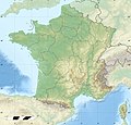
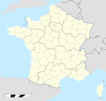
Fichièr:France relief location map.jpg

Fichièr d'origina (2 000 × 1 922 pixèl, talha del fichièr: 907 Ko, tipe MIME: image/jpeg)
Istoric del fichièr
Clicar sus una data e una ora per veire lo fichièr tal coma èra a aqueste moment
| Data e ora | Miniatura | Dimensions | Utilizaire | Comentari | |
|---|---|---|---|---|---|
| actual | 19 octobre de 2017 a 15.01 |  | 2 000×1 922 (907 Ko) | Sting | No borders over the Lake of Constance |
| 3 genièr de 2016 a 08.44 |  | 2 000×1 922 (888 Ko) | Jack ma | updated new administrative region boundaries 1/1/2016 | |
| 2 octobre de 2012 a 12.31 |  | 2 000×1 922 (814 Ko) | Palosirkka | Reverted to version as of 22:20, 17 July 2010 Location maps must remain very accurate | |
| 2 octobre de 2012 a 09.14 |  | 2 000×1 922 (797 Ko) | Palosirkka | Optimized with http://trimage.org | |
| 17 julhet de 2010 a 22.20 |  | 2 000×1 922 (814 Ko) | Sting | Color profile | |
| 17 novembre de 2009 a 14.15 |  | 2 000×1 922 (822 Ko) | Sting | Embedded sRGB profile | |
| 7 novembre de 2008 a 13.29 |  | 2 000×1 922 (801 Ko) | Sting | + boundary for Channel Islands ; - canals | |
| 23 agost de 2008 a 16.41 |  | 2 000×1 922 (803 Ko) | Sting | Larger strokes for boundaries | |
| 25 julhet de 2008 a 17.58 |  | 2 000×1 922 (815 Ko) | Sting | Variable scale | |
| 25 julhet de 2008 a 14.46 |  | 2 000×1 922 (814 Ko) | Sting | - border |
Paginas que contenon lo fichièr
Las paginas çaijós compòrtan aqueste imatge :
Usatge global del fichièr
Los autres wikis seguents utilizan aqueste imatge :
- Utilizacion sus als.wikipedia.org
- Grosser Belchen
- Donon
- Vorlage:Positionskarte Frankreich
- Planche des Belles Filles
- Vorlage:Positionskarte Frankreich Haut-Rhin
- Vorlage:Positionskarte Frankreich Bas-Rhin
- Vorlage:Positionskarte Frankreich Saône-et-Loire
- Vorlage:Positionskarte Frankreich Paris
- Vorlage:Positionskarte Frankreich Territoire de Belfort
- Vorlage:Positionskarte Frankreich Essonne
- Vorlage:Positionskarte Frankreich Pyrénées-Orientales
- Vorlage:Positionskarte Frankreich Pas-de-Calais
- Vorlage:Positionskarte Frankreich Normandie
- Vorlage:Positionskarte Frankreich Orne
- Vorlage:Positionskarte Frankreich Île-de-France
- Vorlage:Positionskarte Frankreich Nord
- Vorlage:Positionskarte Frankreich Moselle
- Vorlage:Positionskarte Frankreich Morbihan
- Vorlage:Positionskarte Frankreich Maine-et-Loire
- Vorlage:Positionskarte Frankreich Pays de la Loire
- Vorlage:Positionskarte Frankreich Loire-Atlantique
- Vorlage:Positionskarte Frankreich Isère
- Vorlage:Positionskarte Frankreich Ille-et-Vilaine
- Vorlage:Positionskarte Frankreich Okzitanien
- Vorlage:Positionskarte Frankreich Gard
- Vorlage:Positionskarte Frankreich Korsika
- Vorlage:Positionskarte Frankreich Corse-du-Sud
- Vorlage:Positionskarte Frankreich Nouvelle-Aquitaine
- Vorlage:Positionskarte Frankreich Dordogne
- Vorlage:Positionskarte Frankreich Bretagne
- Vorlage:Positionskarte Frankreich Finistère
- Vorlage:Positionskarte Frankreich Côtes-d’Armor
- Vorlage:Positionskarte Frankreich Bourgogne-Franche-Comté
- Vorlage:Positionskarte Frankreich Alpes-Maritimes
- Vorlage:Positionskarte Frankreich Provence-Alpes-Côte d’Azur
- Vorlage:Positionskarte Frankreich Alpes-de-Haute-Provence
- Vorlage:Positionskarte Frankreich Allier
- Vorlage:Positionskarte Frankreich Hauts-de-France
- Vorlage:Positionskarte Frankreich Aisne
- Vorlage:Positionskarte Frankreich Auvergne-Rhône-Alpes
- Vorlage:Positionskarte Frankreich Ain
- Vorlage:Positionskarte Frankreich Grand Est
- Vorlage:Positionskarte Frankreich Ardèche
- Vorlage:Positionskarte Frankreich Calvados
- Vorlage:Positionskarte Frankreich Cantal
- Vorlage:Positionskarte Frankreich Charente
- Vorlage:Positionskarte Frankreich Centre-Val de Loire
- Vorlage:Positionskarte Frankreich Charente-Maritime
- Vorlage:Positionskarte Frankreich Haute-Corse
- Vorlage:Positionskarte Frankreich Eure
Veire l'utilizacion globala d'aqueste fichièr.
Metadonadas
Text is available under the CC BY-SA 4.0 license; additional terms may apply.
Images, videos and audio are available under their respective licenses.


