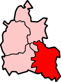
South Oxfordshire
| South Oxfordshire | |||
|---|---|---|---|
 | |||
| Land | |||
| Konst. land | |||
| Region | Sørøst-England | ||
| Adm. grevskap | Oxfordshire | ||
| Seremonielt grevskap | Oxfordshire | ||
| Status | Distrikt | ||
| Grunnlagt | 1. april 1974 | ||
| Adm. senter | Wallingford | ||
| Areal | 678,53 km² | ||
| Befolkning | 127 808 (2003) | ||
| Bef.tetthet | 188,36 innb./km² | ||
| Antall husholdninger | 56 663 | ||
| ONS-kode | 38UD | ||
 South Oxfordshire 51°39′N 1°03′V | |||
South Oxfordshire er et administrativt distrikt i Oxfordshire i England.
Administrasjonssenteret er Wallingford.
South Oxfordshire is a local government district in Oxfordshire, England. Its council is based in Wallingford.
Byer og landsbyer
[rediger | rediger kilde]- Adwell, Albury, Assendon, Aston Rowant, Aston Tirrold, Aston Upthorpe
- Beckley, Benson, Berinsfield, Berrick Salome, Binfield Heath, Bix, Brightwell Baldwin, Brightwell-Cum-Sotwell, Britwell Salome
- Chalgrove, Checkendon, Chinnor, Chiselhampton, Cholsey, Clifton Hampden, Crowell, Crowmarsh, Cuddesdon, Culham, Cuxham
- Denton, Didcot, Dorchester, Drayton St Leonard
- Easington, East Hagbourne, Elsfield, Ewelme, Eye and Dunsden
- Forest Hill
- Garsington, Goring, Goring Heath, Great Haseley, Great Milton
- Harpsden, Henley-on-Thames, Highmoor, Holton, Horspath
- Ipsden
- Kidmore End
- Lewknor, Little Haseley, Little Milton, Little Wittenham, Long Wittenham
- Mapledurham, Marsh Baldon, Mongewell, Moulsford
- Nettlebed, Newington, North Moreton, North Stoke, Nuffield, Nuneham Courtenay
- Pishill Pyrton]
- Rotherfield Greys, Rotherfield Peppard, Rycote
- Sandford on Thames, Shillingford, Shiplake, Shirburn, Shotover, Sonning Common, South Moreton, South Stoke, Stadhampton, Stanton St John, Stoke Row, Stoke Talmage, Stonor, Stowood, Swyncombe, Sydenham
- Tetsworth, Tiddington, Toot Baldon, Towersey
- Wallingford, Warborough, Waterperry, Waterstock, Watlington, West Hagbourne, Wheatfield, Wheatley, Whitchurch On Thames, Woodcote, Woodeaton
Eksterne lenker
[rediger | rediger kilde]Text is available under the CC BY-SA 4.0 license; additional terms may apply.
Images, videos and audio are available under their respective licenses.

