Fil:Political map of England 1140.PNG
Størrelse på denne forhåndsvisningen: 736 × 600 piksler. Andre oppløsninger: 295 × 240 piksler | 589 × 480 piksler | 943 × 768 piksler | 1 257 × 1 024 piksler | 1 489 × 1 213 piksler.
Opprinnelig fil (1 489 × 1 213 piksler, filstørrelse: 163 KB, MIME-type: image/png)
| Denne filen er fra Wikimedia Commons og kan brukes av andre prosjekter. Informasjonen fra filbeskrivelsessiden vises nedenfor. |

|
Dette bildet bør gjenskapes med hjelp av vektorgrafikk som en SVG-fil. Dette har flere fordeler, se Commons:Media for cleanup for mer informasjon. Hvis en SVG-fil med dette bildet er tilgjengelig, vennligst last den opp. Etter opplasting erstatt denne malen med ((vector version available|nytt bilde.svg)).
|
Beskrivelse
| Beskrivelse |
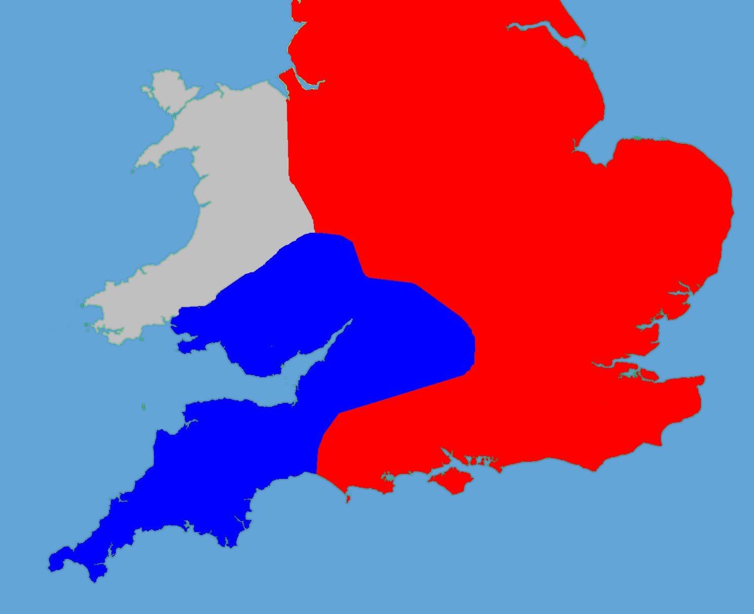
English: A political map of England in 1140 |
| Dato | (UTC) |
| Kilde |
Own work using:
|
| Opphavsperson |
|
| This is a retouched picture, which means that it has been digitally altered from its original version. Modifications: Retouched, historical data added. The original can be viewed here: Gb4dot.svg:
|
Jeg, rettighetsinnehaver av dette arbeidet, publiserer det herved under følgende lisens:
| Jeg, opphavsrettensholderen til dette verket, frigir dette verket til allmennheten. Dette gjelder på verdensbasis. I enkelte land kan dette være juridisk umulig. I så fall: Jeg gir hvem som helst retten til å bruke dette verket for ethvert formål, uten noen vilkår, med mindre slike vilkår kreves ved lov. |
Orginal opplastningslogg
This image is a derivative work of the following images:
- File:Gb4dot.svg licensed with PD-self
Uploaded with derivativeFX
Filhistorikk
Klikk på et tidspunkt for å vise filen slik den var på det tidspunktet.
| Dato/klokkeslett | Miniatyrbilde | Dimensjoner | Bruker | Kommentar | |
|---|---|---|---|---|---|
| nåværende | 27. mai 2011 kl. 20:14 | | 1 489 × 1 213 (163 KB) | Hchc2009 | Trimmed to just show the south and Wales |
| 27. mai 2011 kl. 20:11 |  | 1 489 × 1 753 (224 KB) | Hchc2009 | ((Information |Description=A political map of England in 1140, based on data in Jim Bradbury's book "Stephen and Matilda", p.89 and p.180. The original map was a blank locator map for Great Britain. The idea is to superimpose Image:dot4gb.svg at the |
Filbruk
Den følgende siden bruker denne filen:
Global filbruk
Følgende andre wikier bruker denne filen:
- Bruk i bg.wikipedia.org
- Bruk i en.wikipedia.org
- Bruk i gl.wikipedia.org
- Bruk i hu.wikipedia.org
- Bruk i id.wikipedia.org
- Bruk i it.wikipedia.org
- Bruk i ja.wikipedia.org
- Bruk i pt.wikipedia.org
- Bruk i ru.wikipedia.org
- Bruk i tr.wikipedia.org
Text is available under the CC BY-SA 4.0 license; additional terms may apply.
Images, videos and audio are available under their respective licenses.
Cover photo is available under {{::mainImage.info.license.name || 'Unknown'}} license.
Cover photo is available under {{::mainImage.info.license.name || 'Unknown'}} license.
Credit:
(see original file).
