Fil:Karte Oscarsborg.png
Størrelse på denne forhåndsvisningen: 471 × 600 piksler. Andre oppløsninger: 188 × 240 piksler | 570 × 726 piksler.
Opprinnelig fil (570 × 726 piksler, filstørrelse: 79 KB, MIME-type: image/png)
| Denne filen er fra Wikimedia Commons og kan brukes av andre prosjekter. Informasjonen fra filbeskrivelsessiden vises nedenfor. |

|
Dette bildet bør gjenskapes med hjelp av vektorgrafikk som en SVG-fil. Dette har flere fordeler, se Commons:Media for cleanup for mer informasjon. Hvis en SVG-fil med dette bildet er tilgjengelig, vennligst last den opp. Etter opplasting erstatt denne malen med ((vector version available|nytt bilde.svg)).
|
Beskrivelse
Lisensiering

|
Det tillates at dette dokumentet kopieres, distribueres og/eller modifiseres under retningslinjene som beskrevet i GNU fri dokumentasjonslisens, versjon 1.2 eller senere utgave utgitt av Free Software Foundation; med alle seksjoner, uten noen forsidetekster og baksidetekster. En kopi av lisensen er inkludert i avsnittet GNU Free Documentation License. |
| Denne filen er lisensiert under lisensen Creative Commons Navngivelse-DelPåSammeVilkår 3.0 Unported | ||
| ||
| Dette lisensmerket ble lagt til filen som del av lisensoppdateringen av GFDL. |
Filhistorikk
Klikk på et tidspunkt for å vise filen slik den var på det tidspunktet.
| Dato/klokkeslett | Miniatyrbilde | Dimensjoner | Bruker | Kommentar | |
|---|---|---|---|---|---|
| nåværende | 9. jun. 2015 kl. 02:29 | | 570 × 726 (79 KB) | Cmdrjameson | Compressed with pngout. Reduced by 94kB (54% decrease). |
| 7. apr. 2005 kl. 21:23 |  | 570 × 726 (173 KB) | Markus Schweiss | Map refined with help of a norwegian wikipedian and his nautical chart of this area, sent by E-Mail to me ((GFDL)) | |
| 4. apr. 2005 kl. 06:32 |  | 570 × 726 (173 KB) | Markus Schweiss | Map correction ((GFDL)) | |
| 3. apr. 2005 kl. 22:48 |  | 570 × 726 (173 KB) | Markus Schweiss | Correction of the map, ((GFDL)) | |
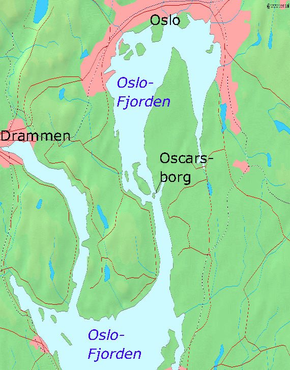
| 3. apr. 2005 kl. 22:24 |  | 570 × 726 (173 KB) | Markus Schweiss | Map of the Oslofjord and the fortress of Oscarsborg, Source of Map: [http://www2.demis.nl/mapserver/mapper.asp] ((GFDL)) Category:Norwegian history |
Filbruk
De følgende 3 sidene bruker denne filen:
Global filbruk
Følgende andre wikier bruker denne filen:
- Bruk i azb.wikipedia.org
- Bruk i bg.wikipedia.org
- Bruk i da.wikipedia.org
- Bruk i de.wikipedia.org
- Bruk i en.wikipedia.org
- Bruk i fr.wikipedia.org
- Bruk i hr.wikipedia.org
- Bruk i hu.wikipedia.org
- Bruk i id.wikipedia.org
- Bruk i it.wikipedia.org
- Bruk i ja.wikipedia.org
- Bruk i mk.wikipedia.org
- Bruk i nl.wikipedia.org
- Bruk i nn.wikipedia.org
- Bruk i pl.wikipedia.org
- Bruk i sr.wikipedia.org
- Bruk i sv.wikipedia.org
- Bruk i vi.wikipedia.org
- Bruk i zh-yue.wikipedia.org
- Bruk i zh.wikipedia.org
Text is available under the CC BY-SA 4.0 license; additional terms may apply.
Images, videos and audio are available under their respective licenses.
Cover photo is available under {{::mainImage.info.license.name || 'Unknown'}} license.
Cover photo is available under {{::mainImage.info.license.name || 'Unknown'}} license.
Credit:
(see original file).
