Fil:Chicago Demographics in 1950 Map.jpg
Størrelse på denne forhåndsvisningen: 400 × 599 piksler. Andre oppløsninger: 160 × 240 piksler | 320 × 480 piksler | 513 × 768 piksler | 683 × 1 024 piksler | 1 984 × 2 972 piksler.
Opprinnelig fil (1 984 × 2 972 piksler, filstørrelse: 1,28 MB, MIME-type: image/jpeg)
| Denne filen er fra Wikimedia Commons og kan brukes av andre prosjekter. Informasjonen fra filbeskrivelsessiden vises nedenfor. |
Beskrivelse
| Beskrivelse |
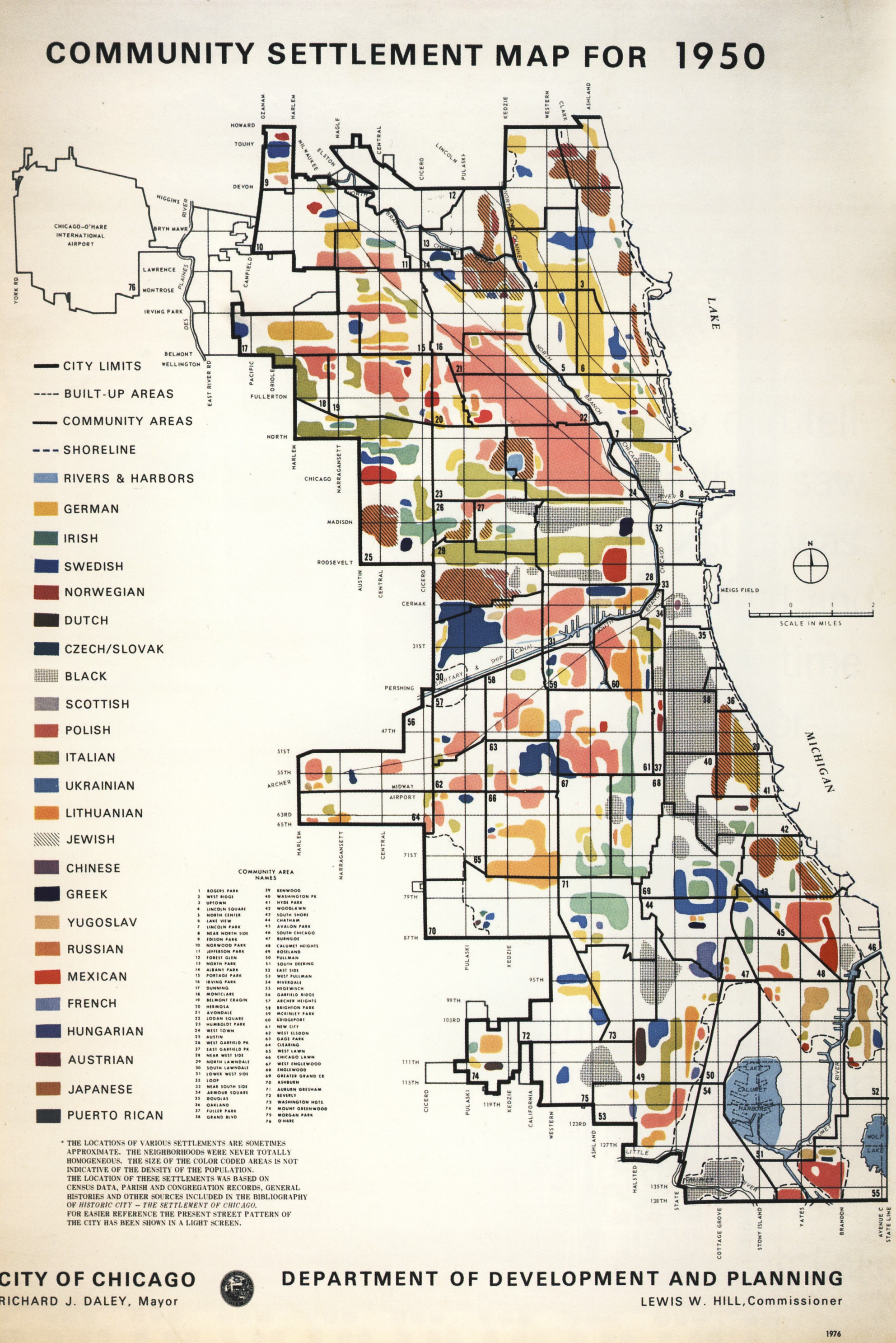
English: Map illustrating the dominant ethnicities of different areas of Chicago in 1950
Polski: Mapa ukazujaca rozmieszczenie poszczegolnych narodowosci w Chicago w r. 1950. |
| Dato | |
| Kilde | City of Chicago Department of Planning and Development |
| Opphavsperson | City of Chicago Department of Planning and Development |
| Tillatelse (Gjenbruk av denne filen) |
PD-US-1978-89 |
Lisensiering
This work is in the public domain because it was published in the United States between 1978 and March 1, 1989 without a copyright notice, and its copyright was not subsequently registered with the U.S. Copyright Office within 5 years. Unless its author has been dead for several years, it is copyrighted in the countries or areas that do not apply the rule of the shorter term for US works, such as Canada (50 pma), Mainland China (50 pma, not Hong Kong or Macau), Germany (70 pma), Mexico (100 pma), Switzerland (70 pma), and other countries with individual treaties. See this page for further explanation.
|
 |
Filhistorikk
Klikk på et tidspunkt for å vise filen slik den var på det tidspunktet.
| Dato/klokkeslett | Miniatyrbilde | Dimensjoner | Bruker | Kommentar | |
|---|---|---|---|---|---|
| nåværende | 8. jun. 2009 kl. 04:55 | | 1 984 × 2 972 (1,28 MB) | Orestek | ((Information |Description=((en|1=Map illustrating the dominant ethnicities of different areas of Chicago in 1950)) ((pl|1=Mapa ukazujaca rozmieszczenie poszczegolnych narodowosci w Chicago w r. 1950.)) |Source=City of Chicago Department of Planning and D |
Filbruk
Den følgende siden bruker denne filen:
Global filbruk
Følgende andre wikier bruker denne filen:
- Bruk i en.wikipedia.org
Metadata
Text is available under the CC BY-SA 4.0 license; additional terms may apply.
Images, videos and audio are available under their respective licenses.
Cover photo is available under {{::mainImage.info.license.name || 'Unknown'}} license.
Cover photo is available under {{::mainImage.info.license.name || 'Unknown'}} license.
Credit:
(see original file).
