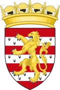
East Lothian
| East Lothian | |||
|---|---|---|---|
 | |||
| Land | |||
| Hovedstad | Haddington | ||
| Areal | 679,18 km²[1] | ||
| Befolkning | 107 090[2] (2019) | ||
| Bef.tetthet | 157,68 innb./km² | ||
| Nettside | www | ||
 East Lothian 55°55′00″N 2°45′00″V | |||
East Lothian (skotsk-gælisk: Lodainn an Ear; skotsk: Aest Lowden), også kalt Haddingtonshire er en region i Skottland, og et stattholderskap. Det grenser mot City of Edinburgh, Scottish Borders og Midlothian. Administrasjonssenteret er Haddington, og den største byen er Musselburgh. East Lothian er offisielt den mest solfylte delen av Skottland.[3]
Det tradisjonelle grevskapet grenser mot Midlothian og Berwickshire.
Historie
[rediger | rediger kilde]Haddingtonshire har gammel opprinnelse og er navngitt i et charter fra 1139 som Hadintunschira[4] og i en annen av 1141 som Hadintunshire.[5] Tre av grevskapsbyene ble utpekt som kongelige burgher: Haddington, Dunbar og North Berwick.
Som med resten av Lothian, utgjorde det en del av det angelsaksiske riket Bernicia og senere kongeriket Northumbria. Folkelig legende antyder at det var i en kamp mellom pikterne og anglere ved landsbyen Athelstaneford i østlige Lothian-i 823 og hvor Skottlands flagg ble unnfanget.[6][7] Fra 900-talletble Lothian overført fra kongeriket England til herredømmet til kongene i Skottland. Det var et kryssningspunkt i flere slag mellom England og Skottland og senere stedet for en betydelig jakobittisk seier mot de britiske regjeringsstyrker i slaget ved Prestonpans den 21. september 1745.[8] På 1800-tallet er fylket nevnt i Gazetteer for Scotland som hovedsakelig landbruk og husdyrhold, med jordbruk, fiske og kullgruvedrift som utgjør betydelige deler av den lokale økonomien.[9]
Byer og landsbyer
[rediger | rediger kilde]- Athelstaneford, Auldhame
- Bolton, Broxburn
- Cockenzie
- Dirleton, Dunbar
- East Fortune, East Linton
- Gullane
- Haddington
- Kingston
- Longniddry
- Musselburgh
- North Berwick
- Pencaitland, Port Seton, Prestonpans
- Tranent
Referanser
[rediger | rediger kilde]- ^ https://ons.maps.arcgis.com/home/item.html?id=a79de233ad254a6d9f76298e666abb2b.
- ^ http://statistics.gov.scot/data/population-estimates-current-geographic-boundaries.
- ^ «East Lothian», Visit Scotland
- ^ Charter by King David to the church of St. Andrews of the church of St. Mary at Haddington
- ^ Charter by King David granting Clerchetune to the church of St. Mary of Haddington
- ^ Turnbull, Michael (2014): Saint Andrew: Myth, Legend and Reality. Neil Wilson Publishing. ISBN 9781906000776.
- ^ «National Flag Heritage Centre», Visit Scotland
- ^ «The Inventory of Historic Battlefields – Battle of Prestonpans» (PDF). Historic Scotland.
- ^ «Old County of East Lothian (Haddingtonshire)», Gazetteer for Scotland
Eksterne lenker
[rediger | rediger kilde]- Offisielt nettsted
- (en) East Lothian – kategori av bilder, video eller lyd på Commons
- Offisielt nettsted for East Lothian Council
Text is available under the CC BY-SA 4.0 license; additional terms may apply.
Images, videos and audio are available under their respective licenses.

