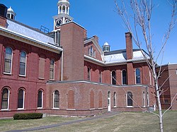
Aroostook County
| Aroostook County i Maine | |||
|---|---|---|---|
 | |||
| Grunnlagt | 1. mai 1839 | ||
| Fylkessete | Houlton | ||
| Areal - Totalt - Land - Vann | 17 686,48 km² 17 279,21 km² 407,27 km² | ||
| Befolkning - Tetthet | 73 008 (2006) 4,13 innb./km² | ||
 Aroostook County 46°38′15″N 68°15′42″V | |||
Aroostook County er et fylke i den amerikanske delstaten Maine. Det ligger i helt nord i staten og det grenser mot Washington County i sørøst, Penobscot County og Piscataquis County i sør og mot Somerset County i sørvest. Det har også grense mot Canada i nord, vest og øst.
Aroostook Countys totale areal er 17 686 km² hvorav 407 km² er vann. Det er det største fylket i Maine. I 2000 hadde fylket 79 938 innbyggere og administrasjonssenteret ligger i byen Houlton.
Fylket ble grunnlagt i 1839 av land fra fylkene Penobscot County og Washington County.
Klima
[rediger | rediger kilde]| Månedlige maksimum- og minimumnormaltemperaturer (°C) for Caribou | |||||||||||||
| By | Jan | Feb | Mar | Apr | Mai | Jun | Jul | Aug | Sep | Okt | Nov | Des | Gjennomsnitt |
|---|---|---|---|---|---|---|---|---|---|---|---|---|---|
| Caribou | -7/-18 | -5/-16 | 1/-9 | 8/-2 | 17/5 | 22/10 | 24/13 | 23/12 | 18/7 | 11/1 | 3/-4 | -4/-13 | 9/-1 |
Byer
[rediger | rediger kilde]- Allagash
- Amity
- Ashland
- Bancroft
- Blaine
- Bridgewater
- Caribou
- Cary
- Castle Hill
- Caswell
- Chapman
- Crystal
- Cyr
- Dyer Brook
- Eagle Lake
- Easton
- Estcourt Station
- Fort Fairfield
- Fort Kent
- Frenchville
- Garfield
- Glenwood
- Grand Isle
- Hamlin
- Hammond
- Haynesville
- Hersey
- Hodgdon
- Houlton
- Island Falls
- Limestone
- Linneus
- Littleton
- Loring Commerce Center
- Ludlow
- Macwahoc
- Madawaska
- Mapleton
- Mars Hill
- Mars Hill-Blaine
- Masardis
- Merrill
- Monticello
- Moro
- Nashville
- New Canada
- New Limerick
- New Sweden
- Oakfield
- Orient
- Oxbow
- Perham
- Portage Lake
- Presque Isle
- Reed
- Sherman
- Smyrna
- St. Agatha
- St. Francis
- St. John
- Stockholm
- Van Buren
- Wade
- Wallagrass
- Washburn
- Westfield
- Westmanland
- Weston
- Winterville
- Woodland
Eksterne lenker
[rediger | rediger kilde]- (en) Offisielt nettsted
- (en) Aroostook County, Maine – kategori av bilder, video eller lyd på Commons
- Aroostook County på Maine.gov
- Aroostook County events
| ||||||||||||||
Text is available under the CC BY-SA 4.0 license; additional terms may apply.
Images, videos and audio are available under their respective licenses.

