Fil:Plan of the Attack of Camaret Bay.jpg
Storleik på førehandsvising: 746 × 600 pikslar. Andre oppløysingar: 299 × 240 pikslar | 597 × 480 pikslar | 956 × 768 pikslar | 1 274 × 1 024 pikslar | 2 150 × 1 728 pikslar.
Opphavleg fil (2 150 × 1 728 pikslar, filstorleik: 1,97 MB, MIME-type: image/jpeg)
Følgjande er henta frå filomtalen åt denne fila på Wikimedia Commons:
Skildring
| Skildring |
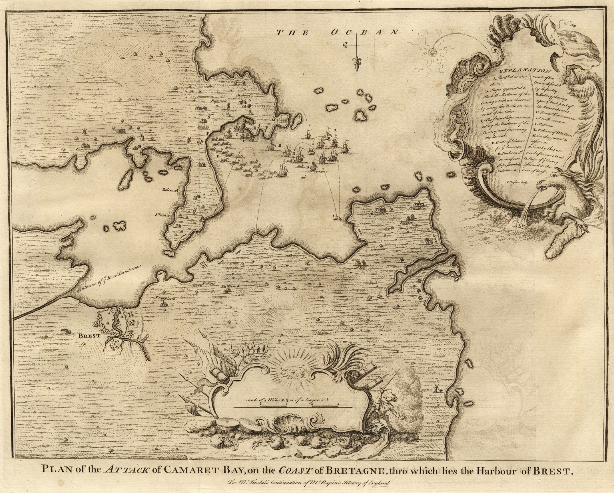
English: Plan of the Attack of Camaret Bay, on the Coast of Bretagne, thro which lies the Harbour of Brest.
For Mr. Tindal's continuation of Mr. Rapin's History of England Explanation:
Français : Plan de l'attaque dans la baie de Camaret, sur la côte de la Bretagne, où se trouve le port de Brest.
Deutsch: Angriffsplan der Bucht von Camaret, an der Küste der Bretagne, wo den Hafen von Brest liegt.
Español: Plan de batalla de la bahía de Camaret, en la costa de la Bretaña, donde se encuentra el puerto de Brest. |
| Dato | |
| Kjelde | own property |
| Opphavsperson | Basire, James [engraver] |
Lisensiering:
|
Dette verket er falt i det fri i Noreg, og dei landa som har opphavsrettsleg vernetid på 100 år etter opphavsmannen sin død, eller kortare. | |
| Denne fila er fastsett å vera fri for kjende avgrensingar under opphavsrettlovgjeving, medrekna alle relaterte og nærliggjande rettar. | |
Filhistorikk
Klikk på dato/klokkeslett for å sjå fila slik ho var på det tidspunktet.
| Dato/klokkeslett | Miniatyrbilete | Oppløysing | Brukar | Kommentar | |
|---|---|---|---|---|---|
| gjeldande | 10. november 2008 kl. 23:42 | | 2 150 × 1 728 (1,97 MB) | Mike bzh | ((Information |Description= |Source= |Date= |Author= |Permission= |other_versions= )) |
| 4. november 2008 kl. 22:14 |  | 3 015 × 2 425 (3,02 MB) | Mike bzh | ((Information |Description=((en|1=Plan of the Attack of Camaret Bay, on the Coast of Bretagne, thro which lies the Harbour of Brest.)) ((fr|1=Plan de l'attaque dans la baie de Camaret, sur la côte de la Bretagne, où se trouve le port de Brest.)) ((de|1= |
Filbruk
Den følgjande sida bruker denne fila:
Global filbruk
Desse andre wikiane nyttar fila:
- Bruk på de.wikipedia.org
- Bruk på en.wikipedia.org
- Bruk på fr.wikipedia.org
- Bruk på no.wikipedia.org
- Bruk på ru.wikipedia.org
- Bruk på www.wikidata.org
- Bruk på zh.wikipedia.org
Utvida informasjon
Text is available under the CC BY-SA 4.0 license; additional terms may apply.
Images, videos and audio are available under their respective licenses.
Cover photo is available under {{::mainImage.info.license.name || 'Unknown'}} license.
Cover photo is available under {{::mainImage.info.license.name || 'Unknown'}} license.
Credit:
(see original file).
