Manitowoc
| Plaats in de Verenigde Staten | |||
|---|---|---|---|
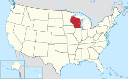
| Locatie van Manitowoc in Wisconsin | |||
 Locatie van Wisconsin in de VS | |||
| Situering | |||
| County | Manitowoc County | ||
| Type plaats | City | ||
| Staat | Wisconsin | ||
| Coördinaten | 44° 6′ NB, 87° 41′ WL | ||
| Algemeen | |||
| Oppervlakte | 43,7 km² | ||
| - land | 42,9 km² | ||
| - water | 0,8 km² | ||
| Inwoners (2006) |
33.635 | ||
| Hoogte | 223 m | ||
| Overig | |||
| ZIP-code(s) | 54220 | ||
| FIPS-code | 48500 | ||
| Website | Officiële website | ||
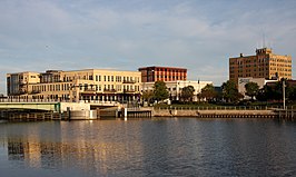
| Foto's | |||

| |||
| Manitowoc | |||
| |||
Manitowoc is een plaats (city) in de Amerikaanse staat Wisconsin, en valt bestuurlijk gezien onder Manitowoc County.
Demografie
[bewerken | brontekst bewerken]Bij de volkstelling in 2000 werd het aantal inwoners vastgesteld op 34.053.[1] In 2006 is het aantal inwoners door het United States Census Bureau geschat op 33.635,[2] een daling van 418 (-1,2%).
Geografie
[bewerken | brontekst bewerken]Volgens het United States Census Bureau beslaat de plaats een oppervlakte van 44,5 km², waarvan 43,7 km² land en 0,8 km² water. Manitowoc ligt op ongeveer 223 m boven zeeniveau.[3]
Op 5 september 1962 stortte een stuk van 9,1 kilo van de Spoetnik 4 van 7 ton neer op North 8th Street. Spoetnik 4 was een Russische-satelliet, onderdeel van het Spoetnik-programma en een testvlucht van het Vostokprogramma-ruimtevaartuig dat zou worden gebruikt voor de eerste menselijke ruimtevlucht. Het werd gelanceerd op 15 mei 1960. Een bug in het geleidingssysteem had de capsule in de verkeerde richting gewezen, dus in plaats van in de atmosfeer te vallen, verhuisde de satelliet naar een hogere baan. Het kwam opnieuw in de atmosfeer op of rond 5 september 1962. Een afgietsel werd gemaakt van het originele stuk voordat de Sovjets het claimden, en het afgietsel werd tentoongesteld in het Rahr West Art Museum. Een klant in een nabijgelegen kunstgalerie stelde voor de grap dat de stad een festival zou moeten houden om de crash te vieren. De stad organiseerde het eerste Spoetnikfest in 2008, dat werd georganiseerd door het hoofd van beide musea.
Plaatsen in de nabije omgeving
[bewerken | brontekst bewerken]De onderstaande figuur toont nabijgelegen plaatsen in een straal van 20 km rond Manitowoc.
Externe link
[bewerken | brontekst bewerken]
Text is available under the CC BY-SA 4.0 license; additional terms may apply.
Images, videos and audio are available under their respective licenses.


