Bestand:VOC Octrooigebied 1.jpg
Grootte van deze voorvertoning: 800 × 585 pixels. Andere resoluties: 320 × 234 pixels | 640 × 468 pixels | 1.024 × 749 pixels | 1.280 × 936 pixels | 2.268 × 1.659 pixels.
Oorspronkelijk bestand (2.268 × 1.659 pixels, bestandsgrootte: 626 kB, MIME-type: image/jpeg)
Dit is een bestand van Wikimedia Commons.
Onderstaande beschrijving komt van de beschrijving van het bestand daar.
Onderstaande beschrijving komt van de beschrijving van het bestand daar.
The official trade zone was indicated (several times) in the 1602 Charter of the VOC. That's why I suggest to add a link under "files" to the site where recently an English translation was published of that charter. www.australiaonthemap.org.au/content/view/50/59 AHS encourages this. Peter R the translator
Beschrijving
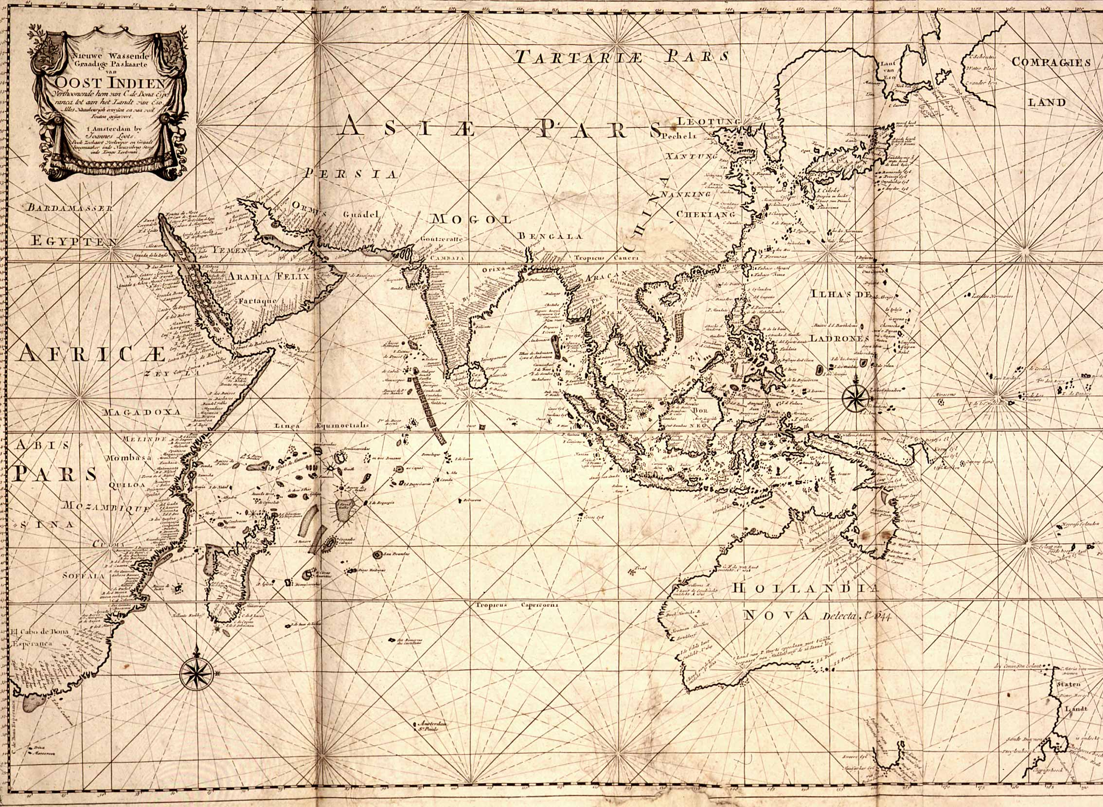
| Beschrijving | Map of the East Indies; the official trade zone (octrooigebied) of the VOC according to the VOC Charter, which was between Cape of Good Hope (South Africa) and Street Magallan (South America); printed c. 1700. |
| Datum | |
| Bron | TANAP |
| Auteur |
Licentie
|
Dit werk bevindt zich in het publiek domein in landen en gebieden waar de auteursrechttermijn het leven van de auteur plus 100 jaar of minder is. | |
| Van dit bestand is vastgesteld dat er geen bekende auteursrechtaanspraken op rusten, alle aanverwante en naburige rechten daarbij inbegrepen. | |
Bestandsgeschiedenis
Klik op een datum/tijd om het bestand te zien zoals het destijds was.
| Datum/tijd | Miniatuur | Afmetingen | Gebruiker | Opmerking | |
|---|---|---|---|---|---|
| huidige versie | 3 mei 2008 12:31 | | 2.268 × 1.659 (626 kB) | BoH | ((Information |Description=Map of the East Indies; the official trade zone (octrooigebied) of the VOC according to the VOC Charter, which was between Cape of Good Hope (South Africa) and Street Magallan (South America); printed c. 1700. |Source=[http://ww |
Bestandsgebruik
Dit bestand wordt op de volgende pagina gebruikt:
Globaal bestandsgebruik
De volgende andere wiki's gebruiken dit bestand:
- Gebruikt op af.wikipedia.org
- Gebruikt op en.wikipedia.org
Metadata
Text is available under the CC BY-SA 4.0 license; additional terms may apply.
Images, videos and audio are available under their respective licenses.
Cover photo is available under {{::mainImage.info.license.name || 'Unknown'}} license.
Cover photo is available under {{::mainImage.info.license.name || 'Unknown'}} license.
Credit:
(see original file).
